


Below is the uncorrected machine-read text of this chapter, intended to provide our own search engines and external engines with highly rich, chapter-representative searchable text of each book. Because it is UNCORRECTED material, please consider the following text as a useful but insufficient proxy for the authoritative book pages.
C-1 APPENDIX C CINCINNATI, OHIO, CASE STUDY ACKNOWLEDGMENTS The research reported herein was performed under NCHRP Project 3-63 by Mitretek Systems, Inc. The principal investi- gators for this project are Kevin Dopart, Manager, and Ken Brooke, Principal Engineer. The other researchers on this pro- ject were Aimee Flannery (now Assistant Professor at George Mason University, Fairfax, Virginia) and Ted Smith, both Lead Engineers at Mitretek Systems. The principal authors of this case study were Aimee Flannery and Ken Brooke. The authors would like to thank and acknowledge the fol- lowing individual contributors from the Cincinnati metropoli- tan area. Without their ready, willing, and enthusiastic partic- ipation, this case study would not have been possible. Timothy D. Schoch Deputy Program Manager Elaine Baker Supervisor ARTIMIS 508 West Third Street Cincinnati, Ohio 45202-3410 (513) 564-6116 tim.schoch@ngc.com William H. Hinkle Director Gregory Wenz, ENP Operations Director Michael Bailey, ENP Technical Services Manger Hamilton County Department of Communications 2377 Civic Center Drive Cincinnati, Ohio 45231 (513) 825-2170 bill.hinkle@hccc.hamilton-co.org Sergeant Neil Gilreath Traffic Division Supervisor Covington Police Department 1929 Madison Avenue Covington, Kentucky 41014 (859) 292-2252 ngilreath@covkypd.org Police Officer Mark Ziegler Cincinnati Police Department, Traffic Unit 800 Evans Street Cincinnati, Ohio 45204 (513) 352-2514 1 SUMMARY A mature interagency operation is in place in Cincinnati, where various types of information are regularly and rou- tinely exchanged between transportation and public safety. The Advanced Regional Traffic Interactive Management Information System (ARTIMIS) (see Figure 1) unites inter- ests in three states to address traffic management in the met- ropolitan area. The freeway service patrols are of particular note, representing a public-private partnership between the state DOTs and CVS Pharmacies, where roadway assistance is provided by certified mechanics who are also licensed emergency medical technicians. 2 INTRODUCTION This document summarizes information collected while assessing information sharing as facilitated by ARTIMIS in the greater Cincinnati metropolitan area. Partners in ARTIMIS include the Ohio Department of Transportation (ODOT), the Kentucky Transportation Cabinet, the Federal Highway Administration, the city of Cincinnati, and the Ohio-Kentucky- Indiana Regional Council of Governments (OKI). 2.1 Site Contributors Information collected related to information exchanges between ARTIMIS partners was collected during site visits in January 2003. Site visits provided researchers with the oppor- tunity to observe data sharing and communication between ARTIMIS partners in the context of actual operations. Tim Schoch, ARTIMIS Deputy Program Manager, hosted the site visit to the ARTIMIS Operations Control Center in down- town Cincinnati. Bill Hinkle, Director of Communications, Hamilton County Communications Center, hosted the site visit to the Hamilton County Communications Center. A drive along was also conducted with Police Officer Mark Ziegler of the Traffic Unit of the Cincinnati Police Department. Finally, an interview was also conducted with Sergeant Neil Gilreath, Traffic Division Supervisor of the Covington Police Depart- ment at the ARTIMIS Operations Control Center. 3 SHARING INFORMATION 3.1 Methods Used in Practice This section summarizes information-sharing activities between ARTIMIS and its partners in the greater Cincinnati
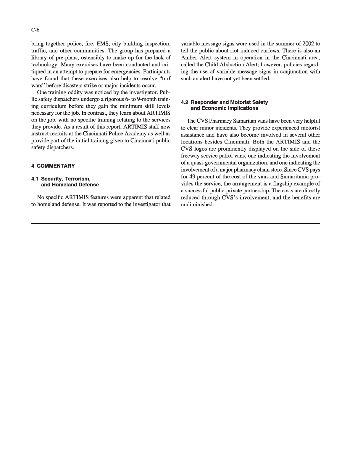
metropolitan area. The relay of information from ARTIMIS to its partner agencies is accomplished either verbally (using radio or telephone reports) or by the transfer of video to the partners equipped to receive it. ARTIMIS has also distrib- uted many video tapes to television stations, cable television providers, and driverâs education schools. 3.1.1 ARTIMIS Public Information Services ARTIMIS supports several traveler information services for the general public. Even though ARTIMIS is designed as a means to inform the traveling public, the information con- tent is designed in cooperation between transportation and public safety. ARTIMIS reflects the result of information being exchanged between the two communities. Following are the systemâs operating components: ⢠Roadway Message Signs InformationâDynamic mes- sage signs (DMSs) are located at fixed locations prior to major freeway interchanges and at temporary locations as needed for special events or other occurrences (see Figure 2). They display short textual information to alert travelers to incidents ahead and to notify travelers about alternative routes. ⢠Highway Advisory Radio (HAR) AdvisoriesâHAR advisories notify travelers about major incidents and highway construction activities. HAR advisories broad- cast 24 hours a day. ⢠Traveler Advisory Telephone Service (511)âThe first of only two 511 systems in the United States that is accessible by using a single three-digit calling number from either landline or cellular telephones, this system fields on average 64,000 calls per month. The informa- tion content is updated automatically more than 1,400 times per day, providing up-to-date, route-specific infor- mation and construction information accessible by dial- C-2 ing 511. The service is free to landline callers and most wireless callers. ⢠Television and Radio ReportsâLocal television and radio stations use reports and video feeds supplied by ARTIMIS to convey traveler information to the viewing audiences. Since April 2002, all four major television net- work affiliates in the Cincinnati area have been broad- casting live closed-circuit television (CCTV) video feeds from the ARTIMIS Operations Center showing current freeway traffic situations. As part of the agreement with these television stations, ARTIMIS requires that its web- site URL (www.artimis.org) be displayed at the bottom of these images when re-broadcasted to increase the URLâs visibility in the community. On average, 25 tele- vision traffic reports using ARTIMIS-supplied infor- mation are made each day. In addition, traffic conditions are e-mailed every 10 minutes to 10 radio stations. ⢠ARTIMIS WebsiteâA traveler information website (www.artimis.org) is maintained by ARTIMIS that (along with a complete ARTIMIS system description) provides continuous camera image coverage of the regionâs freeways and information about congestion and construction zones. Approximately 760 updates are made each day to the website. The popularity of the website is evidenced by the 6 million hits per month it receives. ⢠Radio SystemâARTIMIS is part of the new Hamilton County 800-MHz radio system. 3.1.2 ARTIMIS Special Information Services ARTIMIS also provides several specialty services for the general public, public safety, and services organizations: ⢠Freeway Service Patrol VansâTo help clear incidents and disabled vehicles from the traveled lanes, five ser- vice patrol vans (see Figure 3) have been deployed by ARTIMIS in cooperation with CVS Pharmacy stores. The service vans patrol the freeway in the ARTIMIS jurisdiction between 6:30 a.m. and 7:00 p.m. weekdays and during special events. The service patrol drivers are Figure 1. ARTIMIS logo. Figure 2. DMS sign. Figure 3. Freeway service patrol van.
certified mechanics by the National Institute for Auto- motive Excellence (ASE) and are licensed emergency medical technicians in the jurisdictions where they patrol. The freeway service patrol vans have been loaned to other cities for major events (e.g., Thunder Over Louis- ville and the Kentucky Derby). These vans are listed as an information service because of the interaction that occurs among the service patrol drivers, the traveling public, and public safety responders. ⢠ARTIMIS Primary Radio FrequencyâThis radio channel is used by ARTIMIS to exchange information with freeway service patrols, aircraft, mobile probes, and police and fire agencies throughout the region. ⢠ARTIMIS Transit Radio FrequencyâARTIMIS pro- vides timely information regarding closures and major incidents to the Queen City Metro Authority (Metro) and Transit Authority of Northern Kentucky (TANK) through a direct radio link. ⢠ARTIMIS Transit Video FeedâARTIMIS provides direct video feeds of freeway CCTV imagery to the major transit agencies in the greater Cincinnati area. 3.2 Institutional Implications Four central themes provide foundation for traffic incident management (TIM) endeavours in the Cincinnati metropoli- tan area: ⢠Unique leadership at the helm of ARTIMIS to facili- tate the cooperation between ARTIMIS staff and pub- lic safety officers, in particular with Hamilton County Department of Communications; ⢠A commitment from ARTIMIS leaders to assist public safety officers in their day-to-day duties, including acci- dent investigation; ⢠A commitment from ARTIMIS staff and leaders to be eager providers of incident information to many public agencies to achieve the common goal of moving people and goods through the system quickly without sacrific- ing safety; and ⢠The ability to work cooperatively on TIM operations to ensure the safety and mobility of travellers in the region, as well as responders. 3.2.1 Institutional Framework of ARTIMIS This section describes the ARTIMIS system, specifically the network coverage of ARTIMIS, the services provided by ARTIMIS, the institutional agreements that support ARTIMIS, and the various public safety partners that currently receive information and support from ARTIMIS regarding traffic incidents (see Figure 4). The ARTIMIS program is funded by ODOT and the Ken- tucky Transportation Cabinet and operates in cooperation with C-3 OKI and the Federal Highway Administration. ARTIMIS acts as an independent organization whose mission is to improve air quality, overall safety, and motoristâs travel time and is governed as a partnership between several agencies that encompass the greater Cincinnati area, which includes areas in the states of both Ohio and Kentucky. The partnership was formed among ODOT, Kentucky Transportation Cabinet (KYTC), and OKI. ARTIMIS began limited operations in June 1995, and the current system was completed in Decem- ber of 1998. There are three major components of ARTIMIS: ⢠Regional Traffic Management System (RTMS), ⢠Traveler Information System (TIS), and ⢠Freeway service patrol vans. These components were deployed to meet the follow- ing goals: ⢠Improve air quality, ⢠Improve overall safety, and ⢠Improve motoristsâ travel time. ARTIMIS is made possible by joint funding provided by ODOT and KYTC. ODOT contributes 75 percent of system- wide costs, and KYTC provides the remaining 25 percent. The deployment of various monitoring sensor equipment is paid for by each state independently. The freeway service patrol vans are funded through a public-private joint venture with CVS Pharmacy stores. ODOT pays for 51 percent of three service patrol vans, and KYTC pays for 51 percent of two service patrol vans. The remaining costs for all five ser- vice patrol vans are paid for by CVS Pharmacy stores. 3.2.2 Coverage Area of ARTIMIS The ARTIMIS coverage area is split into two areas: the North Area and the South Area. Both areas primarily consist Figure 4. ARTIMIS member organizations.
of Interstates and freeways. The North Area consists of the following roadways: ⢠Portions of I-275 in Ohio and Kentucky; ⢠Portions of I-75, I-74, and I-71 in Ohio; ⢠State Route 562 in Ohio; ⢠Ronald Reagan Highway; and ⢠US 50 from downtown Cincinnati to I-275 in Dearborn County, Indiana. The South Area consists of the following roadways: ⢠Portions of I-275 in Kentucky, Ohio, and Indiana; ⢠I-71, I-75, and I-471 in Kentucky; and ⢠Portions of I-71 and I-75 in Ohio. In all, 88 miles of freeway are monitored by ARTIMIS (as of April 21, 2002). The system uses cameras and sen- sors to continuously monitor traffic conditions 24 hours a day, 7 days a week. Information is routed by fiber-optic cable or via dial-up telephone line to the control center, where the imagery and data are analyzed to determine the occurrences of traffic incidents. Various response plans are then activated as needed. 3.2.3 Issues and Barriers The few issues mentioned to the investigator all related to desired improvements to ARTIMIS. It was unusual not to hear about problems with current systems, policies, or operations. Reportedly, there are no traffic management components in the mass evacuation plans for the greater Cincinnati area. While it would be somewhat surprising for the topic to be completely missing from the mass evacuation plans, it would not be surprising for the plans to lack an explicitly labeled section on traffic management. It would also be understand- able for transportation agencies to desire coverage in these plans, for it would provide the agencies with the opportunity to become involved in that aspect of emergency management. Mention was made that there is a need to improve the emergency medical services (EMS) communications sys- tems in the area and to include the ARTIMIS community in their upgrade. This would presumably cover radio systems that are used by EMS response agencies in the greater Cincin- nati metropolitan area. Such communications would typically be used to enable EMS vehicles to communicate with each other and with emergency departments of local hospitals. A logical extension to the current transportation/public safety interaction was noted on one suggestion passed along to the investigator. Noting the coverage of freeway incident scenes that ARTIMIS is now able to provide to public safety, C-4 it was suggested that the same sort of CCTV coverage be extended to cover the response and approach routes to those incidents. It would of course be an obvious enhancement to also provide coverage on demand from public safety for any response planned to traverse the ARTIMIS CCTV coverage area. A related suggestion extended the concept to include the emergency rooms at local hospitals because the addi- tional visual information would help prepare emergency room staff for incoming trauma cases. And finally, it was suggested that the changeable message sign (CMS) network be extended to include more major arte- rials. This extension appears to be a logical enhancement that might help a great deal in managing traffic approaching the freeway system. 3.3 Technical Implications ARTIMIS consists of several components: ⢠CCTVsâMore than 80 CCTVs have been deployed in the greater Cincinnati area. Three types of cameras have been deployed: full-motion color video, slow-scan color video, and fixed black-and-white cameras. The majority of cameras are full-motion color video, but in some areas where poor lighting exists (such as tunnels), fixed black- and-white cameras have been installed. ⢠Changeable Message Signs (CMSs)âForty CMSs are located before the major freeway interchanges to notify motorists of traffic problems and potential alternate routes. There are also three portable CMSs that can be towed to locations where a specific, short-term need exists. ⢠Highway Advisory Radio (HARs)âARTIMIS broad- casts traffic advisories and construction information on broadcast radio 530 AM (from fixed locations) and 580 AM (from temporary locations), which may be received by standard car radios. Advisories are available during operational hours, and construction information is available 24 hours a day. ⢠Vehicle DetectionâEleven hundred vehicle detection locations are maintained by ARTIMIS (as of April 21, 2002). Vehicle count, occupancy, and speed informa- tion is collected at each of these locations using one of three technologies: radar, induction loop detectors, and video imaging. ⢠Reference and Ramp MarkersâTo assist travelers and emergency responders in locating incidents or those in need of assistance, reference and ramp markers have been deployed on most of the freeway systems in the greater Cincinnati area. Blue and white signs have been positioned about every 500 feet that contain information relating to the roadway name, direction of travel, and the specific milepost location.
3.4 Operational Implications 3.4.1 ARTIMIS ARTIMIS often serves as the coordination center for major incidents. A typical evolution of an incident proceeds as fol- lows. An incident management team is formed once either a major incident has been declared by a public safety officer on the scene or the ARTIMIS staff issues a warning based on input gathered from the system. Specific roles and responsi- bilities for each team member involved have been docu- mented and accepted by the agencies involved. ARTIMIS acts as the host for the incident management team and provides necessary facilities, including work space and equipment. ARTIMIS personnel provide support mate- rials and resources to the incident management team, includ- ing communication services, video feeds, portable and fixed HAR/DMS systems, and freeway service patrol vehicles. Finally, ARTIMIS staff assess and report the status of upstream and downstream traffic flow from the incident and propose and prepare potential alternative routes. 3.4.2 Public Safety Agencies ARTIMIS has established close working relationships with several local jurisdictionsâ public safety organizations, includ- ing the Cincinnati and Covington Police Departments. During major incidents, the following things happen: Command-level personnel are assigned to serve on the major incident team. An agency command post is established to manage police activity and personnel. Public safety agencies also establish a perimeter around the incident to isolate the incident from the surrounding area, control the crowd and traffic at the inci- dent, and identify and implement alternative routes on the Interstate system. Finally, the public safety agencies investi- gate the incident and determine causal factors. These find- ingsâas well as the usual forums related to traffic, civil court, criminal court, and insurance claimsâcan sometimes be used to improve travel conditions on the freeways. 3.4.3 ODOT and KYTC ARTIMIS coordinates traveller information and TIM for the greater Cincinnati area, acting on behalf of ODOT and KYTC. This has off-loaded a significant amount of ODOT and KYTCâs day-to-day operational responsibilities. The agencies have been assigned on-call responsibilities for major incidents and provide representatives to serve on the incident manage- ment team. These duties include providing support resources as requested; assessing and evaluating the repair needs of the freeway infrastructure; and collecting cost data pertain- ing to personnel, equipment, and material relating to the major incident. C-5 3.4.4 Fire Departments Metropolitan area fire departments that respond to major incidents in the ARTIMIS jurisdiction provide staff to serve on the incident management team. They also provide spe- cialized technical information related to hazardous materials incidents. Hazardous materials incidents can involve com- plex information that can have far-reaching effects on traffic flow, such as hot zones; areas of isolation and evacuation; control, containment, and stabilization operational require- ments; and remediation operations. The fire departments also provide EMS and aid to those at the scene of the incident. The Cincinnati Fire Department is the oldest professional fire department in the nation, having a full-time paid pro- fessional staff since 1853. The fire service is known for its traditions, which can at times be barriers to innovation. If transportation/public safety partnerships work in Cincinnati with this sort of institutional history, they can work anywhere. 3.4.5 Special Events There are plans to use ARTIMIS as a central command post for Riverfest September 2003, which draws 500,000+ visitors to the riverbanks. That is a significant traffic load for the region. There will be several major street closures (includ- ing Interstates) on the night of the fireworks, and coordination will be required among the cities of Covington, Newport, and Cincinnati; the law enforcement, EMS, and fire components of public safety; and the Ohio and Kentucky DOTs. 3.5 Benefits In October of 2001, Cambridge Systematics, Inc., with PB Farradyne, conducted an evaluation of the ARTIMIS system for OKI. The investigator did not research the content of this evaluation; however, the investigator believes that it might be fair to characterize all of ARTIMIS as such an information- sharing system and activity and credit all of the reported ben- efits to that category. One law enforcement source estimated that the time sav- ings for roadway closures after fatal accidents were as much as 90 minutes to 2 hours. The source attributed this savings to the use of the Total Station survey equipment, which was provided by ARTIMIS to public safety agencies in the area. The source reports that this act was seen as a very good ges- ture by ARTIMIS to forge better relationships with public safety agencies. 3.6 Training The Tri-State Emergency Management System has been in place for many years and holds regular forums to help
bring together police, fire, EMS, city building inspection, traffic, and other communities. The group has prepared a library of pre-plans, ostensibly to make up for the lack of technology. Many exercises have been conducted and cri- tiqued in an attempt to prepare for emergencies. Participants have found that these exercises also help to resolve âturf warsâ before disasters strike or major incidents occur. One training oddity was noticed by the investigator. Pub- lic safety dispatchers undergo a rigorous 6- to 9-month train- ing curriculum before they gain the minimum skill levels necessary for the job. In contrast, they learn about ARTIMIS on the job, with no specific training relating to the services they provide. As a result of this report, ARTIMIS staff now instruct recruits at the Cincinnati Police Academy as well as provide part of the initial training given to Cincinnati public safety dispatchers. 4 COMMENTARY 4.1 Security, Terrorism, and Homeland Defense No specific ARTIMIS features were apparent that related to homeland defense. It was reported to the investigator that C-6 variable message signs were used in the summer of 2002 to tell the public about riot-induced curfews. There is also an Amber Alert system in operation in the Cincinnati area, called the Child Abduction Alert; however, policies regard- ing the use of variable message signs in conjunction with such an alert have not yet been settled. 4.2 Responder and Motorist Safety and Economic Implications The CVS Pharmacy Samaritan vans have been very helpful to clear minor incidents. They provide experienced motorist assistance and have also become involved in several other locations besides Cincinnati. Both the ARTIMIS and the CVS logos are prominently displayed on the side of these freeway service patrol vans, one indicating the involvement of a quasi-governmental organization, and one indicating the involvement of a major pharmacy chain store. Since CVS pays for 49 percent of the cost of the vans and Samaritania pro- vides the service, the arrangement is a flagship example of a successful public-private partnership. The costs are directly reduced through CVSâs involvement, and the benefits are undiminished.
