


Below is the uncorrected machine-read text of this chapter, intended to provide our own search engines and external engines with highly rich, chapter-representative searchable text of each book. Because it is UNCORRECTED material, please consider the following text as a useful but insufficient proxy for the authoritative book pages.
FATE AND TRANSPORT OF SEDIMENTS 337 9 Fate and Transport of Sediments Sedimentsâeroded soil deposited in streams, rivers, drainage ways, and lakesâcan be defined as a soil resource out of place. As such, it is widely recognized as one of the major environmental concerns worldwide. EFFECTS OF EROSION AND SEDIMENTATION Erosion reduces the productivity of the land resource. Sediment degrades water quality and often carries soil-absorbed polluting chemicals. Sediment deposition in stream channels, irrigation canals, reservoirs, estuaries, harbors, and water conveyance structures reduces the capacities of these water bodies to perform their prime functions and often requires costly treatments. In many instances, the sediments removed from upland areas and channels and subsequently transported downstream carry adsorbed chemicals that exacerbate water quality problems at points downstream. Such chemicals exacerbate the effect of sediments on aquatic habitats and may destroy fish spawning grounds (Alonzo and Theurer, 1988). Sediments may also reduce water conveyance capacity (increasing flooding) and water storage capacity in reservoirs. Agriculture has a great impact on sediments deposition. Judson (1981) estimated that river-borne sediments carried into the oceans increased from 9 billion metric tons (10 billion tons) per year before the introduction of intensive agriculture, grazing, and other activities to between 23 billion and 45 billion metric tons (25 billion and 50 billion tons)
FATE AND TRANSPORT OF SEDIMENTS 338 thereafter. Dudal (1981) reported that the current rate of agricultural land degradation, primarily because of soil erosion, is leading to an irreversible loss in productivity on about 6 million ha (15 million acres) of fertile land a year worldwide. Crop productivity on about 20 million ha (49 million acres) each year is reduced to zero or becomes uneconomical because of soil erosion and erosion-induced degradation (Lal, 1988). Since humans first began cultivating crops on a yearly basis, soil erosion has destroyed about 430 million ha (1,063 million acres) of productive land globally (Lal, 1988). Buringh (1981) estimated that the annual global loss of agricultural land is 3 million ha (7 million acres) because of soil erosion and 2 million ha (5 million acres) because of desertification. Of the total 0.9 billion metric tons (1 billion tons) of sediment carried by rivers from the continental United States, about 60 percent is estimated to be from agricultural lands (National Research Council, 1974). The off-site damages (''off-site" refers to locations where damages are due primarily to deposition of eroded material) caused by sediments in the United States are exorbitant. For example, several million cubic meters of sediment are washed into U.S. rivers, harbors, and reservoirs each year, and dredging of these sediments requires significant financial resources. Wind erosion problems are especially acute in more arid regions. As with water erosion, wind abrasion destroys many young crops; it also causes severe air quality problems. Reduced vision caused by wind erosion has been identified as the cause of numerous multiple-vehicle accidents in the southwestern United States and has resulted in the loss of many lives. Blowing dust from fallow fields has been identified as the cause of many breathing problems for humans. There are, however, even fewer research data on the definition and control of the wind erosion process than there are for water erosion (Lal, 1988). Although the basic principles governing wind erosion process and control are similar to those governing water erosion, the specific cause-effect relationships and the effectiveness of wind erosion control practices have not been as widely investigated as have those for water erosion. SEDIMENTATION PROCESSES Erosion and sedimentation by water and wind embody the processes of detachment, transport, and deposition of soil particles (sediment) by the erosive forces of wind, the impacts of raindrops, water and wind shear, and water runoff over the soil surface. Detachment is the dislodging of soil particles by the erosive agents. Transportation is the entrainment of the sediment in wind or water and movement of the
FATE AND TRANSPORT OF SEDIMENTS 339 sediment from its original position. Sediment travels in wind or water from its point of origin through air or steam systems until it reaches a point where the wind and water energy is insufficient to continue the movement and deposition occurs. The ultimate sites of deposition are the oceans, but in general, only a small portion of the eroded sediment moves that far without interruption by storage. Deposition occurs at a wide variety of sites, including the bottom of a hill slope; the edge of a field; in a windbreak, lake, or reservoir; and on a floodplain. This process is sedimentation. On-Site Processes Precipitation is a key resource that makes land productive. Each year, roughly 378 million to 8 billion liters (100 million to 2 billion gallons) of rain falls on each square kilometer of U.S. land. This water is essential for crop production, but it may also cause soil erosion and flooding. Rain falls as drops averaging less than 0.3 cm (one-eighth inch) in diameter, but each drop strikes the land as a tiny bomb. Every year throughout most of the United States, more than a quadrillion rain drops strike each square kilometer of land with an impact energy of thousands of metric tons of TNT. The impact energy of rain falling on the state of Mississippi, for example, annually equals the energy of 1,000 1-megaton bombs, or 0.9 billion metric tons (1 billion tons) of TNT (Meyer and Renard, 1991). When raindrops fall on unprotected soil, they detach soil particles from the soil layer and the particles are then transported down slope by the runoff. (Runoff is the rainfall excess that is not absorbed by the soil.) Not only does this runoff carry raindrop-detached soil and cause additional erosion itself but the water is also lost for use in crop production. Runoff from fields and forests to streams and rivers in Mississippi, for instance, averages nearly 76 trillion liters (20 trillion gallons) annually. The factors affecting erosion can be expressed by the following equation Renard and Foster (1983): where Er is erosion, Ci is climate, Sp is soil properties, To is topography, SS is soil surface conditions, and M is human activities. The universal soil loss equation (Wischmeier and Smith, 1978) and the revised universal soil loss equation (Renard et al., 1991) are essentially expressions of the functional relationship shown in Equation 9-1. In the
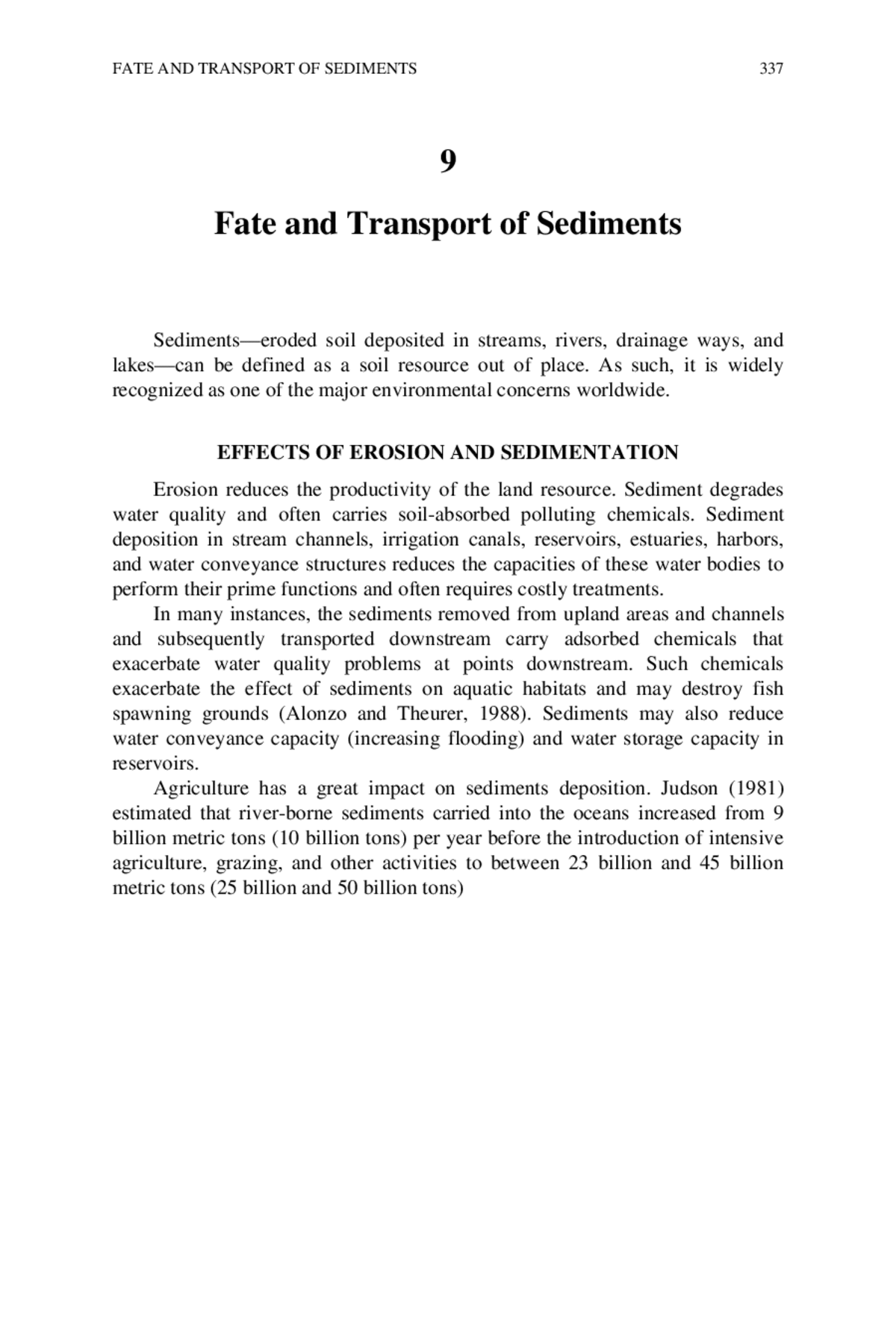
FATE AND TRANSPORT OF SEDIMENTS 340 Up on the hillside the evidence of eroded soil is obvious. The path of the soil's movement can be traced by the rills that cut through the vegetation on the slope and into the mud at the bottom of the hill's slope. Credit: U.S. Department of Agriculture.
FATE AND TRANSPORT OF SEDIMENTS 341 revised universal soil loss equation, R, the rainfall-runoff factor, expresses the climate; K, the soil erodibility factor, and C, the cover and management factor, reflect the soil properties; L, the slope length factor, and S, the slope- steepness factor, reflect the topography; C, the cover management factor, reflects the soil surface conditions; and C and P, the support practice factor, reflect human activities. As with water erosion, the factors in the wind erosion equation (Skidmore and Woodruff, 1968) essentially express the same functional relationship shown in Equation 9-1. The wind erosion equation's C factor represents the climate; I, the soil erodibility factor, and K, the soil ridge roughness factor, represent soil properties; L, the unsheltered median travel distance of the wind across a field, represents the topography; K and V represent the soil surface conditions and human activities, respectively. Although erosion processes can be complex, the principles of controlling erosion are relatively simple. Effective water erosion control requires simultaneous efforts to increase the degree to which and the length of the season during which the soil is covered by plants or plant residues and to decrease the volume and energy of runoff water. Effective wind erosion control also depends on increased amounts of soil cover and reductions in the energy of wind that is in contact with soil particles. In-Channel Processes Agricultural production practices have led to radically altered water flow regimes within agricultural watersheds. Modification of virgin (noncultivated) land often involved deforestation and drainage activities. In combination with cropping and grazing practices, these disruptions of the natural vegetation and soil resulted in loss of the land's water storage capacity. As local water tables lowered, many perennial springs ceased to flow, and streams that were once permanent flowed only intermittently. In addition, the rapid loss of water from the land produced a sharply exaggerated seasonal flow regime, increasing the frequency, severity, and unpredictability of high-volume flows (Menzel, 1983). Commonly, these alterations were well established within the first 40 to 50 years of agricultural development of an area (Trautman, 1957, 1977). These changes in flow regimes have been compounded by intensified land drainage (Menzel, 1983). The flow regime changes have had serious disruptive effects on streams and rivers by substantially increasing discharge peaks and the erosive powers of streams. The net effect has been to create conditions
FATE AND TRANSPORT OF SEDIMENTS 342 of serious channel morphology disequilibrium in many drainage systems (Leedy, 1979). As a consequence, headwater channels of the region commonly experience active bed degradation. Whereas in their natural condition the channels were deep and narrow, they have now broadened extensively through active bank and bed erosion. The rapidity of this erosive process can be dramatic, as exemplified by Four Mile Creek in Tama County, Iowa, where average cross-sectional areas increased 54 percent between 1967 and 1979; the channel width increased at an average rate of nearly 0.4 m/year (16 inches/year) and the depth increased at a rate of 0.03 m/year (1.2 inches/year) (Kimes et al., 1979; Menzel, 1983). The kind of channel erosion described above can become an important contributor to the sediment load in streams and rivers. In Four Mile Creek, 25 percent of the average annual loading of sediment is contributed by channel erosion (Menzel, 1983). Forty percent or more of the sediment load of streams and rivers in Iowa and Illinois has been estimated to arise from channel erosion (Glymph, 1956; Leedy, 1979). Measurements on Goodwin Creek in Mississippi revealed that over 60 percent of the sediment consisting of the silt and clay size fractions came from channel and gully erosion, whereas practically all sand came from gullies and channels (Grissinger et al., 1991). Channel instabilities cause sedimentation problems in many areas of the United States. They vary from the filling in of channels to entrenchment and bank failures associated with erosion within channels. The problems are especially severe along the bluff of the Mississippi and Yazoo river floodplain, where steep gradients promote channel erosion and the low gradients on the flood plain cause the sediment to be deposited. Flood control reservoirs also induce sediment deposition within upstream channels. Reductions in sediment movements to streams and rivers from adjacent croplands may not result in comparable improvements in sediment loads unless the distortions of watershed flow regimes are addressed. There are two ways to address this problem: (1) reduce the runoff energy of the water and sediments entering stream channels, and (2) protect or restore bottomlands in agricultural watersheds. These solutions are discussed more fully in the section on treatment technology. SEDIMENT ESTIMATION AND PREDICTION TECHNOLOGIES The ability to design programs and policies to control sedimentation in surface water depends on investigators' abilities to predict erosion,
FATE AND TRANSPORT OF SEDIMENTS 343 sediment delivery, and in stream processes. Understanding of these phenomena is often incomplete because of the unknown cause-effect implications of human influences. Erosion Estimation and Prediction Research begun in the 1930s under the leadership of Hugh Hammond Bennett, the father of modern soil conservation, ultimately led to the universal soil loss equation (Wischmeier and Smith, 1978) and the wind erosion equation (Skidmore and Woodruff, 1968). This technology has been widely used in the United States and worldwide for several decades for conservation planning efforts. Although the technology is old, investigators initiated an effort to update the universal soil loss equation; and the new technology, the revised universal soil loss equation, is being installed in the Soil Conservation Service of the U.S. Department of Agriculture for conservation program planning (Renard et al., 1991). Although the revised equation retains the six factors of the universal soil loss equation for estimating soil loss, the algorithms used for factor values are different, with the result that soil loss estimates for specific in situ scenarios obtained by the revised equation differ from those obtained by the universal soil loss equation. Similarly, the wind erosion equation predicts wind erosion rates as the product of five values representing soil erodibility, soil ridge roughness, climate, field length, and vegetative cover. Since the original and revised universal soil loss equations and the wind erosion equation were first introduced, their systematic approach has had a tremendous effect on erosion technology and conservation planning. During the 1960s and 1970s, fundamental research designed to create a better understanding of the principles and processes of soil erosion by water and wind received increased emphasis. Researchers analyzed and quantified the companion but very different processes of erosion caused by raindrops and runoff. Investigators defined the aerodynamics of wind in relation to soil detachment and transport. During the 1980s, the knowledge gained from past experiments and fundamental studies provided the basis for developing mathematical models to describe erosion over a wide range of specific conditions and to improve erosion prediction and control methods. At about the same time, the environmental movement gave impetus to an expanded research effort to understand the off-site effects of soil erosion and the potential for chemical pollution resulting from it. Models such as the chemicals, runoff, and erosion from agricultural management systems (CREAMS) model (Knisel, 1980) were formulated. The CREAMS model
FATE AND TRANSPORT OF SEDIMENTS 344 included hydrologic, erosion, pesticide, and nutrient components. Such models incorporated major advances in describing the physical processes involved in soil erosion, sediment transport and deposition, and chemical transport. Most recently, the water erosion prediction project (WEPP) model (Lane and Nearing, 1989) was developed by the Agricultural Research Service, the Soil Conservation Service, and the U.S. Forest Service of the U.S. Department of Agriculture (USDA); the Bureau of Land Management of the U.S. Department of the Interior; and cooperating universities. WEPP was developed as the next-generation water erosion prediction model to replace the original and revised universal soil loss equations. The more versatile WEPP model incorporates many of the scientific advances that have been made since development of the universal soil loss equation and is based on the physical principles and processes of soil erosion by water. A companion effort by other Agricultural Research Service, Soil Conservation Service, and university investigators is under way to improve the predictive capability of sediment loss from wind erosion, culminating in the wind erosion prediction system (WEPS) model. The WEPS model is based on the principles of wind erosion physics associated with climate, soil, topography, and cropping and management systems that affect sediment detachment, transport, and deposition by wind. These and similar models should assist conservation planners well into the twenty-first century. However, land management agencies in the United States and worldwide will need to expend numerous resources (time, labor, and money) developing new data bases to fully implement the technology. Given currently available modeling capacities, it should be possible to improve conservation planning. Computer technology should give conservationists the capability of using computer models to assist them in deciding between alternatives, thereby improving soil resource protection. The new technology is not without some costs, however, especially because computer-based planning requires personnel with expertise and training different from those classically required by conservationists. With the new models, it should be possible to improve the definition of highly erodible lands and predict the effects of farming system changes on erosion. More importantly, it will permit the design of erosion control systems and plans by using probabilistic relationships that recognize the uncertainties of erosion hazards. For example, much of the erosion occurs during relatively infrequent precipitation events. If
FATE AND TRANSPORT OF SEDIMENTS 345 such infrequent events occur during a particular time of the year, it is imperative that the land have good ground cover at that time. Thus, with carefully designed erosion control practices (for example, use of cover crops), it is possible to minimize the erosion hazard. Transport and Delivery Most watershed planning and evaluation methods require the use of some type of computer model. These models, designed for specific and general applications, deal with watersheds as landscape pieces (grid pieces and/or subwatersheds) or deal with processes such as runoff and erosion in upland areas, channel processes such as the route that water runoff takes, and erosion and sediment transport processes. Unfortunately, the currently available models emphasize upland processes or channel hydraulic processes; a model that treats each of these equally is not available. Analytical models that simulate the transport of sediments and adsorbed chemicals to points downstream have not progressed to the extent that those for on-site erosion have. The kinematic runoff and erosion (KINEROS) model (Woolhiser et al., 1990) and a mathematical model for simulating the effects of land use and management on water quality (ANSWERS) (Beasley et al., 1980) are capable of addressing hydrology, erosion, and sediment transport but are intended for the simulation of discrete events. In other instances there is a need for continuous simulation of runoff and sediment yields from watersheds and river basins where the impacts of conservation practices must be assessed. In such instances, the user must decide among such models as the simulator for water in rural basins (SWRRB) model (Williams et al., 1985), the agricultural nonpoint source pollution (AGNPS) model (Young et al., 1987), the CREAMS model (Knisel, 1980), and the watershed and grid version of the WEPP model that is being developed (Foster and Lane, 1987). These and other models (Fan, 1988; Renard et al., 1982) represent a wealth of technology, but they generally have limitations when applied to small upland watersheds where rills and ephemeral gullies may be filled in by tillage. Current technology for addressing ephemeral gully erosion involves use of the ephemeral gully erosion model (EGEM) (Woodward et al., 1991), which is an offshoot of the CREAMS model (Knisel, 1980). Sediment yields estimated with EGEM are at best subject to large errors, and the model is considered interim technology until more physically based process models such as the WEPP model become available.
FATE AND TRANSPORT OF SEDIMENTS 346 Regression models have been used to estimate sediment yields into small reservoirs (farm ponds) (American Society of Agricultural Engineers, 1977; Anderson, 1975; Dendy and Bolton, 1976; Flaxman, 1972; Pacific Southwest Inter-Agency Committee, 1968). Most of this technology is site-specific and does not permit the land manager or conservationist to assess the impact of agronomic and mechanical changes or the impact of hydraulic erosion control structures on sediment yields. Thus, there is a pressing need to replace such technology, even when it is used only for planning and assessment purposes. The currently available models used to simulate sediment transport and delivery are generally too site-specific (suffer from limited validation and verification) to be widely used in different climates and for different land uses. Although detailed models capable of simulating sediment transport exist, they are expensive (because they require many data) and are specific in their application (for example, sediment transport in a major river) but are impractical for such tasks as targeting lands that produce excessive sediments so that the lands might be targeted for a change in the ways they are managed to reduce sediment yields. Inadequacy of Technology Nearing and colleagues (1990) discussed water erosion prediction technology and identified research needs (weaknesses in technology) in four areas: (1) fundamental erosion relationships; (2) soil and plant parameters and their effects on erosion; (3) data bases, user interfaces, and conservation system design; and (4) model development and analysis. The review of Nearing and colleagues (1990) is based on experience through the development of the WEPP hill slope profile erosion model, which is a computer-based technology for estimating rill and interrill soil losses on hill slopes. They stated the following (Nearing et al., 1990:1710): Development of process-based erosion prediction technology has required the delineation and description of fundamental erosion processes and their interactions. Further improvement in prediction technology will require further delineation and mathematical descriptions. Some key topics for study include (i) describing headcutting and sidewall sloughing in rills, (ii) replacing or better describing the concept of sediment transport capacity and its relationships to detachment and deposition processes, (iii) developing theory and data sets to better predict deposition and sediment enrichment on complex slope profiles, and (iv) developing criteria for climate
FATE AND TRANSPORT OF SEDIMENTS 347 selection to obtain long-term average estimates of soil loss. New technology for describing erosion and sediment movement on complex hillslope profiles is also needed. Rainfall on unprotected soil detaches soil particles from the soil layer transports the particles downslope. This runoff carries rain-detached soil, which causes additional erosion; and the water is also lost for use in crop production. Credit: U.S. Department of Agriculture. Research on soil and plant parameters related to erosion can be divided into that focused on baseline conditions and on temporal changes. Statistical relationships for estimating baseline soil erodibility as a function of time- invariant soil properties exist. A fundamental approach to prediction is needed to further improve baseline erodibility estimation. Fundamental approaches are also needed to predict temporal changes in soil erodibility in response to climatic and cropping and management influences. Our understanding of and ability to characterize temporal changes in soil properties needs much improvement.
FATE AND TRANSPORT OF SEDIMENTS 348 Two specific areas that deserve attention are surface roughness effects on erosion and the effects of surface sealing on infiltration (Nearing et al., 1990:1710). New process-based erosion prediction technology will require an extensive data base to be effective. Innovative techniques for developing model parameters will be required, including expert systems. The new technology also opens new opportunities for refining existing and developing new erosion control practices. Methods for using the technology as an interactive tool for conservation systems design are needed. To apply the new process-based technology, we need additional research directed toward developing techniques for modeling natural resource systems. Validation and sensitivity analysis of the new erosion models must be done. We know erosion is highly variable in time and space. With the new simulation models, we can begin to address more fully temporal and spatial distributions of soil loss and sediment yield, confidence limits for our erosion estimates, and probabilities of meeting conservation goals with given management systems. Larson and colleagues (1990) discussed the tools for erosion control options available for conservation planning. Among other things, they discussed the following (Larson et al., 1990:62-63): Parallel to the developments in computer hardware have been developments in computer software such as geographic information systems (GIS), digital elevation models (DEM), and expert systems (ES). These tools will allow development and display of alternatives by conservationist/operators. Combining digital elevation models with soil maps should permit 3- dimensional views of soils on landscapes and display wedges of soil that could be lost as predicted by WEPP and WEPS. However, these software tools are stressing the attribute data of present digital databases such as the soil map which is the base from which all models run. More robust methods of representing the variability of soil properties within polygons (delineations) must be developed, perhaps to present a probabilistic representation of the properties. This same approach could then be extended to fields or watersheds. Combined with climatic probabilities, systems could be developed according to erosion risks and systems designed to control the risks similar to flood control systems. The analytical tools and expert systems must be able to integrate all ramifications of a resource management system such as the effects of erosion control practices and crop management systems on water quality and the soil ecosystem. These ramifications are so extensive
FATE AND TRANSPORT OF SEDIMENTS 349 that only a computer will be able to sort them out and present trade-offs for each conservation system and crop management system. Inadequate knowledge of the transport of sediments of specific particle size ranges is a major limitation in predicting the fate of adsorbed agricultural chemicals. Furthermore, investigators must be aware of the temporal and spatial variabilities of absorbed chemicals in upland environments in contrast to those in gullies and channels. Concentrations of adsorbed chemicals in upland areas are presumably high, whereas the sediments originating in gullies and channel peripheries conceivably have lower amounts of adsorbed chemicals. A major problem with modeling upland erosion and sediment transport where concentrated flow begins involves the hydraulic transport process. Most sediment transport processes for upland erosion models are taken from those developed for stream flows. The WEPP model uses a mathematical relationship described by Yalin (1963), as modified by Foster and colleagues (1981), for nonuniform sediments. It is doubtful whether investigators can make significant progress in this area simply by using a different sediment transport formula. Theory must be developed and experiments specifically related to the development of new transport equations must be conducted for shallow rill- and interrill-type flows. Significant advances in characterizing turbulent flows have recently been made by using flow visualization and other techniques, but those studies have not been extended to the shallow flow conditions common to areas with rill and interrill erosion. More important than which sediment transport equation should be used to predict soil erosion is the issue of what transport capacity means and how it is used. In basic terms, transport capacity is a balance between the entrainment and the deposition rates of the already detached sediment in the flow. The description of the entrainment process does not include a factor for cohesive soil forces, but considers only the gravity forces of the sediment that must be overcome for the particle to be lifted into the flow. The implicit assumption, then, for erosion of cohesive soils is that cohesive forces are negligible once the soil has initially been detached from the in situ soil mass. The technology currently used to predict wind erosion in the United States is based on variations of the wind erosion equation (WEQ). The technology uses erosion loss estimates that are integrated over large areas and long time scales to produce average annual values. In order to increase the range of conditions to which WEQ technology can be applied in the short-term, a revised wind erosion equation (RWEQ) is under development. The RWEQ embodies improved values for the
FATE AND TRANSPORT OF SEDIMENTS 350 WEQ factors and is designed to calculate erosion during periods as short as a month. As with water erosion, the widespread availability of personal computers and new research has led to results that can be used to adopt flexible, process- based technologies to assess and plan conservation practices for wind erosion control. Thus the USDA also has a major program under way to develop new wind erosion prediction technologies. The wind erosion model development program has two stages. The first stage is development of a wind erosion research model (WERM); the second stage is development of a wind erosion prediction system (WEPS). In this second stage, the submodels of WERM will be reorganized to increase computational speed, data bases will be expanded in size, and a user-friendly input-output section will be added to make the technology of greater utility to users. WERM is modular and consists of a supervisory program and seven submodels (weather, hydrology, decomposition, crop, management, soil, and erosion). Four databases are neededâsoils, climate, crop growth and decomposition, and management. The submodels permit easy testing and updating with new data during development of the technology. Finally, as in the WEPP technology, extensive experimental work is being carried out simultaneously with model development and is devoted to delineating parameter values that facilitate application of the algorithm to both measured and unmeasured processes (Hagen, 1988; Hagen et al., 1988). As the new wind erosion prediction technology becomes operational, considerable work will need to be done to develop the data bases required for its implementation over the wide range of environmental conditions that occur in the United States and worldwide. As with water erosion, wind erosion prediction technology will require development of associated technologies such as expert systems, digital elevation models, and geographic information systems. Future Needs Despite the advances that have been made in estimating and predicting erosion by wind and water, many questions related to data sources, methods of data collection and extrapolation, and data accuracy and reliability remain unanswered. Soil erosion and sedimentation research is a capital-intensive and time-consuming exercise. Furthermore, extrapolation to the global scale on the basis of the limited data collected by diverse and nonstandardized methods leads to gross approximations. There is an urgent need for methods that can be used to increase the
FATE AND TRANSPORT OF SEDIMENTS 351 reliability and accuracy of soil erosion and sedimentation data. Current data are often collected with equipment developed decades ago, and such equipment is incompatible with modern computer simulation technologies. Finally, the historical erosion data bases are often developed from data for agricultural crops (varieties, row spacing, management practices) that are different from those planted today. Significant investments in personnel and funds that are in excess of those currently available will be required to overcome such problems. From a policy standpoint, land managers and conservationists need to be able to (1) target those lands that are most vulnerable to erosion, (2) develop and apply treatments to these vulnerable lands, and (3) predict how changing land uses and conservation practices have an impact on erosion from the new land uses and conservation practices. Finally, the financial implications of those relationships need to be estimated. With the current state of technology, the objectives described above will be expedited with further development of (1) geographic information systems, to permit assembly and input of the data needed by the evolving models; (2) the data bases required by the new erosion and sedimentation models; (3) fundamental sediment transport relationships appropriate for use in upland farming areas where runoff occurs in small channels and where the hydraulic roughness is large relative to the flow depth; and (4) transport relations that address the particle size ranges of sediments so that assessments of adsorbed agricultural chemical transports can be made. TREATMENT TECHNOLOGY Technologies that can be used to reduce the amount of sediment in surface water focus on two objectives: (1) improving farming practices to reduce erosion and runoff, and (2) improving stream channels and riparian vegetation to reduce erosion of stream banks and streambeds. Farming Practices The effects of different types of plant cover, tillage, and cropping systems have been evaluated on erosion plots and watersheds and by using rainfall simulators and wind tunnels. Various types of conservation tillage practices have been developed and evaluated. They have been found to reduce greatly both water and wind erosion from land during intensive cropping. Scientists have also identified and quantified those soil and sediment characteristics that affect erosion rates and sediment pollution potential.
FATE AND TRANSPORT OF SEDIMENTS 352 Farming technologies, in an effort to meet producer needs to preserve soil quality, are designing equipment to meet changing farming systems. This no- till drill has an adjustable down-pressure system that applies constant force on the openers for consistent penetration in varying soil conditions. Credit: Deere & Company. In most farming systems, the critical period for erosion is the time after harvest but before a new crop is established. During this period, soil is most exposed to wind and water, and, therefore, is most vulnerable to erosion. Efforts have been and are being made to develop farming practices that increase soil cover during this noncrop period (Mills et al., 1991). Much effort has gone into the development of reduced-tillage systems that increase the amounts of crop residues to provide soil cover after the crop is harvested. Many different systems of conservation tillage have been developed for different farming systems in different regions. Mannering and colleagues (1987) described five kinds of conservation tillage systems in use in the United States, including no-till or slot planting, ridge-till, strip-till, mulch-till, and reduced-till systems (Table 9-1). All of these systems are designed to cover at least 30 percent of the soil at the time of planting.
FATE AND TRANSPORT OF SEDIMENTS 353 TABLE 9-1 Conservation Tillage Systems in the United States Tillage System Description No-till or slot planting The soil is left undisturbed prior to planting. Planting is completed in a narrow seedbed about 2- to 8-cm wide. Weed control is accomplished primarily with herbicides. Ridge-till The soil is left undisturbed prior to planting. About one-third of the soil surface is tilled with sweeps or row cleaners at planting time. Planting is completed on ridges usually 10 to 15 cm higher than row middles. Weed control is usually accomplished with a combination of herbicides and cultivation. Strip-till The soil is left undisturbed prior to planting. About one-third of the soil surface is tilled at planting time. Tillage in the row may be done by a rototiller, in-row chisel, row cleaners, and so on. Weed control is accomplished with a combination of herbicides and cultivation. Mulch-till The total surface is disturbed prior to planting. Tillage tools such as chisels, field cultivators, disks, sweeps, or blades are used. A combination of herbicides and cultivation is used to control weeds. Reduced-till This system consists of any other tillage and planting system not described above that produces 30 percent surface residue cover after planting. SOURCE: Adapted from J. V. Mannering, D. L. Schertz, and B. A. Julian. 1987. Overview of conservation tillage. Pp. 3â17 in Effects of Conservation Tillage on Groundwater Quality, T. J. Logan, J. M. Davidson, J. L. Baker, and M. R. Overcash, eds. Chelsea, Mich.: Lewis Publishers. The effects of conservation tillage systems on runoff and soil loss can be dramatic. Table 9-2 compares the amount of surface soil cover, soil erosion, and runoff from a rainfall simulator for three different wheat tillage systems. Increased soil cover was found to greatly reduce both water runoff and soil erosion. Table 9-3 gives sediment yields (soil loss) and water runoffs from two watersheds, one under a conservation (ridge-till) tillage system and one under a conventional tillage system. Average runoff was nearly 3 times greater and soil loss was 10 times greater in the conventionally tilled watershed than were those in the conservation tilled watershed. Table 9-4 illustrates the percentage of cropland (nonforage crops) planted under various forms of conservation tillage in 1985. The National Association of Conservation Districts reports the area of land under conservation tillage annually through its Conservation Tillage Information Center. The 1991 report (National Association of Conservation Districts, Conservation Tillage Information Center, 1991)
FATE AND TRANSPORT OF SEDIMENTS 354 TABLE 9-2 Surface Soil Cover, Soil Erosion, and Runoff from Different Wheat Tillage Systems Period System Cover (percent) Runoff (cm) Soil Loss (kg/ ha) Fallow after Bare fallow 62 0.9 662 harvest Stubble mulch 91 1.5 803 No-till 91 0.1 718 Fallow after Bare fallow 4 3.6 9,401 tillage Stubble mulch 92 0.9 208 No-till 96 0.1 17 Wheat 10-cm tall Bare fallow 26 3.5 7,246 Stubble mulch 38 2.4 2,576 No-till 85 0.5 550 Wheat 45-cm tall Bare fallow 78 4.3 2,094 Stubble mulch 83 2.9 836 No-till 88 1.6 337 SOURCE: J. M. Laflen, R. Lal, and S. A. El-Swaify. 1990. Soil erosion and a sustainable agriculture. Pp. 569â581 in Sustainable Agricultural Systems, C. A. Edwards, R. Lal, P. Madden, R. H. Miller, and G. House, eds. Ankeny, Iowa: Soil and Water Conservation Society. Reprinted with permission from © Soil and Water Conservation Society. TABLE 9-3 Runoff and Soil Loss from Watersheds under Conventionally and Conservation Tilled Systems Conservation Tilled Watershed Conventionally Tilled Watershed Year Runoff (mm) Soil loss (metric Runoff (mm) Soil loss (metric tons/ha) tons/ha) 1973 27 0.2 75 1.1 1974 2 0.0 14 0.7 1975 3 0.0 21 1.8 1976 10 2.5 4 0.0 1977 8 0.2 104 18.4 1978 40 1.1 81 9.3 1979 76 0.2 102 4.3 1980 50 4.5 116 51.8 Average 27 1.1 65 10.9 SOURCE: J. M. Laflen, R. Lal, and S. A. El-Swaify. 1990. Soil erosion and a sustainable agriculture. Pp. 569â581 in Sustainable Agricultural Systems, C. A. Edwards, R. Lal, P. Madden, R. H. Miller, and G. House, eds. Ankeny, Iowa: Soil and Water Conservation Society. Reprinted with permission from © Soil and Water Conservation Society.
FATE AND TRANSPORT OF SEDIMENTS 355 contains much information regarding efforts to control erosion with conservation tillage practices. Figure 9-1 shows, by U.S. counties, the land area on which conservation tillage systems are used. In 1991, conservation tillage was used on 28.14 percent of all planted lands; this estimate was up from 26 percent in 1990 and 25.6 percent in 1989, indicating increasing adoption of this method of erosion control. TABLE 9-4 Cropland Area under Various Forms of Conservation Tillage, 1985 Percent Cropland Planted in Nonforage Crops by Region NT RiT ST MT ReT All Percent Idle Pacific Northwest 3.6 0.1 0.0 20.7 7.9 32.2 32 Northern Great Plains 3.6 0.1 0.0 16.0 9.5 29.3 32 Central Great Plains 3.5 2.0 1.3 24.0 14.8 45.7 27 Southern Great Plains 1.2 0.2 0.1 16.7 12.3 30.5 24 Northern Corn Belt 3.1 1.4 0.2 31.5 0.5 36.6 5 Southern Corn Belt 7.3 0.7 0.2 29.4 2.7 40.3 5 Northeast 6.2 0.1 0.0 7.0 8.9 22.2 3 Eastern Uplands 15.4 0.0 0.1 14.9 8.4 38.8 6 Piedmont 22.7 0.3 0.3 16.4 8.0 47.7 3 Coastal Plains 8.6 0.1 0.6 13.1 2.8 25.2 6 Associated Delta 2.0 0.2 0.0 4.4 5.3 11.7 12 NOTE: NT, no-till; RiT, ridge-till; ST, strip-till; MT, mulch-till; ReT, reduced-till; All, sum of area under any conservation tillage system. SOURCE: R. R. Allmaras, G. W. Langdale, P. W. Unger, R. H. Dowdy, and D. M. Van Doren. 1991. Adoption of conservation tillage and associated planting systems. Pp. 53â84 in Soil Management for Sustainability, R. Lal and F. J. Pierce, eds. Ankeny, Iowa: Soil and Water Conservation Society. Reprinted with permission from © Soil and Water Conservation Society. The use of cover crops is an important way of controlling erosion. For example, an extended period without soil cover during periods of potentially high erosion leads to excessive erosion in many areas. Hargrove (1991) recently described research highlighting the advantages of using cover crops for maintaining clean water. Channel Management Channel erosion tends to increase when there are low sediment loads from decreased upland erosion and tends to decrease when there are high sediment loads from increased upland erosion. Thus, erosion control on-farm fields and upland areas, such as that which might result from the use of conservation tillage or grassed waterways, may result in excessive channel instability if runoff is also not controlled. Channel
FATE AND TRANSPORT OF SEDIMENTS 356 erosion damages include instability resulting from steepened banks and storm flows over channel banks in reaches where sand and gravel accumulate, leading to poor floodplain drainage, runoff pollution, and off-site damages. Upland erosion control programs may also reduce runoff rates and amounts, but it may be accomplished at the expense of reduced water supplies downstream. FIGURE 9-1 Crop residue levels on planted acreage by region in 1992. U.S. Department of Agriculture, Economic Research Service. 1993. Agricultural Resources: Cropland, Water, and Conservation. Situation and Outlook Report AR-30. Washington, D.C.: U.S. Department of Agriculture, Soil Conservation Service. Channel maintenance programs suffer from the perceived idea that engineering efforts associated with, for example, bank stabilization, grade control, dredging, and energy control are aesthetically unacceptable and destroy wildlife and biological habitats. Therefore, engineering approaches to watershed management (as well as flood control and channel maintenance) are not receiving public support. Yet, there are many scenarios by which a combination of upland and channel treatments are required for ecological, natural resource, and environmental protection or enhancement. Treatment of channel erosion must be based on consideration of the temporal and spatial complexities within the entire watershed, which is a very complex problem at best.
FATE AND TRANSPORT OF SEDIMENTS 357 Technologies for channel erosion rectification are available. Such technologies include the use of vegetation, rip-rap (protecting stream banks with rock or other nonerodible materials), and various structural materials for bank stabilization; grade control structures for bed stabilization; and debris removal, channel realignment, and river-training structures (structures that control or direct the flow of water in river channels) for increasing the amount of sediment and water that can be conveyed. Upland treatments may increase the retention times of water runoffs and thus reduce the flood peaks and their associated erosive capacity through channels and limit the delivery of sediments to channels subject to deposition. Channel maintenance involves control of the energy of the flowing water in such a way that erosion of the stream banks and streambed is minimized in an environmentally and aesthetically acceptable way. Energy control methods involve combinations of agronomic and engineering treatments that enhance channel dynamics and environmental control. Some specific technical problems are described below. Sediment Transport Sediment transport is still poorly defined. Deviations of actual sand transport rate measurements from average trends are large with long time cycles. Consequently, estimates of the sand load for unmeasured streams or for single events in even the most intensively observed channels cannot be made on a reliable basis. Few measurements of the fraction of gravel in the bed material load have been made, but the evidence suggests that gravel accumulation in alternate sand and gravel bars may deflect the water flow and cause erosion of the opposite banks. Consequently, design of control measures remains largely an empirical equilibrium relation with a limited basis to define the probability of failure. Rectification methods vary in cost, so the means to design rectifications to balance construction and maintenance costs with potential losses from failures are needed. Development of new, more economical rectification methods may be feasible. Research is needed to define the relative effectiveness of combinations of various protective measures not only in protecting upstream channels but also in altering the amount of sediment delivered downstream. Development of a systems approach to channel rectification is needed. Distribution of Erosive Forces The distribution of erosive forces between bed and bank materials and between particles of different sizes is poorly understood. More importantly,
FATE AND TRANSPORT OF SEDIMENTS 358 critical shears are not well understood. Bank material is often affected by electrochemical forces, primarily in the silt-clay fraction, and knowledge of how to treat these forces remains obscure, especially given the heterogeneity of bank materials. Fundamental studies are needed to clarify these uncertainties. River crossings can be affected by both scour and bed degradation caused by erosion in the river channel. Scouring causes local and often temporary lowering of bed levels over a short distance, whereas degradation causes an extensive and often progressive lowering of the riverbed over a fairly long distance, which also implies a disequilibrium. Whereas scour problems can often be controlled by local protective measures, progressive degradation may be more difficult to control if it is not detected in time. Consequences may include loss of land, exposure of building foundations, stream bank failures, and loss of embankments, dams, or other structures. On the other hand, scour around local structures such as jetties and bridge abutments can proceed independently of the more general degradation process. Downstream Impacts Downstream impacts have been restricted mostly to evaluation of the effects of sediment on channel stability and the filling of reservoirs in relatively small watersheds. Most of this effort has been concentrated in traditionally agricultural areas in the South and Midwest. In addition to climatic variability and hydrologic differences, some areas of the United States have influent rather than effluent streambeds, which change the nature of downstream impacts of channel instability. Channel Dynamic Conditions The channel dynamic conditions must be incorporated into water resource analytic models in sufficient detail to permit meaningful assessment of the role of engineering structures and channel heterogeneity. Whereas past modeling efforts have generally been approached with one-dimensional models, the technology is not appropriate when suspended and bed material move along nonaligned paths. Effect of Wetlands on Sedimentation Wetlands can have important effects on sedimentation. For example, drainage from wetlands can alter the stability and hydrologic balance of downstream channels. Furthermore, the runoff moving from wetlands
FATE AND TRANSPORT OF SEDIMENTS 359 may be clear of sediment and have sufficient energy to degrade downstream channels. In still another scenario, the runoff storage provided by a wetland may reduce peak discharge rates and reduce downstream flooding and channel deterioration. What is needed is a wetland classification linked to geographic, aquatic, or ecological features; the relative abundance of wetland types within a regionâ especially critical watersheds; and the threat of degradation both to the wetland and to off-site resources (Reilly, 1991). Habitat, water quality improvement, flood prevention, and groundwater recharge should be considered. Bottomlands are a special classification of wetlands that differ considerably between the humid eastern and the semiarid western parts of the United States. The more even distribution of monthly precipitation in humid areas results in infiltration in the upper part of a watershed that often reemerges in bottomlands. The bottomland width is controlled by topography, climate, and geology. Bottomlands tend to discharge groundwater to their associated streams and provide a significant part of the stream flow. Bottomlands in humid areas are often sinks for nutrients and sediments. Thus, the floods that do occur are shallow and of low velocity across heavily vegetated bottomlands that trap most of the upland sediments. In more arid regions such as those in the western United States, influent streams that result when the water table is below the level of the channel bed result in unique problems in maintaining stable channels. Vegetation in such zones is controlled by the water table depth, which in turn affects above- and belowground biomass and the natural stabilities of the streambeds and stream banks. In other instances, grazing animals have access to the channels (where they go for shade and water) and trample the vegetation, causing bank sloughing and pollution from fecal matter. Thus, downcutting of the channel can lower the water table, have a negative impact on plant physiology and production, and further exacerbate downstream problems of sedimentation, channel stability, water yield, and the ecological balance.
FATE AND TRANSPORT OF SEDIMENTS 360
