
Essen and John V.L. Parry, but this clock required a roomful of equipment. Another of Rabi's former associates, Jerrold Zacharias of MIT, managed to turn the atomic clocks into practical devices. Zacharias had plans for building what he called an atomic fountain, a visionary type of atomic clock that would be accurate enough to study the effect of gravity on time that had been predicted by Einstein. In the process, he developed an atomic clock small enough to be wheeled from one laboratory to another. In 1954, Zacharias joined with the National Company in Malden, Massachusetts, to build a commercial atomic clock based on his portable device. The company produced the Atomichron, the first commercial atomic clock, 2 years later and sold 50 within 4 years. The cesium atomic clocks used in GPS today are all descendants of the Atomichron.
By 1967, research in atomic clocks had proved so fruitful that the second had been redefined in terms of an atomic standard relative to the 9 billion-plus oscillations of a cesium atom per second. Today 's atomic clocks are typically accurate to within 1 second in 100,000 years.
Physicists have continued to experiment with novel variations on the atomic-resonance ideas of Rabi and his students and to put them to work in atomic clocks. Rather than using magnets, one technique makes use of a phenomenon known as optical pumping to select out the energy levels of the atoms that will do the timekeeping and employs a beam of light to force all the atoms in the beam into the desired state. This work led to a Nobel Prize for Alfred Kastler of the École Normal Supérieure in Paris. Today, many atomic clocks use optically pumped rubidium atoms instead of cesium. The rubidium clocks are considerably less expensive and smaller than cesium clocks, but they are not quite as accurate.
Another type of atomic clock is known as the hydrogen maser. Masers originated in research on the structure of molecules by Charles Townes and his colleagues at Columbia University in 1954, work for which Townes shared the 1964 Nobel Prize in physics. The maser, which is the precursor of the laser, is a microwave device that generates its signal by direct emission of radiation from atoms or molecules. While Townes's original maser used ammonia, Ramsey and his colleagues at Harvard developed a maser in 1960 that operates with hydrogen and serves as an atomic clock of extreme precision.
By 1967, research in atomic clocks had proved so fruitful that the second was redefined in terms of the oscillations of a cesium atom. Today's atomic clocks are typically accurate to within 1 second in 100,000 years. Our nation's primary time standard is the recently inaugurated atomic clock at the National Institute of Standards and Technology, called NIST-7. Its estimated accuracy is to within 1 second in 3 million years.
Over the years, all three clocks—the cesium-beam clock, the hydrogen-maser clock, and the rubidium clock—have seen service in space, either in satellites or in ground control systems. GPS satellites ultimately rely on cesium clocks that resemble those conceptualized by Rabi 60 years ago.
In 1993, 2 decades after it was conceived in the Pentagon, GPS became fully functional with the launching of its 24th satellite. The satellites are operated by the U.S. Air Force, which monitors them from five ground stations around the world. The data gathered are analyzed at the Air Force Consolidated Space Operations Center in Colorado, which transmits daily updates to each satellite, correcting their clocks and their orbital data.
GPS and the Future
It is often forgotten that GPS is still a military device built by the Department of Defense at a cost of $12 billion and intended primarily for military use. That fact has led to one of the few controversies surrounding the remarkably successful system. As with any new technology, progress brings risk, and GPS potentially could be used to aid smugglers, terrorists, or hostile forces. The Pentagon made the GPS system available for commercial use only after being pressured by the companies that built the equipment and saw the enormous potential market for it. As a compromise, however, the Pentagon initiated a policy known as selective availability, whereby the most accurate signals broadcast by GPS satellites would be reserved strictly for military and other authorized users. GPS satellites now broadcast two signals: a civilian signal that is accurate to within 100 feet and a second signal that only the military can decode that is accurate to within 60 feet. The Pentagon has also reserved the
ability to introduce errors at any time into the civilian signal to reduce its accuracy to about 300 feet.
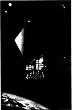
Twenty-four Navstar satellites—each the size of a large automobile and weighing some 1,900 pounds —circle the earth in 11,000-mile-high orbits. The satellite system, built by Rockwell International and operated by the U.S. Air Force, was completed in 1993, 20 years after it was first conceived in the Pentagon. (Lockheed Martin Astro Space)
In March 1996, the White House announced that the highest level of GPS accuracy will be made available to everyone, and the practice of degrading civil GPS signals will be phased out within a decade. The White House also reaffirmed the federal government's commitment to providing GPS services for peaceful civil, commercial, and scientific use on a worldwide basis and free of charge.
The future of GPS appears to be virtually unlimited; technological fantasies abound. The system provides a novel, unique, and instantly available address for every square yard on the surface of the planet —a new international standard for locations and distances. To the computers of the world, at least, our locations may be defined not by a street address, a city, and a state, but by a longitude and a latitude. With the GPS location of services stored with phone numbers in computerized “yellow pages,” the search for a local restaurant or the nearest gas station in any city, town, or suburb will be completed in an instant. With GPS, the world has been given a technology of unbounded promise, born in the laboratories of scientists who were motivated by their own curiosity to probe the nature of the universe and our world, and built on the fruits of publically supported basic research.
In March 1996, the White House announced that the highest level of GPS accuracy will be made available to everyone, and the practice of degrading civil GPS signals will be phased out within a decade. The White House also reaffirmed the federal government's commitment to providing GPS services for peaceful civil, commercial, and scientific use on a worldwide basis and free of charge.


