
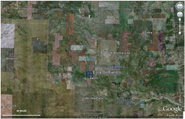
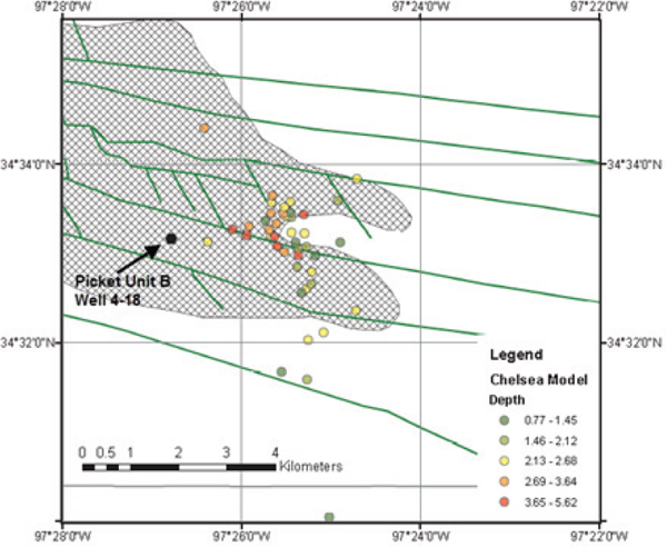
A hydraulic fracture treatment in January 2011 in Eola field, Oklahoma, coincided with a series of earthquakes. Eola field is located in central Oklahoma, southwest of Oklahoma City (Figure J.1). Felt seismicity was reported on the evening of January 18 from one resident near Elmore City, Oklahoma. Further analysis showed 50 earthquakes occurred that evening, 43 of which were large enough to be located, ranging in magnitude from M 1.0 to M 2.8. The earthquakes are coincident in location and timing with a hydraulic fracture in the Eola field, Picket Unit B well 4-18. The events all occurred within 24 hours of the first activity. The deepest hydraulic fracture in the Picket Unit B well 4-18 occurred 7 hours before the first earthquake was detected. Most of the events appear to be about 3.5 km (2.2 miles) from the hydraulic fracture well (Figure J.2).
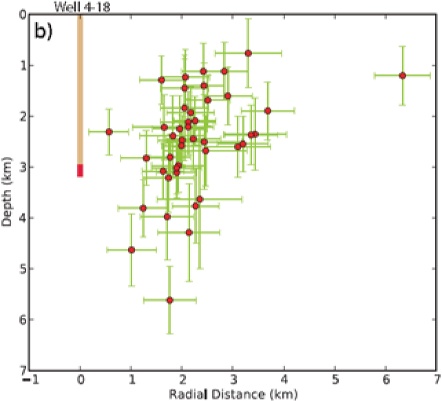
Accurate event locations were difficult to establish; the closest seismic station was 35 km (22 miles) away from the locus of the events. Errors in location are estimated to be 100-500 m (~100 to more than 500 yards) in ground distance and twice that for depth. The hypocenter depths are approximately 1 to 5 km in depth, similar to the injection depth for the 4-18 well (Figure J.3).
Other cases of suspected induced activity in Oklahoma have been reported in the past. For example, in June 1978, 70 earthquakes occurred in 6.2 hours in Garvin County after a hydraulic fracture treatment. In May 1979, a well was stimulated over a 4-day period, where three different formations were hydraulically fractured over at depths of 3.7, 3.4, and 3.0 km (2.2 to 1.8 miles). The first and deepest hydraulic fracture stage was followed by 50 earthquakes over the next 4 hours. The second stage was followed immediately by 40 earthquakes in 2 hours; no activity was associated with the third and shallowest hydraulic fracture (Nicholson and Wesson, 1990). The largest event in the sequence was M 1.9. Just two of the earthquakes were felt. The activity was 1 km (0.6 miles) away from the Wilson seismic station in Oklahoma.
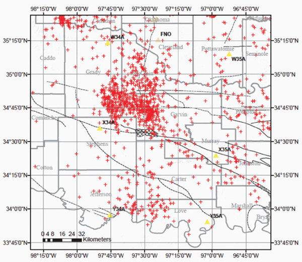
South central Oklahoma has experienced historical seismicity (Figure J.4) and has been the most seismically active part of the state since 1977. A series of Earthscope Transportable Array stations were located near the events by coincidence; without these stations, a majority of the earthquakes could not be located.
REFERENCES
Harlton, B.H. 1964. Tectonic framework of Eola and Southeast Hoover oil fields and West Timbered Hills area, Garvin and Murray counties, Oklahoma. Bulletin of the American Association of Petroleum Geologists 48(9):1555-1567.
Holland, A. 2011. Examination of possibly induced seismicity from hydraulic fracturing in the Eola Field, Garvin County, Oklahoma. Oklahoma Geological Survey Open-File Report OF1-2011. Available at www.ogs.ou.edu/pubsscanned/openfile/OF1_2011.pdf. Accessed April 2012.
Nicholson, C., and R.L. Wesson. 1990. Earthquake Hazard Associated with Deep Well Injection—A Report to the U.S. Environmental Protection Agency. U.S. Geological Survey Bulletin 1951, 74 pp.


