


Below is the uncorrected machine-read text of this chapter, intended to provide our own search engines and external engines with highly rich, chapter-representative searchable text of each book. Because it is UNCORRECTED material, please consider the following text as a useful but insufficient proxy for the authoritative book pages.
65 A P P E N D I X B B.1 American Trucking Trends (ATT) B.1.1 Overview ATT is the almanac of U.S. trucking that amalgamates vari- ous data sources. ATT is produced by ATAâs Economics and Statistics Department and provides data items of interestâ VMT, tons, and value of cargoâas a secondary analysis. ATT identifies significant trends in truck tonnage, freight revenue, and revenue share for the motor carrier industry, as well as facts about North American trucking. Specifically, Chapters 2, 7, and 8 of this report cover trucking performance and international surface trade, which contains data items of interest. The contents of ATT include ⢠Trucking Performance: Commodity Flow Data; trucking failures; truck tonnage; truck revenue; revenue per mile and revenue per ton; and Trucking Producer Price Indexes; ⢠Fleet Demographics: Registrations; ⢠International Trade: surface trade by transportation mode; truck trade by commodity; and truck trade by U.S. state; and ⢠Vehicle miles and fuel consumption; and emissions. B.1.2 The Basics Differing amounts of detailed information are available per primary data source to complete the sections under the heading, The Basics. Where information could not be located, the section on The Basics, has been omitted. B.1.2.1 How Are the Data Generated? As a secondary analysis, ATT cites the following data sources for data items of interest: ⢠Value of Cargo by truck typeâFor-hire truck and private truck: 2007 Commodity Flow Survey; ⢠Value of Cargo by commodityâExports and imports by commodity: North American Transborder Freight Data; ⢠VMTâSingle-unit and combination truck: Highway Statistics 2008; ⢠Tons: Monthly Truck Tonnage Trends and Trucking Activ- ity Report. Primary Data Sources ATT Definition of Truck All trucks (excluding vehicles used by the government and on farms, but including all weight classes) Data Items of Interest VMT, tons, value of cargo Geographical Level National Source Data Commodity Flow Survey, North American Transborder Freight Data, Highway Statistics, Monthly Truck Tonnage Trends, and Trucking Activity Report Data Gathering Method N/A Agency in Charge ATA Years Covered 1999-2009 Table B-1. American Trucking Trends (ATT).
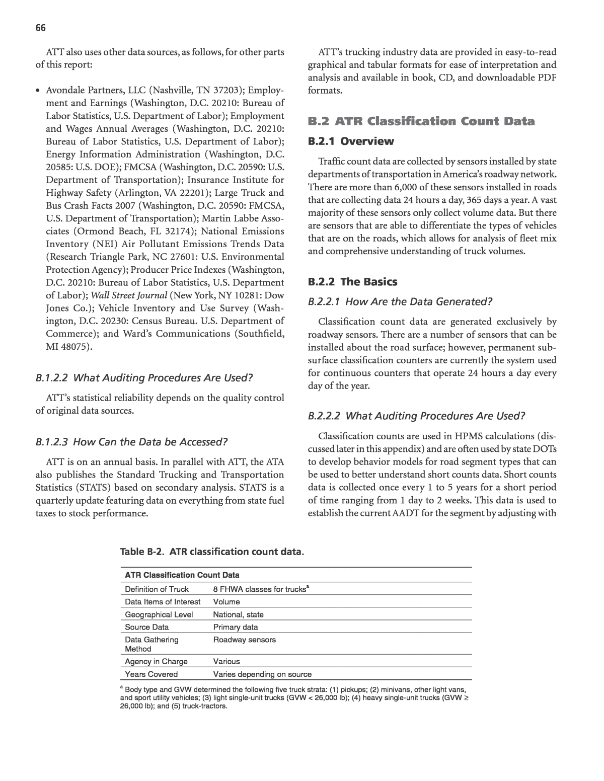
66 ATT also uses other data sources, as follows, for other parts of this report: ⢠Avondale Partners, LLC (Nashville, TN 37203); Employ- ment and Earnings (Washington, D.C. 20210: Bureau of Labor Statistics, U.S. Department of Labor); Employment and Wages Annual Averages (Washington, D.C. 20210: Bureau of Labor Statistics, U.S. Department of Labor); Energy Information Administration (Washington, D.C. 20585: U.S. DOE); FMCSA (Washington, D.C. 20590: U.S. Department of Transportation); Insurance Institute for Highway Safety (Arlington, VA 22201); Large Truck and Bus Crash Facts 2007 (Washington, D.C. 20590: FMCSA, U.S. Department of Transportation); Martin Labbe Asso- ciates (Ormond Beach, FL 32174); National Emissions Inventory (NEI) Air Pollutant Emissions Trends Data (Research Triangle Park, NC 27601: U.S. Environmental Protection Agency); Producer Price Indexes (Washington, D.C. 20210: Bureau of Labor Statistics, U.S. Department of Labor); Wall Street Journal (New York, NY 10281: Dow Jones Co.); Vehicle Inventory and Use Survey (Wash- ington, D.C. 20230: Census Bureau. U.S. Department of Commerce); and Wardâs Communications (Southfield, MI 48075). B.1.2.2 What Auditing Procedures Are Used? ATTâs statistical reliability depends on the quality control of original data sources. B.1.2.3 How Can the Data be Accessed? ATT is on an annual basis. In parallel with ATT, the ATA also publishes the Standard Trucking and Transportation Statistics (STATS) based on secondary analysis. STATS is a quarterly update featuring data on everything from state fuel taxes to stock performance. ATTâs trucking industry data are provided in easy-to-read graphical and tabular formats for ease of interpretation and analysis and available in book, CD, and downloadable PDF formats. B.2 ATR Classification Count Data B.2.1 Overview Traffic count data are collected by sensors installed by state departments of transportation in Americaâs roadway network. There are more than 6,000 of these sensors installed in roads that are collecting data 24 hours a day, 365 days a year. A vast majority of these sensors only collect volume data. But there are sensors that are able to differentiate the types of vehicles that are on the roads, which allows for analysis of fleet mix and comprehensive understanding of truck volumes. B.2.2 The Basics B.2.2.1 How Are the Data Generated? Classification count data are generated exclusively by roadway sensors. There are a number of sensors that can be installed about the road surface; however, permanent sub- surface classification counters are currently the system used for continuous counters that operate 24 hours a day every day of the year. B.2.2.2 What Auditing Procedures Are Used? Classification counts are used in HPMS calculations (dis- cussed later in this appendix) and are often used by state DOTs to develop behavior models for road segment types that can be used to better understand short counts data. Short counts data is collected once every 1 to 5 years for a short period of time ranging from 1 day to 2 weeks. This data is used to establish the current AADT for the segment by adjusting with ATR Classification Count Data Definition of Truck 8 FHWA classes for trucksa Data Items of Interest Volume Geographical Level National, state Source Data Primary data Data Gathering Method Roadway sensors Agency in Charge Various Years Covered Varies depending on source a Body type and GVW determined the following five truck strata: (1) pickups; (2) minivans, other light vans, and sport utility vehicles; (3) light single-unit trucks (GVW < 26,000 lb); (4) heavy single-unit trucks (GVW ⥠26,000 lb); and (5) truck-tractors. Table B-2. ATR classification count data.
67 seasonal weighting. Continuous count class data is reported to TMAS, which uses the following automated checks for data quality: ⢠Duplicates within the batch ⢠Fatal error occurs if â No C in the 1st digit of the record â Record length less than number of characters based on station data field 15 â No station ID in the record (columns 4-9) â No corresponding station in National Database ⢠Critical errors occur if â Volume checks 77 Record includes 7 or more consecutive zero hours 77 Record includes zero hour volume with one or more 77 Boundaries with over 50 vehicles 77 24 hours of data not in a given record 77 Any hourly volume exceeds the max per hour per lane value 77 Splits check show unbalanced directional volumes greater than 77 5 percent variance from 50 percent 77 MADT from same month previous year not within 30 percent ⢠Caution flags occur if â Classification checks 77 Percent class by day maximum check 77 Percent class by day based on historical valueâ (Jessberger, 2009) State DOTs and, in this case, occasionally MPOs or other local planning organizations, have control over collecting the microdata and maintaining the physical machines. This means that the state of practice of maintaining good data varies greatly across the country. Review processes for class counts data tend to be automated by different software that often accompanies the counting hardware, sometimes with additional third-party software for using traffic count data. B.2.2.3 How Are the Data Maintained? Classification count data is required to be reported monthly to FHWA for HPMS and VMT calculation. The responsibility to collect and maintain the data is, however, the responsibility of individual state DOTs, and can be considered part of their work plan for the collection in the Intelligent Transportation System (ITS) programs. B.2.2.4 How Can the Data be Accessed? Continuous count data is rolled into HPMS data and is used to for FHWAâs monthly VMT calculations, however, no other summary data of classification counts is available. Some state DOTs provide summary data from their counts data on their website at varying intervals. As of the writing of this report, the researchers could not find any agency that publicly publishes the microdata for classification counts. However, agencies will often make the data available upon request. B.2.2.5 How Were the Data Archived? The FHWA keeps the microdata archived in TMAS. Addi- tionally, all of the states have different archiving programs as directed by their ITS programs. B.2.2.6 Do Metadata Exist? Classification counts have benefited from the wide adop- tion of the metadata descriptions in FHWAâs Traffic Monitor- ing Guide. B.2.2.7 What Are Previous Uses of the Data? The most widely used dataset derived from continuous count classification data is FHWAâs monthly nationwide VMT report, Travel Volume Trends (TVT). Individual state DOTs also often publish count data in monthly and annual reports on paper and often publish them on their websites. B.3 ATRI per Freight Performance Measures Initiative B.3.1 Overview Since 2002, ATRI, working closely with FHWA, has led the Freight Performance Measures (FPM) program, which evalu- ates the effectiveness of the highway system to facilitate fast, efficient goods movement. Performance measurements are produced for this program through the use of real, anony- mous, private-sector truck data sourced through unique industry partnerships. ATRIâs FPM database currently con- tains billions of truck data points from several hundred thousand unique vehicles spanning more than 7 years. These data, which include periodic time, location, speed and anony- mous unique identification information, are used by ATRI researchers to produce the following: ⢠Average speed, travel time, and reliability of truck move- ment on large transportation networks such as the Inter- state Highway System; ⢠Quantification and ranking of highway bottlenecks, urban congestion and localized system deficiencies on the nationâs freight transportation system;
68 ⢠Crossing time and delay statistics at freight significant U.S.- Canadian border crossings; and ⢠Information describing demand for truck routes and high- way facilities throughout the U.S. These efforts have already had a promising start, ATRIâs first report using FPM web to understand bottlenecks has led to the State of Illinois promising to address the reportâs Number 1 bottleneck in the United States, which is outside of Chicago (ATRI and FHWA, 2011). N-CAST is the second-generation product following FPM web that has greater coverage of the national highway sys- tem and reduces the segmentation for measurement from 3 miles to 1 mile. In its current state, even though it has bet- ter granularity and coverage than the FPM tool and is by far easier to use, it does not allow the user to query by time, and only shows the average speed for a.m., midday, and p.m. peaks without any indication of when the data was gathered. B.3.2 The Basics B.3.2.1 How Are the Data Generated? The FPM database consists of billions of truck position data points. These data points are derived from wireless technology and global positioning systems used by the trucking industry as an operations management tool. Each data point received by ATRI contains, at the very least, a unique identifier, a lati- tude reading, a longitude reading, and a time/date stamp. B.3.2.2 What Auditing Procedures Are Used? Raw data is processed for N-CAST using both proprietary and off-the-shelf software and methods, as well as significant back-end hardware. The resulting processed data represents average truck speeds that are derived from the spot speeds of individual trucks. B.3.2.3 How Are the Data Maintained? ATRI has been collecting GPS data from GPS vendors to the trucking industry since 2002. It is currently unclear how often they receive new data and what the nature of the con- tracts they have with providers are, if any. B.3.2.4 How Can the Data be Accessed? Both systems take GPS microdata, link it to a highway seg- ment and then summarize the average speed by time on those segments. FPM web can be accessed at freightperformance. org; you must request and receive a password from admin- istrators before accessing the data and instructions. N-CAST is not yet currently available, but is planned to be hosted on FHWAâs website. B.3.2.5 How Are the Data Archived? Both systems are archived centrally by ATRI in online systems. B.3.2.6 Do Metadata Exist? Metadata is available for both the FPM web CSV files as well as the N-CAST shapefiles; the metadata is included in the appendix. B.3.2.7 What Are Previous Uses of the Data? ATRI has produced several reports on the state of the national freight network using early analysis of these datasets (American Transportation Research Institute, 2011). Other- wise, these datasets are too new to have any documented uses in the public domain. B.4 Cass Information Systems B.4.1 Overview Cass is a business process outsourcer that serves large cor- porations with expense management by processing complex invoices and providing post-processing and analysis of these expense areas. Cass customers are large enterprises with com- plex payables such as those for freight, parcel, utilities, and telecom expenses. Based on data derived from paying freight invoices from its customers, Cass publishes four indexes that ATRI per Freight Performance Measures Initiative Definition of Truck Commercial fleets Data Items of Interest Truck speeds Geographical Level Selected states and regions Source Data Primary data Data Gathering Method Onboard communications equipment used to record GPS data Agency in Charge ATRI and FHWA Years Covered Continuous since 2003 Table B-3. ATRI per freight performance measures initiative.
69 are relevant to truck activity: Cass Freight Index, a measure of North American freight shipments and expenditures; Cass Truckload Linehaul Index, reflecting fluctuations in U.S. domestic truckload linehaul rates; Cass Intermodal Price Index, measuring changes in U.S. domestic intermodal costs; and Cass/INTTRA Ocean Freight index, a measure of fluc- tuation in U.S. import and export ocean container activity. B.4.2 The Basics B.4.2.1 How Are the Data Generated? Data within the Freight, Truckload Linehaul, and Intermodal Price Indices include all domestic freight modes and are derived from $22 billion in freight transactions processed by Cass annu- ally on behalf of its client base. These companies represent a broad sampling of industries including consumer packaged goods, food, automotive, chemical, original equipment manu- facturers (OEM), retail, and heavy equipment. Cass claims that the diversity of shippers and aggregate volume provide a statis- tically valid representation of North American shipping activity. The Freight Index uses January 1990 as its base month. The index is updated with monthly freight expenditures and shipment volumes from the entire Cass client base. Volumes represent the month in which transactions are processed by Cass, not necessarily the month when the corresponding shipments took place. The January 1990 base point is 1.00. The Index point for each subsequent month represents that monthâs volume in relation to the January 1990 baseline. For the Freight Index, each monthâs volumes are adjusted to pro- vide an average 21-day work month. Adjustments also are made to compensate for business additions/deletions to the volume figures. These adjustments help normalize the data to provide a sound basis for ongoing monthly comparison. The Truckload Linehaul index is an indicator of market fluctuations in per-mile truckload pricing. The index isolates the linehaul component of full truckload costs from other components (e.g., fuel and accessorials), providing an accu- rate reflection of trends in baseline truckload prices. The index uses January 2005 as its base month and a baseline of 100.0 for that date. The Intermodal Price Index is an indicator of market fluc- tuations in per-mile U.S. domestic intermodal costs. The index includes all costs associated with the move (linehaul, fuel, and accessorials). It is based on costs as of January 2005 and uses a base value of 100. Until March 2013, this index was known as the Cass Intermodal Linehaul Index and measured changes in linehaul rates only. Data for the Ocean Freight Indexes are derived from the data for executed shipments processed within the INTTRA e-commerce platform between the U.S. and a select group of 25 leading impact and export trading partner countries that account for the vast majority of container activity into and out of the U.S. INTTRAâs platform processes transac- tions for more than 21 percent of the worldâs ocean con- tainer traffic. The Ocean Freight Indexes use January 2010 as their base month. The indexes are updated monthly and are driven by ocean container activity processed on the INTTRA portal. Container activity is included for the month in which the con- tainerâs shipping instructions were submitted to the ocean car- rier, which usually occurs 2 to 3 days prior to vessel departure. The January 2010 base point for each index is 1.00, so the index points for each subsequent month represent that monthâs volumes in relation to the January 2010 baseline. INTTRA applies a same-store sales methodology, measuring differences generated by the same customers for the selected timeframes. Excluding new customer volumes enables year- over-year measurements on a like-for-like basis, providing a sound basis for ongoing monthly comparison. Export data included in the index is derived from cumu- lative shipment activity of U.S. exports to the twenty-five countries receiving the largest container volumes. Data for imports is derived from total shipment activity for imports to the U.S. from the top twenty-five overseas origins. B.4.2.2 How Can the Data be Accessed? The indexes are available by subscription from Cass Information Systems (http://www.cassinfo.com/Transportation- Expense-Management/Supply-Chain-Analysis/Transportation- Indexes). There is no cost to subscribe. Cass Information Systems Definition of Truck For-hire transportation carriers Data Items of Interest Freight volumes and expenditures Geographical Level National Source Data Primary data (invoices and payment service audits) Data Gathering Method Reporting from Cass Information Systemsâ customers Agency in Charge Cass Information Systems Years Covered Continuous since 1990 Table B-4. Cass information systems.
70 B.5 Commodity Flow Survey B.5.1 Overview The Commodity Flow Survey (CFS) is a shipper-based survey conducted every 5 years as part of the economic census. The survey is a joint project of the Bureau of the Census and BTS. It is conducted as part of the Census Bureauâs quinquennial economic census to capture data on the flow of goods and materials by mode of transpor- tation. CFS provides a national- and state-level data view on domestic freight shipments in mining, manufacturing, wholesale, auxiliaries, and selected other industries. This level of detail provides a national perspective of systemic shipment flow. CFS was first released in 1993; however, it revised and dramatically expanded the Census Bureauâs Commodity Transportation Survey, conducted in 1963, 1967, 1972, and 1977. No data were published from a lim- ited version attempted in 1983 (see http://www.census.gov/ econ/cfs/faqs.htm). B.5.2 The Basics B.5.2.1 How Are the Data Generated? CFS is a shipper-based survey that gathers data from ship- ments in the United States. With the exception of operating status and the verification of name and location, CFS does not collect data on shipper or receiver descriptors. CFS includes the following shipment data: ⢠Shipment ID number, date, value, and weight; ⢠SCTG commodity code; ⢠Commodity description; ⢠Destination (and port of exit in the case of exports); ⢠Mode(s) of transportation; ⢠Mode of export; and ⢠Hazardous material (hazmat) code. CFS collects shipment data from a sample of establish- ments selected from the U.S. Census Bureau Business Reg- ister. These establishments are from manufacturing, mining, wholesale, select retail and service industries (electronic shopping, mail-order houses, and fuel dealers), and auxiliary establishments (i.e., warehouses and managing offices) of multi-establishment companies. CFS does not include estab- lishments from the following industries: crude petroleum and natural gas extraction, farms, government establish- ments, transborder shipments, imports (until the shipment reaches the first domestic shipper), and remaining service industries. Many of these industries (e.g., farms and govern- ment establishments) are not included in the Business Reg- ister. Each establishment selected is mailed a questionnaire four times during the year. For each questionnaire, the estab- lishment provides specific data about a sample of individual outbound shipments during a pre-specified 1-week period (Quiroga et al., 2011). B.5.2.2 What Auditing Procedures Are Used? The methodology for survey design and implementation is available at http://www.bts.gov/publications/commodity_ flow_survey/methodology/index.html. The document also covers data collection, imputation and estimations from that dataset, the sampling and non-sampling error, as well as the reliability of estimates. B.5.2.3 How is the Data Maintained? CFS is a survey given to shippers every 5 years as part of the economic census, starting in 1993. The CFS was conducted in 1993, 1997, 2002, 2007, and most recently in 2012. Preliminary estimates from the 2012 survey were released December 10, 2013. Final data will be released December 2014. Commodity Flow Survey Definition of Truck Truck definition includes for-hire truck, private truck, and truck Data Items of Interest VMT (by geography) Ton (by commodity type and geography) Ton-miles (by commodity type and geography) Value of cargo (by commodity type and geography) Geographical Level National, state, and selected metro areas Source Data Primary shipper-based survey Data Gathering Method Survey Agency in Charge BTS, U.S. Department of Transportation and Bureau of the Census, U.S. Department of Commerce Years Covered 1993, 1997, 2002, 2007, 2012 Table B-5. Commodity flow survey.
71 B.5.2.4 How Can the Data be Accessed? A variety of high-level summaries are available for down- load and viewing in HTML, xls, and csv formats from the BTS website for the Commodity Flow Survey at http://www.bts. gov/publications/commodity_flow_survey/. The data can also be accessed through the U.S. Censusâs American Fact Finder 2 at http://factfinder2.census.gov/ faces/nav/jsf/pages/index.xhtml. The microdata is available at the U.S. Census Bureau, however it is not publicly available due to confidential- ity concerns for the private firms who participate in the study. Access to the microdata is available through the Census Bureauâs Center for Economic Studies on a limited research-only basis. Access requires a substantial justifica- tion process, an extensive approval process and member- ship in the Census Bureauâs center where the data can be accessed only within the center, with very strict permis- sions and clearances. NCFRP Project 25: Freight Trip Generation and Land Use, involves research that uses the microdata to understand the relationships between business types and truck trip gen- eration. The research will be undertaken utilizing 2007 CFS microdata reviewed at one of the Census Bureauâs Research Data Centers (BTS, 2011). B.5.2.5 How Are the Data Archived? The data is archived centrally, in summary form online by the Bureau of Transportations Statistics and in microdata form by the U.S. Census Bureau at its census centers. B.5.2.6 Does Metadata Exist? The metadata (e.g., electronic listings, paper details) and instructions are available for download on the BTS Commodity Flow website at http://www.bts.gov/publica tions/commodity_flow_survey/survey_materials/index. html. B.5.2.7 What are Previous Uses of the Data? The main use of the Commodity Flow Survey is in con- structing the Freight Analysis Framework. It is also used in commercial products such as Global Insight Transearch data. Both of these datasets leverage CFS to produce what is seen as more usable freight data. For the National Cooperative Highway Research Program (Donnelly, 2011) Rick Donnelly of Parsons Brinckerhoff, Inc. interviewed a total of 22 state and 15 MPO planners from across the country and reported that âNo ongoing applica- tions of the CFS by states and MPOs are known.â He states, âit is likely that many use the tabular summaries published for each state to support broad policy analyses or document trends.â He found that instead, most state and MPO planners were using the Freight Analysis Framework to support their statewide, or even local, freight models. B.6 Economic Census B.6.1 Overview The economic census is the foundation for measuring business activity across the U.S. economy, and response to it is required by law. The economic census has been taken as an integrated program at 5-year intervals since 1967 and before that for 1954, 1958, and 1963. Prior to that time, indi- vidual components were taken separately at varying inter- vals. Its beginnings trace to the 1810 Decennial Census, when questions on manufacturing were included with those for population. The first census of business, covering retail and wholesale trade, was conducted in 1930, and shortly there- after was broadened to include some service trades. The 1954 economic census was the first to fully integrate census taking for various kinds of business. The census provided compa- rable statistics across economic sectors, using consistent time periods, concepts, definitions, classification, and reporting units. The census of transportation began in 1963 as a set of surveys covering travel, transportation of commodities, and trucks. Starting in 1987, census publications also reported on Economic Census Definition of Truck Truck definition local trucking, long-distance trucking, courier, and messenger services Data Items of Interest Cost Geographical Level National to local level Source Data Survey of business establishments Data Gathering Method Survey Agency in Charge Bureau of the Census Years Covered Long history, currently every 5 years in years ending in 2 and 7 Table B-6. Economic census.
72 business establishments engaged in several transportation industries, paralleling the data on establishments in other sectors. The final major expansion of the economic census took place in 1992, adding more transportation industries, plus finance, insurance, real estate, communications, and utilities, a group accounting for more than 20 percent of U.S. GDP. The 1997 economic census was the first major statistical report based on NAICS. The current economic census has a broad scope and coverageâminerals, construction, manufacturing, whole- sale, retail and accommodations, service industries, transpor- tation, communication, utilities, and finance, insurance, and real estate services. The economic census covers data for 1,000 industries, more than 28 million establishments (including approximately 7.4 million employer businesses and 21.1 mil- lion non-employer businesses), 13,000 goods and services products, and 15,000 different geographies. It includes the Survey of Business Owners, the Business Expenses Survey, and the Economic Census of Puerto Rico, Guam, Virgin Islands, Commonwealth of the Northern Mariana Islands, and American Samoa. As noted elsewhere, BTS conducts the Commodity Flow Survey, which is part of the economic cen- sus. The economic census has a unique role. It includes some 40 billion data cells and 1,641 data product releases. B.6.2 The Basics B.6.2.1 How Are the Data Generated? The economic census is primarily conducted on an estab- lishment basis. In the economic census, large- and medium- sized firms, plus all firms known to operate more than one establishment, are sent questionnaires to be completed and returned to the Census Bureau by mail or via online reporting. A company operating at more than one location is required to file a separate report for each location or establishment. Companies engaged in distinctly different lines of activity at one location are requested to submit separate reports, if the business records permit such a separation and if the activities are substantial in size. For the 2012 census (according to the Bureau of the Census), nearly 4 million businesses with paid employees received census forms. These forms were sent to most businesses in nearly every industry in the private, non- farm economy and every geographic area of the United States, Puerto Rico, and other U.S. island areas. Although the precise cutoff varies from industry to industry, most businesses with four or more paid employees, and a sample of smaller ones, receive census forms. For most very small firms, data from existing administrative records of other federal agencies were used instead. These records provide basic information on location, kind of business, sales, payroll, number of employ- ees, and legal form of organization. B.6.2.2 What Auditing Procedures Are Used? The methodology for data processing and treatment of non-response can be found at http://www.census.gov/ econ/census07/www/methodology/data_processing_and_ treatment_of_nonresponse.html. B.6.2.3 How is the Data Maintained? The economic census is conducted every 5 years in years ending in 2 and 7. B.6.2.4 How Can the Data be Accessed? Full statistical tables from the economic census can be found in American FactFinder. All 2012 economic cen- sus results will be released intermittently on the Internet at American Fact Finder, starting with the Advance Report in March 2014. With very few exceptions, the public use versions for eco- nomic census microdata files are limited to data presented in aggregate form. Access to these data is only granted to quali- fied researchers on approved projects with authorization to use specific datasets. B.6.2.5 How Are the Data Archived? The data is archived centrally, in summary form online and in microdata form by the U.S. Census Bureau. B.6.2.6 Does Metadata Exist? The metadata (e.g., electronic listings, paper details) are available in American FactFinder. B.7 Freight Analysis Framework B.7.1 Overview The Freight Analysis Framework (FAF) integrates data from the Commodity Flow Survey (CFS), other data sources, and models to create a comprehensive picture of freight movement among regions of the United States by all modes and along major highways for tonnage moved by truck. The FAF has gone through three major updates, with a fourth planned following release of data from the 2012 CFS. Each major update creates estimates of tons, ton-miles, and value by mode for each origin-destination pair of regions for the benchmark year, 20-year forecasts of the benchmark flows, and estimates of tons moved by truck on individual highways for the benchmark year and final forecast year. The bench- mark is the most recent economic census year ending in 2 or 7, for which the CFS measures about three-fourths of the
73 tonnage in the FAF. Modal and economic data are used for provisional annual estimates for years since the last bench- mark. The next FAF will be benchmarked for 2012. B.7.2 The Basics B.7.2.1 How Are the Data Generated? The Freight Analysis Framework is a freight model based foremost on the Commodity Flow Survey (CFS) and High- way Performance Monitoring System (HPMS). In addition, a large number of other datasets are used to fill in CFS data gaps. Although the research team was not been able to find a concise list of data sources used in the FAF, the data sources that follow are all mentioned in the FAF3 documentation. ⢠2007 U.S. Commodity Flow Survey â http://www.bts.gov/publications/commodity_flow_ survey/index.html ⢠Surface Transportation Boardâs Public Use Railcar Waybill Data â http://www.stb.dot.gov/stb/industry/econ_waybill. html ⢠U.S. Army Corps of Engineersâ 2007 Waterborne Com- merce O-D-C Data â http://www.iwr.usace.army.mil/ndc/wcsc/wcsc.htm ⢠U.S. Department of Agricultureâs 2007 Census of Agricul- ture and 2008 Agricultural Statistics â http://www.agcensus.usda.gov/Publications/2007/Full_ Report/Volume_1,_Chapter_1_US/usappxb.pdf ⢠2002 Vehicle Inventory and Use Survey (VIUS) â http://www.agcensus.usda.gov/Publications/2007/Full_ Report/Volume_1,_Chapter_1_US/usappxb.pdf ⢠2008 Fisheries of the United States â http://www.st.nmfs.noaa.gov/st5/publication/fisheries_ economics_2008.htmlInter ⢠2002 U.S. National Input-Output Accounts reported by the Bureau of Economic Analysis (BEA) in the U.S. Depart- ment of Commerce â http://www.bea.gov/industry/io_benchmark.htm ⢠Import and export data â http://www.iwr.usace.army.mil/ndc/db/foreign/data/ ⢠Municipal Solid Waste-BioCycle and Beck/Chartwell Studies â http://www.jgpress.com/biocycle.htm ⢠2007 Municipal Solid Waste-Franklin/EPA Study â http://www.fal.com/solid-waste-management.html â http://www.epa.gov/epawaste/nonhaz/municipal/ msw99.htm ⢠U.S. Census Bureauâs Foreign Trade Database â http://www.census.gov/foreign-trade/reference/ products/index.html ⢠PIERS Import/Export Database â http://www.piers.com/ ⢠2007 BTS Transborder Freight Database â http://www.bts.gov/transborder/ ⢠U.S. Air Freight Movements â http://www.transtats.bts.gov/ ⢠2007 U.S. Census Bureau-County Business Patterns â http://www.census.gov/econ/cbp/ ⢠U.S. DOE-Energy Information Administration â http://www.eia.doe.gov/emeu/aer/contents.html B.7.2.2 What Auditing Procedures Are Used? The methodology for creating the FAF3 network can be found on the FHWA website in a series of reports on creating different parts of the FAF. http://faf.ornl.gov/fafweb/Documentation.aspx The FAF3 documentation describes in detail the disparate data sources that are brought together to complete the FAF3 Origin-Destination Estimates and freight flows for the U.S. highway system (see Figure B-1). Freight Analysis Framework Definition of Truck Includes private and for-hire truck; private trucks are owned or operated by shippers and exclude personal-use vehicles hauling over-the-counter purchases from retail establishments: excludes utility and construction vehicles Data Items of Interest Tons, ton-miles, value by origin, destination, mode, and commodity; truck tons by major highway Geographical Level National, state, and state portions of major metropolitan areas and balances of states; truck tons for major routes Source Data Various sources Data Gathering Method Synthetic data (modeled) Agency in Charge FHWA Years Covered 1997, 2002, 2007, provisional estimates from 2008 through most recent year, forecasts to 2040 Table B-7. Freight analysis framework.
74 B.7.2.3 How Are the Data Maintained? The FAF is an ongoing project that is funded by FHWA using in-house staff and contractors, including Oak Ridge National Laboratories. As an internal program at FHWA, it is subject to the work program and resource allocation decisions made in future years. B.7.2.4 How Can the Data be Accessed? The FAF is maintained in several different formats (MS Access, CSV, dbf, ESRI shapefiles, TransCad files) online at http://ops.fhwa.dot.gov/freight/freight_analysis/faf/index. htm. The data also can be accessed via a data summary and extraction tool at http://faf.ornl.gov/fafweb/Extraction0.aspx. B.7.2.5 How Are the Data Archived? The data is archived centrally at the websites of FHWA and ORNL. ⢠The Data Summary and Extraction Tools are available at http://faf.ornl.gov/fafweb/Extraction1.aspx ⢠The regional and state data is available at http://www.ops. fhwa.dot.gov/freight/freight_analysis/faf/ ⢠The network database and flow assignment is available at http://www.ops.fhwa.dot.gov/freight/freight_analysis/faf/ faf3/netwkdbflow/index.htm B.7.2.6 Does Metadata Exist? Metadata in HTML and PDF is available for all datasets at their individual websites. B.7.2.7 What Are Previous Uses of the Data? The following list is from Best Practices for Incorporating Commodity Flow Survey and Related Data into the MPO and Statewide Planning Process (Donnelly, 2011). B.7.3 Use in Planning and Policy Studies ⢠The Binghamton (NY) Metropolitan Transportation Study used the FAF2 regional origin/destination data to create summaries of trading partners, imports and exports, and domestic flows by commodity and mode of transport for their portion of the New York remainder zone. ⢠The Maine DOT created summaries of base and forecast year inbound, outbound, and internal flows for the state by commodity and mode of transport. Several charts and tables of these data were included in their Integrated Freight Plan Update. ⢠The West Coast Corridor Coalition generated summaries of trade flows through West Coast seaports in order to bet- ter understand trade and traffic patterns associated with trade with the Pacific Rim over the next 20 years. ⢠Fresno County (CA) used the FAF2 to validate 2002 truck traffic estimates produced by the Intermodal Transportation Management System. Because Fresno sits in âthe remainder of Californiaâ they used both databases at that level. Data from the FAF2 were used to convert value to tons for com- parison, and the results were used in Phase III of the San Joaquin Valley Goods Movement Study. ⢠The Texas DOT and Baltimore Metropolitan Council (MD) used the FAF2 origin-destination trip matrices as a compar- ison to Reebie Transearch data used in various studies. In Texas, the comparison was carried out as part of a study of the impacts of the North American Free Trade Agreement (NAFTA). In Baltimore, it was used to validate Transearch Source: A Description of the FAF3 Regional Database and How It Is Constructed (Southworth et al., 2011) Figure B-1. Principal FAF3 data products.
75 estimates of county-level flows by county, direction, and composition. ⢠Broward County (FL) identified routes into and from Port Everglades in Fort Lauderdale using the FAF2 origin- destination database. ⢠The Delaware Valley Regional Planning Commission developed tables from the FAF2 origin-destination data- base to illustrate domestic and foreign freight flows into the Philadelphia (PA) region. The latter included summa- ries of exports, imports, and trading partners. This infor- mation was included in their Freight Facts and used by policymakers and the public to better understand regional freight trends. B.7.4 Use in Freight Modeling ⢠The Appalachian Region Commission used the FAF2 regional origin-destination matrices to factor a county- to-county trip matrix synthesized from the FAF1 data. Twelve commodity groups were defined, and flows were converted from annual tons to daily trucks. The resulting demand was assigned to a multimodal network and fur- ther adjusted to match observed counts using synthetic matrix estimation. Forecasts for 2020 and 2035 also were developed. ⢠The American Association of Railroads developed growth factors from 2002 to 2035 from the FAF2 and then applied them to existing county-to-county trip matrices derived from the STB Carload Waybill Sample. The results were assigned to the ORNL rail network to estimate flows and levels of service in primary rail corridors. ⢠The Atlanta Regional Commission developed an external trip model for their freight model using the FAF2 origin- destination database. Their modeling region was expanded to match the boundaries of the FAF2 zone it resides in, and flows crossing this cordon were allocated to counties within the Atlanta region. ⢠FAF2 estimates of international flows and through trips passing through Indiana were included in a post-processor for their statewide model truck component. The freight flows generated complemented the internal freight and non-freight truck flows generated by the statewide model. ⢠The Florida DOT is developing a methodology for allocating the FAF2 origin-destination flows to regions within the state, and eventually to the county level. The FAF2 will be used in conjunction with other data to generate the county-level esti- mates. These will be used to update and validate their state- wide freight model, to include derivation of generation and production parameters for internal and special generator trips. Mode split factors will be developed as well. ⢠The FAF2 origin-destination database was used to develop estimates of internal-external and through truck trips for a truck model of the San Diego region. Particular attention was paid to modeling of truck trips crossing the U.S.-Mexico border. ⢠A multi-level statewide model was developed in Maryland, where the FAF2 origin/destination database and forecasts are used to model truck flows through, into, and out of the state. As part of this process the flows are allocated to the county level across the country and then assigned to the ORNL freight network to define the entry and exit points of inter- state flows entering the modeling area. B.8 GPS Truck DataâUniversity of Washington Study B.8.1 Overview The Washington State Department of Transportation (WSDOT), Transportation Northwest (TransNow) at the Uni- versity of Washington (UW), and the Washington Trucking Associations partnered on a research effort to collect and ana- lyze global positioning system (GPS) truck data from com- mercial, in-vehicle, truck fleet management systems used in the central Puget Sound region. The research project collected commercially available GPS data and evaluated their feasi- bility to support a state truck freight network performance monitoring program. WSDOT was interested in using this program to monitor truck travel times and system reliability, and to guide freight investment decisions. GPS Truck Data â University of Washington Study Definition of Truck Commercial fleets Data Items of Interest Truck speeds and origins and destinations Geographical Level Selected states and regions Source Data Primary data Data Gathering Method Onboard communications equipment used to record GPS data Agency in Charge Washington State Department of Transportation/ University of Washington Years Covered N/A Table B-8. GPS truck data from the University of Washington study.
76 B.8.2 The Basics B.8.2.1 How Are the Data Generated? The data was generated by GPS transponders on trucks. WSDOT and UW initially approached trucking companies who readily agreed to share their data with the project. However, a lack of technical support made collecting the data from the firms very difficult. This obstacle was overcome by negotiating (paid) contracts with GPS and telecom vendors to obtain the data. B.8.2.2 What Auditing Procedures Are Used? One of the big advantages to the research conducted at the University of Washington, compared to other efforts (e.g., ATRI), is the careful documentation of the auditing procedures used on the data. First, a number of tests were made to deter- mine the accuracy of spot speeds on GPS data points; these tests concluded that the spot speeds were highly accurate. When using a dataset, automated routines were written to discard points more than 20 feet from the roadway and points with a heading 15 degrees different from the road as well as consecutive points that change heading too quickly. Overall about 20 percent to 30 percent of the data is discarded due to data quality issues. B.8.2.3 How is the Data Maintained? These projects were funded by the State of Washington, there is no ongoing program, and each state or agency would have to negotiate their own contracts to get GPS data for their region. Similar datasets can be obtained through non-disclosure data- sharing agreements with individual fleet managers, data aggre- gators, or other third-party agencies or organizations. B.8.2.4 How Can the Data be Accessed? The final papers for the GPS projects in Washington are available online with summaries of their findings. In another project, a visualization site was developed in Google maps called Driveânet which is available at http://www.uwdrive. net/. Individual non-disclosure data-sharing arrangements can be made with fleets or third-party data aggregators. B.8.2.5 How Are the Data Archived? The microdata is archived in a decentralized system and not available. B.8.2.6 Does Metadata Exist? There is no standard yet for using GPS data in freight plan- ning. In this case, the data elements included truck ID (ano- nymized per trip), latitude, longitude, speed, and heading. Sometimes additional fields are available. B.8.2.7 What Are Previous Uses of the Data? GPS data is used for navigation and tracking, its primary uses. Using it for planning and analysis is still very new and most studies have concentrated on bottlenecks and freight performance measures. B.9 Heavy/Medium Truck Duty Cycle (H/MTDC) Projects B.9.1 Overview The Heavy/Medium Truck Duty Cycle (H/MTDC) Proj- ects are a critical element in DOEâs vision for improved heavy vehicle energy efficiency and are unique in that there is no other existing national database of characteristic duty cycles for heavy and medium trucks. They involve the col- lection of real-world data on heavy/medium trucks for vari- ous situational characteristics (rural/urban, freeway/arterial, congested/free-flowing, good/bad weather, etc.) and look at the unique nature of heavy/medium trucksâ drive cycles (stop-and-go delivery, power takeoff, idle time, short-radius trips) to provide a rich source of dataâin particular, VMT, average load, and average speedâthat can contribute to the development of new tools for fuel efficiency and modeling, provide DOE a sound basis upon which to make technology Heavy/Medium Truck Duty Cycle (H/MTDC) Projects Definition of Truck Heavy truck (Class 8) and medium truck (Class 7) Data Items of Interest VMT, average load, average speed Geographical Level Local Source Data N/A Data Gathering Method Onboard sensors Agency in Charge Oak Ridge National Laboratory (ORNL) Years Covered 2006-2008 (HTDC) and 2009-2010 (MTDC) Table B-9. Heavy/Medium Truck Duty Cycle (H/MTDC) Projects.
77 investment decisions, and provide a national archive of real- world-based heavy/medium-truck operational data to support heavy vehicle energy efficiency research. The H/MTDC Projects are sponsored by DOEâs Office of Vehicle Technologies (OVT). They involved efforts to collect, analyze, and archive data and information related to Class 7 medium-truck and Class 8 heavy-truck operation in real- world highway environments. Led by ORNL, the projects involve industry partners (e.g., Dana Corporation of Kalama- zoo, Michelin Americas Research Company of Greenville, and Schrader Trucking of Jefferson City for HTDC; and H.T. Hack- ney Company and Knoxville Area Transit for MTDC). These partnerships and agreements provided ORNL access to Class 7 and 8 trucks for collection of duty cycle data. The HTDC project involved identification of a fleet, fleet instrumentation, and field testing that included initial data collection, development of a data management system, and quality assurance and verification of the collected data. The MTDC project involves the collection of data from multiple vocations (local delivery, urban transit, towing and recov- ery, and utility) and multiple vehicles within these vocations (three vehicles per vocation) while the vehicles conducted their normal operations. The results of H/MTDC cover the following: ⢠VMT by truck-tire combination: Duals (regular dual tires)- duals, duals-new generation single wide-based tires (NGSWBTs) NGSWBTs-duals, and NGSWBTs-NGSWBTs; ⢠VMT by speed (average speed): Idling; 0â5 mph; 5â10 mph; . . . ; 70â75 mph; and 75â85 mph; and ⢠Other: Fuel efficiency by load level (average load: tractor only, light load, medium load, and heavy load), truck-tire combination, speed, trip type, transmission type, and type of terrain. B.9.2 The Basics B.9.2.1 How Are the Data Generated? HTDCâSixty channels of data were collected at 5 Hz from 6 instrumented tractors and 10 instrumented trailers for more than 1 year during the field operational test (FOT). Much of the data, including fuel consumption, was collected from the vehicleâs databases. Other instrumentation included a GPS system that provided three-dimensional location; a real-time vehicle weight system; a weather station to obtain precipitation, wind direction, and wind velocity data; and a system to collect road condition data. A data acquisition sys- tem was developed, hardened in the pilot testing, and utilized in the FOT. MTDCâTo collect the duty cycle data, ORNL developed a data acquisition and wireless communication system that was placed on each test vehicle. Each signal recorded in this FOT was collected by means of one of the instruments incorporated into each data acquisition system (DAS). Native signals were obtained directly from the vehicleâs data buses. Special equip- ment collected information available from a GPS including speed, acceleration, and spatial location information at a rate of 5 Hz, and communicated this data via the specific proto- col. The self-weighing system (determines the vehicleâs gross weight by means of pressure transducers and posts the weight to the vehicleâs data bus) was used to collect vehicle payload information. A cellular modem facilitated the communication between the data collection engine of the system and the user, via the Internet. The modem functioned as a wireless gateway, allowing data retrievals and system checks to be performed remotely. Seventy-three signals from the different deployed sensors and available vehicle systems were collected. Because of the differences in vehicle databases, not all desired signals were available for both types of vehicles. The additional sen- sors, including the GPS-based and the self-weighing units, and a wiper switch used to collect basic rain data, were incorpo- rated directly into the DAS. B.9.2.2 What Auditing Procedures Are Used? HTDCâThe collected data was quality assured and archived for use in various data analyses. Two software tools were devel- oped to support data analyses. The first involves the ability to identify data files within the database that conform to perfor- mance criteria selected by the user. The identified files were then downloaded and utilized by the user. A second software program is the DCGenT prototype that allows a user to iden- tify files corresponding to a set of user-designated criteria. These files were statistically decomposed into histograms of speed and acceleration, and used to generate a synthetic duty cycle of user-designated duration that is characteristic of the segments from which it was derived. The tool is currently a prototype and still requires some additional effort before it is released. MTDCâUpon installation of the DAS, the sensors were individually monitored through a computer with a wired connection. When the proper operation of the installed sen- sors was confirmed, the cellular modem was connected and the ability to communicate with the system remotely via the Internet was checked. When all systems appeared to be functioning as intended, the vehicle was released to resume normal operations. In addition, ORNL developed a data- retrieval and archiving system that accessed the vehicles automatically over the air and downloaded the information collected and residing on the onboard DAS. Each day the system e-mailed the ORNL researchers a summary of the data downloaded from each vehicle, highlighting any sen- sors that showed a percentage of errors above a pre-defined threshold.
78 B.9.2.3 How Can the Data be Accessed? The final report on the HTDC and MTDC Projects is avail- able online at: http://cta.ornl.gov/cta/CMVRTC/htdc.html and http://cta.ornl.gov/cta/CMVRTC/mtdc.html. B.10 Highway Performance Monitoring System (HPMS) B.10.1 Overview The HPMS provides data that reflects the extent, condition, performance, use, and operating characteristics of the nationâs highways. It was developed as a national highway transporta- tion system database and includes limited data on all pub- lic roads, more detailed data for a sample of the arterial and collector functional systems, and certain statewide summary information. It originated in 1965 when Congress directed FHWA to report biennially on the conditions, performance, and future needs of the nationâs road and highway networks. Previously, the federal government had conducted several studies that sup- ported the planning of the national system but, unlike other efforts, this call was viewed as a challenge posed by Congress for FHWA to coordinate state-level surveys more regularly and in a more innovative manner. Initially, HPMS was designed to describe the condition of the nationâs highway system by capturing the experience of top-level policy decision makers at each of the states. This top-down approach identified many of the high-level highway problems, but by 1978 an approach to collecting regular road segment data was adopted. In 1978, the top-down survey approach was replaced with a continuous, sample-based monitoring program that required annual data reporting instead of relying on biennial studies. Although the data is aggregated and maintained centrally by FHWA, the states provide for the âcounting programâ cov- ering all interstate, principal arterial, and other segments of the national highway system, which continuously builds the HPMS data. With this division, the states are responsible for counting equipment such as automatic traffic recorder stations, classification count stations, and real-time ITS deployment data. Because the transportation infrastructure changes over time, states develop a comprehensive count program, which responds to growth areas in the state by sampling those more frequently than lower growth areas (FHWA, 2010). One of the most significant and visible uses of HPMS data is for the apportionment of Federal-Aid Highway Program funds to the states under current legislation. HPMS also pro- vides data for the biennial Condition and Performance Reports to Congress, which support the development and evaluation of FHWAâs legislative, program, and budget options. These data are the source of information used for assessing highway system performance under FHWAâs strategic planning pro- cess; safety measures in terms of fatalities and injury crashes are benchmarked to VMT; pavement smoothness measured in IRI; and changes in congestion levels to estimate system delay. In addition, HPMS serves the needs of the states, MPOs, local agencies, and other customers in assessing highway condition, system performance, air quality trends, and future investment requirements. Many states rely on traffic and travel data from HPMS to conduct air quality analyses to determine air quality conformity and to assess highway investment needs using HERS-ST. Finally, these data are the principle source of information for FHWAâs annual Highway Statistics and other media publications. B.10.2 The Basics B.10.2.1 How Are the Data Generated? These data are collected by the states through a number of means including roadside sensors, GIS, and other methods. The data are obtained by FHWA via a mandated reporting process by the states. B.10.2.2 What Auditing Procedures Are Used? Both automatic and manual auditing procedures are used. In regards to HPMS, GIS automated systems are employed to check for link connection and GIS visualizations are used to Highway Performance Monitoring System (HPMS) Definition of Truck Truck is reported in terms of light truck, single-unit, combination, tractor, and by axle Data Items of Interest VMT (by vehicle type) Geographical Level National, state Source Data State DOTs and local MPOs Data Gathering Method Count-based data on a sample of roads are collected by each state Agency in Charge FHWA Office of Highway Policy Information Years Covered 1982-present Table B-10. Highway Performance Monitoring System (HPMS).
79 make sure systems have logic flows. There is a large body of automated TMAS quality checks that ensure that good data is collected and bad data is retained but noted. B.10.2.3 How Are the Data Maintained? These are ongoing projects funded by FHWA as well as the states that are mandated to submit data. B.10.2.4 How Can the Data be Accessed? High-level reports are available for HPMS and monthly reports are available for Traffic Volume Trends. TMAS data is not available to the public. Some of the summarized data also is available in the RITA National Transportation Database as GIS files of coverage, however, some of these files are cur- rently incomplete/incorrect. B.10.2.5 How Are the Data Archived? The data are archived centrally at FHWA headquarters in Washington, D.C. B.10.2.6 Does Metadata Exist? The metadata for these datasets exists in the HPMS Man- ual and the Traffic Monitoring Guide. B.10.2.7 What Are Previous Uses of the Data? This data is reported to Congress every 2 years to help pro- vide an understanding of the state of the nationâs transportation system. The data is heavily used in economic models and the Freight Analysis Framework. The data is also frequently shared between states for the purpose of not only increasing the data quality of the HPMS submittal through peer review, but for use in evaluating their own highway systemsâ performance. B.11 Intermodal Market Trends & Statistics (IMT&S) B.11.1 Overview The Intermodal Market Trends & Statistics (IMT&S) Report from the Intermodal Association of North America (IANA) provides intermodal industry data based on its information ser- vices. In particular, IMT&S includes VMT and average load data through intermodal volume, highway truckload volume, total loads, with associated intermodal and highway revenues. Com- parisons of prior quarter and prior year activities are measured, as is current year-to-date activity. Trend charts for activities over the prior 15 months also are illustrated. In addition, trucking statistics include truck capacity analysis, truck load origina- tions, current trucking indicators, heavy-duty truck utilization rate, and trucking analysis and forecasting. As an industry trade association representing the combined interests of the intermodal freight industry, IANA provides industry data through IMT&S and intermodal information services related to trucking as follows: ⢠Uniform Intermodal Interchange and Facilities Access Agreement (UIIA)âIANA administers the standard equip- ment interchange among intermodal trucking companies and others through UIIA. IANA acts as a clearinghouse for the collection and dissemination of insurance infor- mation and supporting documentation necessary to meet the program requirements. ⢠Intermodal Driver Database (IDD)âAs a secure, Web- based system for motor carriers, the database houses spe- cific driver information on over 305,000 active drivers. The IDD enables UIIA to furnish accurate and up-to-date driver information in addition to motor carriersâ interchange sta- tus information via electronic data feeds to UIIA equipment providers. ⢠Intermodal Tractor Registry (ITR)âITR provides a regis- tration point for UIIA licensed motor carriers (LMCs) to Intermodal Market Trends & Statistics (IMT&S) Definition of Truck Truck for highway loads of intermodal volume: privatea vs. rail-controlledb and 20/28â trailers, 40/45â trailers, and 48/53â trailers Data Items of Interest VMT, average load Geographical Level National, states Source Data N/A Data Gathering Method Survey of IANAâs members and participating intermodal marketing companies Agency in Charge Intermodal Association of North America (IANA) Years Covered 2007-2011 a A private unit is any piece of equipment other than a rail-controlled unit. b A rail-controlled unit is a piece of equipment owned or paid for by a rail carrier for at least the reported waybill move. Table B-11. Intermodal Market Trends & Statistics (IMT&S).
80 provide tractor/truck information on behalf of their com- pany drivers or owner-operators. Fully integrated with the California Air Resources Board (CARB) Drayage Truck Registry (DTR), IANA can capture information provided by LMC during the ITR Registration Process and maintain both the IANA ITR and CARB DTR tractor/truck information for each driver record. ⢠Motor Carrier DatabaseâA comprehensive listing of North American intermodal motor carriers, the database contains over 7,000 company listings. B.11.2 The Basics B.11.2.1 How Are the Data Generated? The IMT&S products collect data as follows: ⢠Intermodal Market Trends & StatisticsâA quarterly pub- lication that offers an in-depth examination of inter modal data provided by participating trailer and intermodal mar- keting companies. In the case of the First Quarter 2011 Report, participating IMCs include APL Logistics; Clipper Express; Compass Consolidators; Hub Group, Inc.; Matson Integrated Logistics; Mode Transportation; Pacer Trans- portation Solutions, Inc.; Target Transportation; Trailer Transport Systems, Inc.; Twin Modal, Inc.; and Vitran Logistics. ⢠Five-Year Data File of Industry ActivityâA compre- hensive report that provides analysts with 60 continu- ous months of intermodal data used to compile each quarterly issue of IMT&S. Data can be extracted and manipulated for statistical analyses and data point deter- minations, enabling users to integrate the information with their own business processes. Data includes criti- cal truck statistics: movements by equipment size, type, ownership, and traffic flows between regions (including Canada). ⢠Equipment Type, Size, and OwnershipâContains all the data used in the compilation of the IMT&S quarterly report regarding equipment size, type, and ownership. ⢠Average LoadâTractor/trailer loads originated is the esti- mated number of tractor/trailer loads originated in the United States plus loads that come to U.S. destinations from Mexico and Canada. It is tons divided by the average tons per trailer. ⢠VMTâAverage length-of-haul represents ton-miles divided by tons. B.11.2.2 What Auditing Procedures Are Used? This report reflects data submitted by the above railroads and IMCs to IANA. IANAâs membership roster of over 900 corporate members includes railroadsâClass I, short-line and regional; water carriers and stack-train operators; port authorities; intermodal truckers and over-the-road highway carriers; intermodal marketing and logistics companies; and suppliers to the industry such as equipment manufactur- ers, intermodal leasing companies, and consulting firms. IANAâs associate members include shippers (defined as the beneficial owners of the freight to be shipped), academic institutions, government entities, and non-profit associa- tions. Some region-to-region flows are inflated because this data includes rebills across major interchange points. In the case of First Quarter 2011, participating railroads include BNSF Railway, CN, Canadian Pacific Railway, CSX Inter national, Norfolk Southern Corporation, and Union Pacific Railroad. B.11.2.3 How Can the Data be Accessed? IMT&S is available on a subscription basis, in both elec- tronically published and Excel spreadsheet versions. The report is also available for single quarterly copy purchase. There are three types of IMT&S: Quarterly Analysis of Industry Activities; Equipment Type, Size, and Ownership; and 5-Year Data File of Industry Activity. The quarterly report contains the analysis of the U.S. economy and its potential impact on the intermodal industry, while Equipment Type, Size, and Ownership Data Subscription contains critical rail statistics including movements segmented by equipment size, equipment type, and ownership (whether private or rail-controlled). A Five-Year Data File of Industry Activities provides 60 continuous months of intermodal data, allowing intermodal information to be extracted and manipulated for analyses and data point determinations. The IMT&S Report contains the data of intermodal and highway truckload movements and revenues. Comparisons of prior quarter and prior year activities are measured, as well as current year-to-date activity. IMT&S includes aver- age load data through movements by trailer size (20â, 28â, 40â, 45â, 48â and 53â+), key corridor activity (monthly and quarterly loads by private and rail-controlled trailers), and traffic flows between regions (e.g., Midwest-Southwest, Northeast-Midwest, and South Central-Southwest), includ- ing Canada and Mexico (e.g., East-West Canada). IMT&S also includes VMT data through actual length-of-haul (<125 miles, 125-299 miles, 300-549 miles, and 550+ miles). In addition, trucking industry data includes capacity, orga- nizations, current indicators, forecasting, and heavy-duty truck utilization. B.11.2.4 How Are the Data Archived? Total intermodal volume is available from 1961 to 2011 and annual intermodal volume figures by rail intermodal and IMC activity are available from 2007 to 2011.
81 B.12 International Registration Plan (IRP) Data B.12.1 Overview The International Registration Plan (IRP) is a registration reciprocity agreement among U.S. states, the District of Colum- bia, and provinces of Canada providing for payment of license fees on the basis of fleet distance operated in various jurisdic- tions. For a truck to be operating anywhere in the United States it needs to be registered with at least one stateâs Department of Motor Vehicles. If a truck operates in more than one state (or Canada) it can be registered to IRP, and the number of miles (i.e., VMT) it plans to travel in each state must be reported. Trucks hauling goods over legal size or weight limits are required to have a permit from each state in which they travel. Under IRP provisions, motor carriers can operate on an inter-jurisdictional basis in any IRP member jurisdiction displayed on the cab card, provided they have obtained proper operating authority. The International Registration Plan was initially developed in the 1960s and early 1970s by representatives of the American Association of Motor Vehicle Administrators, with important input from representatives of the interstate motor carrier and truck rental and leasing industries. The plan was conceived as a means of replacing the then-prevailing system of registration reciprocity that was rapidly becoming inadequate for meeting the needs of expanding interstate and international commerce. With the related International Fuel Tax Agreement, IRP is unique in that it is an inter-jurisdictional agreement adminis- tered and managed by the states and provinces that are its mem- bers without any significant federal involvement. In an effort to provide increased efficiency to the plan and to offer new services to member jurisdictions, the AAMVA Board of Directors voted to incorporate the plan in 1993. International Registration Plan, Inc. (IRP, Inc.) was established in August 1994. B.12.2 The Basics B.12.2.1 How Are the Data Generated? The data are collected by state DMVs and similar agencies in all jurisdictions of North America via permitting forms. B.12.2.2 What Auditing Procedures Are Used? Auditing information is not available for IRP data. How- ever, most states have departments devoted to IRP in their DMV and data are submitted after being checked by DMV employees. B.12.2.3 How Are the Data Maintained? The data are constantly maintained and updated monthly by the International Registration Plan, Inc. B.12.2.4 How Can the Data be Accessed? The data are not publicly accessible in microdata or sum- mary format. B.12.2.5 How Are the Data Archived? The data are archived by each separate state and cen- trally by International Registration Plan, Inc. (http://www. irponline.org). B.12.2.6 Does Metadata Exist? Metadata are not available for IRP. B.12.2.7 What Are Previous Uses of the Data? The data are used for apportionment of registration funds between jurisdictions. B.13 Motor Carrier Financial and Operating Information B.13.1 Overview The Motor Carrier Financial and Operating Information (MCF&OI) Program collects annual and quarterly data from motor carriers of property and motor carriers of passengers. The program collects balance sheet and income statement International Registration Plan (IRP) Data Definition of Truck Trucks and truck-tractors, and combinations of vehicles having a gross vehicle weight in excess of 26,000 pounds or 11,793.401 kilograms Data Items of Interest VMT Geographical Level State Source Data N/A Data Gathering Method Registration Agency in Charge International Registration Plan, Inc. Years Covered 1973-2012 Table B-12. International Registration Plan (IRP) data.
82 data along with information on tonnage, mileage, employees, transportation equipment, and other items. The sponsorship of this data program has shifted from Department of Transportation from the Interstate Commerce Commission (ICC) to the BTS to FMCSA. The annual reporting program was implemented on December 24, 1938 (3 FR 3158). It was a mandatory program (regulations: 49 CFR 369) and covered for-hire contract and common motor carriers of property and household goods. Before 1980, the ICC required detailed financial reports from all classes of motor carriers with annual revenues over $500,000. The reporting requirements reflected the ICCâs close economic regulation of the industry. In the years following trucking deregulation, the ICC substantially reduced reporting requirements. It created classes of reporting carriers based on revenues, raised the revenue levels for the vari- ous carrier classes, and reduced the information required for each class. Carriers with a gross annual operating revenue of $3 million or more were required to file 8-page annual reports, while carriers with revenues of $10 million or more also needed to file 2-page quarterly reports. The ICC collected data on an annual and quarterly basis from freight and passenger motor carriers. The quality of the data in the latter years of ICC admin- istration declined considerably, due to constraints on resources needed for support and enforcement. The MCF&OI Program was transferred to BTS from the ICC in 1998 by the âICC Termination Act of 1995.â The relevant excerpt from that legislation follows: The ICC Termination Act of 1995, which went into effect January 1, 1996, abolished the ICC and transferred some former ICC functions to the Department of Transportation (DOT). The Secretary of Transportation delegated respon- sibility and authority for the motor carrier financial data reporting program to DOTâs BTS. Since Congress preserved the data collection provisions, albeit with some differences, the regulations remain in effect until âmodified, terminated, superseded, set aside, or revokedâ by BTS. That is, the program remains current and DOT will continue collecting motor car- rier financial data as was done when the ICC administered the program. The U.S.DOTâs FMCSA was established on January 1, 2000, as a result of the 1999 Motor Carrier Safety Improvement Act. FMCSA is responsible for preventing commercial motor- vehicle-related fatalities and injuries. The MCF&OI Pro- gram was shifted from BTS to this agency in 2004. FMCSA terminated the collection and dissemination of these statis- tics in 2005. B.13.2 The Basics B.13.2.1 How Are the Data Generated? The data were generated from reports (Form M) filed by carriers. The data provided information on LTL, truckload, parcel, and container categories, as well as specialty freight. Of all the data that were collected, the most valuable might have been intercity miles and total miles operated (stratified by above and below 10,000 lb for truckload); miles by highway, rail, water, and air; tons intercity estimated; total shipment carried intercity; revenue intercity; and ton-miles intercity (two methods of calculation). B.13.2.2 How Can the Data be Accessed? Data for the years 1999â2003 (annual) are available from the Transtats website (http://www.transtats.bts.gov/Database Info.asp?DB_ID=170&Link=0). B.13.2.3 How Are the Data Archived? Data for the years noted above are available from the Transtats website. B.13.2.4 What Are Previous Uses of the Data? The data were used by DOT, other federal agencies, motor carriers, shippers, industry analysts, labor unions, segments of the insurance industry, investment analysts, and the con- sultants and data vendors that support these users. Among the Motor Carrier Financial and Operating Information Definition of Truck For-hire contract and common motor carriers of property and household goods with a gross annual operating revenue of $3 million or more Data Items of Interest Tonnage, mileage, cost information Geographical Level National Source Data State crash surveys as uploaded through SAFETYNET Data Gathering Method Computer reporting system and other federal form surveys Agency in Charge FMCSA (prior BTS, Interstate Commerce Commission) Years Covered Annually, 1938-2003 Table B-13. Motor carrier financial and operating information.
83 uses of the data are (1) developing the U.S. national accounts and preparing the quarterly estimates of the GDP; (2) measur- ing the performance of the for-hire motor carrier industry and segments within it; (3) monitoring carrier safety; (4) bench- marking carrier performance; and (5) analyzing motor carrier safety, productivity, and its role in the economy. B.14 Motor Carrier Management Information System (MCMIS) B.14.1 Overview FMCSA maintains information on the safety and fitness of commercial motor carriers and hazardous material ship- pers through MCMIS. MCMIS contains state-reported crash, inspection, and compliance records for several hundred thou- sand active motor carriers, shippers, and other registrants (data elements). Crashes counted in the MCMIS collection include those that are reported by states to the FMCSA com- puter reporting system called SAFETYNET. Additionally, the MCMIS crash reports are only for those data elements recom- mended by the National Governorsâ Association (NGA) and that meet the NGA recommended crash threshold. A state reportable crash, as defined in the MCMIS data must involve a truck or a bus. As defined by the data parameters, a truck is broadly considered a vehicle that was designed and is used or maintained for carrying property, with a gross vehicle weight rating or gross combination weight rating of more than 10,000 lbs. A bus is referred to as a vehicle with seats for at least nine people, including the driver. To be properly counted within MCMIS, a crash must result in at least one fatality, one injury where the person injured is taken to a medical facility for imme- diate medical attention, or one vehicle having been towed from the scene as a result of disabling damage suffered in the crash. A record is considered inactive if the entity is no longer in busi- ness or is no longer subject to specific oversight regulations for hazardous waste management or other safety regulations. As of September 2010, the Crash Profile Reports, in part, have been based on the MCMIS Census data. (see http://mcmis catalog.fmcsa.dot.gov/default.asp). B.14.2 The Basics B.14.2.1 How Are the Data Generated? The data is generated by government mandate self- reporting of any firm that falls under the regulation of the Fed- eral Motor Carrier Safety Regulations (FMCSR) or Hazardous Materials Regulations (HMR) through form MCS-150. B.14.2.2 What Auditing Procedures Are Used? The data from participating companies is sent to the sub- contractor (Computing Technologies, Inc.), which maintains the associated databases. Although some of the data columns in the census file are metadata columns pertaining to the edit- ing and maintenance of the data, there is no documentation of auditing procedures. B.14.2.3 How Are the Data Maintained? MCMIS is an ongoing program funded by FMCSA. B.14.2.4 How Can the Data be Accessed? The microdata is available by mail on CD from Comput- ing Technologies, Inc., in a tilde (~) delimited text file. The census file costs $22 dollars and other files vary in price from $12 to $70. B.14.2.5 How Are the Data Archived? The data is centrally archived by Computing Technologies, Inc. in Fairfax, Virginia. MCMIS Definition of Truck A truck is a vehicle with a gross weight rating or gross combination weight rating of more than 10,000 lbs Data Items of Interest VMT (by vehicle type, commodity class, and geography as specific as location, city, and county code for crash data) and average load (by vehicle type, commodity class, and geography specific to city and county location of a crash) Geographical Level Source Data State crash surveys as uploaded through SAFETYNET Data Gathering Method Computer reporting system and other federal form surveys Agency in Charge FMCSA Years Covered 1989-present Table B-14. MCMIS.
84 B.14.2.6 Does Metadata Exist? The metadata is publicly available on the MCMIS website at http://mcmiscatalog.fmcsa.dot.gov/. B.14.2.7 What Are Previous Uses of the Data? The data is mainly used to track and assess the safe opera- tion of trucking in the United States. Moses and Savage (1991) review the early safety trend following these standards and find that firms that were unsatisfactorily meeting the safety requirements do appear to show substantial improvement in their safety performance over time. B.15 North American Transborder Freight Data (NATF) B.15.1 Overview The BTS North American Transborder Freight Database is used to analyze cross-border freight flows and changes since NAFTA began in 1994. The transborder data captures freight flow geography by commodity type and mode of transporta- tion for U.S. exports to, and imports from, Canada and Mexico from administrative records required by the Census Bureau and Customs and Border Protection (CBP). Historically, these data were obtained from import and export paper documents that the U.S. Customs Service collected at a border, but over time the collection process has become automated. Transbor- der data is released to the general public through the BTS web- site on a monthly and annual schedule in a variety of formats. Beginning with the January 2004 statistics, the transborder data started including freight moving by air and vessel. Pre- viously, only freight moving by land modes were included in the dataset. Beginning in 1997, the transborder data covers only U.S. merchandise trade with Canada and Mexico. Prior to that (April 1994 to December 1996) the data included U.S. trade with Canada and Mexico and trans-shipments that moved from a third country through Canada or Mexico to the United States or from the United States to a third country through Canada or Mexico. Since 1997, trans-shipment data have been removed to provide better comparability of trends by transportation shipment mode between the United States and Canada and Mexico over time. Because the dataset was originally designed to capture trade data rather than freight transportation patterns, certain details are not availableâ specifically, the volume of shipments carried by land mode âtruckâ is known, but characteristics of the truck are not (e.g., axles, capacity, engine size). Although the data also includes a category for âmailâ (i.e., U.S. Postal Service), this cannot be subdivided to the specific mode used to carry the mail. In terms of geographical coverage, the transborder data provides statistics on ⢠U.S. imports and exports of merchandise by commodity type and mode of transportation specific to Canada and Mexico, ⢠U.S. imports from Canada by U.S. state of destination and Canadian province of origin and from Mexico by U.S. state of destination and port of entry, ⢠U.S. exports to Canada by U.S. state of origin and Canadian province of destination, and to Mexico by U.S. state of origin and Mexican state of destination and port of exit. B.15.2 The Basics B.15.2.1 How Are the Data Generated? Statistics for imported goods shipments are compiled from the records filed with CBP, usually within 10 days after the merchandise enters the United States. Estimates are made for low-value shipments by country of origin, based on previous bilateral trade patterns and periodically updated. Statistics for over 99 percent of all commodity transactions are compiled from records filed electronically with CBP and forwarded electronically to the U.S. Census Bureau. Statistics for other transactions are compiled from hard-copy docu- ments filed with CBP and forwarded on a flow basis for U.S. Census Bureau processing. Statistics for exported goods transactions are compiled from two sources: Electronic Export Information filed in the Auto- North American Transborder Freight Data (NATF) Definition of Truck Road modes include âtruckâ with no distinction for capacity, axles, or other characteristics. Data Items of Interest Ton (by commodity type and geography) and value of cargo (by commodity type and geography) Geographical Level National, state, port Source Data US Census Bureau (Census) Foreign Trade Division previously unpublished import and export freight flow data by mode of travel Data Gathering Method Automated and otherwise recorded U.S. foreign trade statistics Agency in Charge BTS Years Covered 1994-present Table B-15. North American Transborder Freight Data (NATF).
85 mated Export System by exporters and their agents (68 percent), and electronic transmissions from Canada for U.S. exports to Canada (32 percent). Estimates are made for low-value exports by country of destination, and based on bilateral trade patterns. Statistics for U.S. exports to Canada are based on import documents filed with Canadian agencies and forwarded to the U.S. Census Bureau under a 1987 data exchange agree- ment. Under this agreement, each country eliminated most cross-border export documents, maintains detailed statistics on cross-border imports, exchanges monthly files of cross- border import statistics, and publishes exchanged statistics in place of previously compiled export statistics. Freight data points for tonnage and value are captured at the ports of entry and exit, by the automated collection systems as well as U.S. import and export paper records (Transborder, 2012). For land trade, the filing requirements indicate that the mode of transportation is to be recorded as the method of transportation in use when the shipment enters or departs the United States. An example provided in the Transborder 2012 documentation makes this quite clear: If a shipment was sent from Kansas City to the Port of Laredo for export and went via rail from Kansas City to Dallas and then was shifted to truck and arrived and crossed the U.S.-Mexico border by truck, it is supposed to be reported as a truck shipment. As described in the example above, the data collection is not currently set up to capture the nature of these intermodal shipments as the primary point of collection for ton and value is the U.S. border. B.15.2.2 What Auditing Procedures Are Used? The transborder data is based on Census- and CBP-run automated collection programs and is therefore not subject to survey sampling errors. However, the data is still subject to several types of non-sampling errors. Because the trans- border data are sourced from data collected for measuring trade activity, emphasis is placed on the reliability of those questions (value and commodity classification), and typi- cally these are more rigorously evaluated than transporta- tion data fields (i.e., mode of transportation and port of entry/exit). This reality also explains why data reliability may be better in one direction of trade than anotherâtrade data is primarily used by CBP for import enforcement pur- poses while it performs no similar function for exports. Additionally, the use of foreign trade data to describe physi- cal transportation flows might not be directâdifferent filing procedures from one country to the next may or may not allow for a good estimate as to exactly where goods crossed the border. This is because the filer of information may choose to file trade documents at one port while shipments actually enter or exit at another port. B.15.2.3 How Can the Data be Accessed? BTS provides access to the data through an interactive searchable interface called North American Transborder Web. This allows users to create multivariable cross-tabulations on port, geography, and commodity for all modes of transporta- tion. Search results can be viewed as a table online and then downloaded. Historical information is also available in the same resource. B.15.2.4 How Are the Data Archived? Transborder data are available from BTS for monthly peri- ods from April 1994 through the present, although not all data elements currently available in the dataset were available beginning at that time. B.15.2.5 Does Metadata Exist? The monthly and annual North American Transborder Freight Data can be downloaded in raw table formats. Meta- data are available to customize and manipulate these statistics for various purposes. B.16 Private-Sector Sources of Traffic Data B.16.1 Overview The private sector has been providing traffic informa- tion for many years. Historically, it has been in the form of radio traffic reports. While this information was useful for Private-Sector Sources of Traffic Data Definition of Truck Commercial fleet Data Items of Interest Travel speed, O/D flows Geographical Level National (limited) Source Data Primary data Data Gathering Method All use fleet GPS, state-installed sensors Agency in Charge Private-sector source Years Covered Depends on source Table B-16. Private-sector sources of traffic data.
86 travelersâ route planning, incident management, and con- gestion mitigation, it was not useful for policy making. But the private-sector has continued to expand its capabilities to provide speed data on corridors that might be useful to policy makers beyond what is currently instrumented by public-sector-operated detection systems. This is done using a combination of fleet-probe GPS data; cell phone probes; privately owned detection infrastructure; aggregated public- sector detection data; incident data (from public and private entities); and, in some cases, historical corridor travel pat- terns. Arterial coverage remains a challenge, whether through traditional sensor-based deployment or through probe-based applications. However, many arterial management agencies recognize the value in CCTV/video coverage. The following are several core data elements provided by private-sector companies: ⢠Date (or day of week for historical data) and time stamp, ⢠Roadway link identifier, ⢠Roadway link length, and ⢠Roadway link travel time or speed (average and specified percentiles for historical data). A common practice among private-sector traffic data pro- viders is to combine several different data sources and/or data types with proprietary algorithms to produce an estimate of current, up-to-date traffic conditions. This practice is referred to as âblendingâ or âfusionâ and typically each company has their own data blending or data fusion algorithm. Because of this, though, most providers do not isolate truck data from automobile data. Most providers can provide national coverage capabilities for travel speed data on main roadways, down to the major arterialsâ street level. This corresponds to the Functional Class (FC) 3 roadways in the TMC location referencing sys- tem. Coverage areas for flow data are more limited because infrastructure is needed on public right-of-way. All sources provide data mapped to some system that allows for the geo- graphic identification of the roadway segment to which it applies. Data on a per-lane basis is still in its infancy. B.16.2 The Basics B.16.2.1 How Are the Data Generated? Providers are using an expansive range of data sources including GPS data from fleet vehicles, commercial devices, cell phone applications, fixed sensors installed and maintained by other agencies, fixed sensors installed and maintained by the data provider, and cell phone location. Although there was some overlap, no responding provider utilized exactly the same data model as another provider. B.16.2.2 What Auditing Data Are Used? The reliability of these data depends on the source and the way in which the source has treated them. There is some data source blending that may be unavoidable with private-sector vehicle probe data, and that is the blending of different types of vehicle probes. For example, several data providers obtain their real-time vehicle probe data from GPS-equipped com- mercial fleet vehicles, which could include long-haul freight trucks, package delivery vans, taxi vehicles, construction vehicles, utility/cable/phone service vehicles, etc. When sample sizes are large, it is more likely that different vehicle types will be proportionally represented in the average speed, resulting in less bias. Again, this blending of different probe vehicle types is unavoidable because, at least in the near future, only a sample of all vehicles will be capable of being monitored. For monitoring mobility and reliability trends over multiple years, there needs to be consistency in the private-sector data- set. There are proven technical means (such as standardized data dictionaries and exchange formats) to ensure consistency among several different data providers. Similarly, core data elements and preferred metadata can be defined to make data integration less difficult. However, the temporal (i.e., time) consistency issue for trend data remains an issue even with data standardization. One approach to address time consistency for trend data is to ensure that every data provider meets certain accuracy and other data quality requirements. If each data provider meets those specified accuracy targets, then fluctuation between different companiesâ datasets will be less likely. B.16.2.3 How Can the Data be Accessed? There are many different providers of traffic information data and new players are entering the market space every year. In the market for some time have been INRIX, NAVTEQ, Air- Sage, TrafficCast, and TomTom. The data are accessed at a cost. B.17 Services Annual Survey (SAS) B.17.1 Overview The U.S. Census Bureau conducts the Service Annual Survey (SAS) to provide national estimates of annual revenues and expenses of establishments classified in select service sectors. It includes the Trucking and Warehousing Survey described in the main body of this report. The SAS provides the only source of annual receipts estimates for the service industries. Among many service industries, this report focuses on truck transportation (NAICS 484), which contains VMT data. The SAS is based on estimates using data from a probability sample and administrative data. The sample includes firms of all sizes and covers both taxable firms and firms exempt from
87 federal income taxes. Firms without paid employees (non- employers) are included in the estimates through adminis- trative data provided by other federal agencies and through imputation. Of the private non-goods-producing industries, services industries account for 55 percent of economic activity in the United States. Most of these industries are surveyed in SAS. The instrument to collect data for SAS is the Annual Services Report. SAS provides estimates of revenue and other measures for most traditional service industries. The United States Code, Title 13, authorizes this survey and provides for mandatory responses. The 2010 Services Annual Survey report for NAICS 48-49, the transportation and warehousing sectors, was published on February 3, 2010. The data elements in the annual report include the following: ⢠Estimated annual revenue for employer firms; ⢠Truck transportation (NAICS 484) estimated sources of revenue for employer firms (local trucking/long distance trucking/other); ⢠Truck transportation (NAICS 484) estimated revenue by size of shipments (less-than-truckload/truckload), commodi- ties handled (11 categories), origin and destination (United States, Canada, Mexico, and other); ⢠Truck transportation (NAICS 484) estimated inventories of revenue generating equipment by type (trucks, truck- tractors, trailers); ⢠Truck transportation (NAICS 484) estimated number of truck miles traveled by trucks operated by employer firms (loaded/empty); and ⢠Transportation and warehousing (NAICS 48, 49) estimated total expenses for employer firms. This survey had its genesis in the Transportation Annual Survey (TAS), formerly known as the Motor Freight Trans- portation and Warehousing Survey, which was conducted between 1985 and 1998. TAS provided national estimates of revenue, expenses, and vehicle fleet inventories for commer- cial motor freight transportation and public warehousing service industries. It represented all employer firms with one or more establishments that were engaged in commercial motor freight transportation and public warehousing ser- vices. Statistics were summarized by kind-of-business classifi- cation and provided detailed estimates of operating revenues and expenses for the for-hire trucking and public warehous- ing industries, as well as inventories of revenue generating freight equipment for the trucking industry at the U.S. level. B.17.2 The Basics B.17.2.1 How Are the Data Generated? Data are generated by a mail-out/mail-back and electronic reporting survey of approximately 72,000 selected service busi- nesses with paid employees, and supplemented by administra- tive records data or imputed values to account for non-employer and certain other businesses. To be eligible for the list sample, service businesses must be in the Standard Statistical Estab- lishment List, which contains all Employer Identification Numbers (EINs) for listed businesses and all locations of multi-establishment companies. EINs may represent one or more establishments and firms may have one or more EINs. In the initial sampling, companies are stratified by major and minor kind of business, and by estimated receipts or revenue. All companies with total receipts above applicable size cutoffs are included in the survey and report for all their service indus- try locations. In a second stage, EINs of unselected companies are stratified by major kind of business and receipts or reve- nue. Within each stratum, a simple random sample of EINs is selected. The initial sample is updated quarterly to reflect births and deathsâadding new employer businesses identified in the busi- ness and professional classification survey and dropping firms and EINs that are no longer active. During interim periods, service non-employer and other businesses are represented by administrative records data or imputed values (Census Bureau Service Annual Survey Methodology). There is no indication of the number of establishments surveyed for each particular service sector. Services Annual Survey (SAS) Definition of Truck Truck transportation in terms of industry (NAICS 484) Data Items of Interest VMT Geographical Level National Source Data N/A Data Gathering Method Mail-out/mail-back survey Agency in Charge U.S. Census Bureau Years Covered 1998-2009 Table B-17. Services Annual Survey (SAS).
88 The Quarterly Services Surveys (QSS) are published in a much more timely fashion than the Services Annual Survey, which is currently published 14 months after the close of a survey year. The first quarter 2012 report was released on June 7, 2012 at 10:00 a.m. The second quarter 2012 report will be released on September 6, 2012 at 10:00 a.m. The third quarter 2012 report will be released on December 6, 2012, at 10:00 a.m. These reports only have the single variable of estimated quar- terly revenue by employer firms by NAICS code. The sample size for the QSS has only 17,000 establishments and imputation rates and coefficient of variation and standard error are reported for each industry revenue estimated included in the report. B.17.2.2 What Auditing Procedures Are Used? A number of automated and manual review procedures are used to sort through the survey sample and the sample responses as described by the Census Bureau: âWe update the sample to represent EINs issued since the initial sample selection. These new EINs, called births, are EINs recently assigned by the IRS, that have an active payroll filing requirement on the IRS Business Master File. An active payroll filing require- ment indicates that the EIN is required to file payroll for the next quarterly period. The Social Security Administration attempts to assign industry classification to each new EIN. EINs with an active payroll filing requirement on the IRS Business Master File are said by the Bureau to be âBMF activeâ and EINs with an inactive payroll filing requirement are said to be âBMF inactive.â B.17.2.3 How Are the Data Maintained? The data are maintained as an ongoing project by the U.S. Census Bureauâs economic census division. B.17.2.4 How Can the Data be Accessed? The data can be accessed only in summary format. From 2010 forward, the data is available in the Excel format; for older datasets, the data is only available in PDF format. B.17.2.5 How Are the Data Archived? The data is archived centrally by the Census Bureau and is available at the website for Annual and Quarterly Service at http://www.census.gov/services/index.html. B.17.2.6 Does Metadata Exist? The documentation and metadata are well documented and available including all of the survey forms, which are designed specifically to the NAICS of the establishment being surveyed and are available on the Census website. B.17.2.7 What Are Previous Uses of the Data? The Services Surveys are used to gauge the health of the sec- tors of the economy that they cover. The Bureau of Economic Analysis uses these data in its preparation of national income and product accounts, and its benchmark and annual input- output tables. The Bureau of Labor Statistics uses the data as input to its producer price indexes and in developing produc- tivity measurements. The Centers for Medicare and Medicaid Services (CMS) uses the data to estimate expenditures for the National Health Accounts. The Coalition of Service Industries uses data for general research and planning. Trade and pro- fessional organizations use the estimates to analyze industry trends and benchmark their own statistical programs, develop forecasts, and evaluate regulatory requirements. The media use estimates for news reports and background information. Private businesses use the estimates to measure market share, analyze business potential, and plan investment decisions. B.18 Transearch B.18.1 Overview The Transearch database is a most widely used commercial source of freight-movement data in the United States. It con- tains U.S. county-level freight movement data by commodity group and mode of transportation. Transearch was originally developed by Reebie Associates. It became a product of IHS Transearch Definition of Truck Truck as compared to air, rail carload, rail intermodal Data Items of Interest O/D flows by commodity, tons by commodity, value of cargo by commodity Geographical Level National, state, some local Source Data Various commercial, public, and proprietary freight data Data Gathering Method N/A Agency in Charge IHS Global Insight Years Covered 1982-present Table B-18. Transearch.
89 Global Insight after the firm acquired Reebie in 2005. The his- torical database combines primary shipment data obtained from 22 of the nationâs largest freight carriers with information from public sources, and is accompanied with 30-year fore- casts consistent with IHS Global Insightâs macro forecasts. Transearch is compiled and produced annually. B.18.2 The Basics B.18.2.1 How Are the Data Generated? Transearch is created each year using the following: ⢠The Annual Survey of Manufacturers (ASM) to establish production levels by state and industry; ⢠The Surface Transportation Board (STB) Rail Waybill Sample to develop all market-to-market rail activity by industry; ⢠The Army Corps of Engineers Waterborne Commerce data to develop all market-to-market water activity by industry; ⢠The Federal Aviation Administration (FAA) Enplanement Statistics; and ⢠Airport-to-airport cargo volumes. In conjunction with information on commodity volumes moving by air from the BTS Commodity Flow Survey, to create detailed air flows, the rail, water, and air freight flow data are deducted from the Bureau of Census ASM-based produc- tion data to establish preliminary levels of truck activity. The proprietary Motor Carrier Data Exchange Program provides information on actual market-to-market trucking industry movement activity. The Data Exchange Program includes car- riers from both the private and for-hire segments of the indus- try and both the truckload (TL) and less-than-truckload (LTL sectors). The truckload sample covers about 6 percent of the market; Transearchâs LTL sample is about 40 percent. In total, information is received on over 75 million individual truck shipments. By way of comparison, the governmentâs CFS covers about 12 million shipments, spread across all modes. The Rail Waybillâs sample rate is about 2.5 percent of all rail freight moves. Transearchâs county-to-county market detail is devel- oped through the use of Global Insightâs Motor Carrier Data Exchange inputs and Freight Locator database of shipping establishments. The Freight Locator database provides infor- mation about the specific location of manufacturing facilities, along with measures of facility size (both in terms of employ- ment and annual sales), and a description of the goods pro- duced. This information is aggregated to the county level and used in allocating production among counties. Much of the data exchange inputs from the trucking indus- try are provided by zip code. The zip code information is translated to counties and used to further refine production patterns. A compilation of county-to-county flows and a summary of terminating freight activity are used to develop destination assignments (FHWA, 2009). B.18.2.2 What Auditing Procedures Are Used? The auditing procedures for Transearch Data are not pub- licly available. Although Transearch data is based on shipping reports from freight companies and claims to collect informa- tion from more than 70,000 organizations, the microdata has never been released. Due to the lack of transparency of this data, it is especially difficult for users to tell how reliable the data they are using is. This problem is compounded by the lack of other datasets that can verify the projections of Transearch data. B.18.2.3 How Are the Data Maintained? The data are commercially maintained by IHS Global Insight. B.18.2.4 How Can the Data be Accessed? The data can be purchased at varying levels of detail from IHS Global Insight. B.18.2.5 How Are the Data Archived? The data is archived centrally by IHS Global Insight. B.18.2.6 Does Metadata Exist? The metadata for any data purchases is provided with the data. B.18.2.7 What Are Previous Uses of the Data? Transearch data is widely used by planning organizations across the United States when fine-grained commodity flow and truck volume projections are required. The Freight Analy- sis Framework uses Transearch data in its future projections of freight flows. B.19 Transportation of U.S. Grains: A Modal Share Analysis B.19.1 Overview The purpose of Transportation of U.S. Grains: A Modal Share Analysis is to examine trends in the type of transporta- tion used to move grains grown for the food and feed indus- try. Grains produced in the United States move to domestic and foreign markets through a well-developed transporta- tion system. One mode, truck transportation, with barge and
90 rail, facilitates a highly competitive market that bridges the gap between U.S. grain producers and domestic and foreign consumers. In this report, tons of grains transported by truck is computed and highlighted. Barges, railroads, and trucks often compete head-to-head to supply transportation for grains. Despite a high degree of competition in some markets, these modes also complement each other. Before a bushel of grain reaches its final destination, it often has been transported by two or more modes. This bal- ance between competition and integration provides grain ship- pers with a highly efficient, low-cost system of transportation. The competitiveness of U.S. grains in the world market and the financial well being of U.S. grain producers depends upon this competitive balance. A highly competitive and efficient trans- portation system results in lower shipping costs, smaller mar- keting margins for middlemen, and more competitive export prices. Such efficiencies also result in lower food costs for U.S. consumers and higher market prices for U.S. producers. This analysis of the transportation of the final movement of grain, by mode, provides information about changes in mar- ket share among the modesâtruck, barge, and rail. Over sev- eral years, such work helps identify critical trends affecting the transportation of grain. It also provides a framework to assess public policies that influence the development and success of the nationâs transportation infrastructure. Public policies that promote an efficient grain transportation system also promote strong U.S. agricultural and rural economies. In this analysis, the term âmodal shareâ describes that portion of the total tonnages of grain moved by each mode of transport. These shares, expressed as percentages, were determined by mode for particular types of grains and move- ments. Grains identified for this analysis were corn, wheat, soybeans, sorghum, and barley. The 1992 and 1998 ver- sions of this study also included rye and oats. Rye and oats were taken out of the calculations for this report because of unreliability due to small volumes, which total less than 1 percent of all grain movements. Transport modes are cat- egorized according to the final movement going to domestic markets or ports for export. This analysis of grain movements by transport mode updates three previous reports. The initial report was completed in 1992, the second was released in 1998, and the third in 2004. The purpose of this series of reports is to provide information about changes in the competitiveness and relative efficiencies among the modes. The goal of this analysis was to estimate the tonnages of grain railed, barged, and trucked, using second- ary data sources. The report analyzes the movements of corn, wheat, soybeans, sorghum, and barley to either the domestic market or to U.S. ports for export. B.19.2 The Basics B.19.2.1 How Are the Data Generated? Accurate data exist for barge and rail freight tonnages and commodities, but not for trucks. Other analyses of grain move- ments have relied extensively on survey data to overcome this obstacle. This analysis uses the Waterborne Commerce Statis- tics of the U.S. Army Corps of Engineers to calculate tonnages of barged grain and uses the Carload Waybill Sample from the Surface Transportation Board to estimate the amount of railed grain. Trucking data are derived from known grain production data, as compared to the estimates of the railed and barged volumes of grain. Estimating these modal grain volumes and modal shares on an annual basis provides a data series that tracks changes in grain transportation over time. The estimates of modal tonnages and shares are based on the amount of grain moved to commercial markets. Tons (truck tonnages) are estimated by subtracting barge and rail tonnages from total tonnages transported. For each crop, total movements are determined first, and then exports are subtracted from the total to get domestic movements. Total rail and barge volumes are subtracted from total movements to get truck movements. B.19.2.2 How Can the Data be Accessed? PDF files of documents are downloadable and an Excel data file is also available at http://www.ams.usda.gov/AMSv1.0/ ams.fetchTemplateData.do?template=TemplateA&navID=A Transportation of U.S. Grains: A Modal Share Analysis Definition of Truck Trucks of aggregate term as compared to other modes such as rail and barge Data Items of Interest Tons Geographical level National Source Data N/A Data Gathering Method Estimate Agency in Charge U.S. Department of Agriculture (USDA) Years Covered 1978-2010 Table B-19. Transportation of U.S. Grains: A Modal Share Analysis.
91 griculturalTransportation&leftNav=AgriculturalTransporta tion&page=ATModalShareReport&description=Transport ation%20of%20U.S.%20Grains:%20%20A%20Modal%20 Share%20Analysis. In parallel with the Transportation of U.S. Grains, USDA shares the Agricultural Refrigerated Truck Quarterly Report (AgRTQ). The AgRTQ provides a view of U.S. regional refrig- erated truckload movements, in terms of volume and rates, to gauge the vital component of truck transportation applied to fresh fruit and vegetable markets. The AgRTQ also features a rotating regional focus and a review of relevant issues that impact fresh fruit and vegetable truck transportation. The AgRTQ covers 2003 to 2012 in terms of tons, one item of interest. B.20 Truck Overweight Permitting Data B.20.1 Overview There are federally mandated maximum weights for the National System of Interstate and Defense Highways based on commercial vehiclesâ gross vehicle weight, single-axle weight, and tandem axle weight. Axle spacing is another consider- ation that must be taken into account when looking at federal weight compliance. To protect bridges, the number and spacing of axles carrying the vehicle load must be calculated. Thus, a bridge weight formula also is applied to commercial vehicles in determining their compliance with federal weight limits. The federal government does not issue permits for oversize or over- weight vehicles. This is a state option. Although states might not report overweight truck permitting nationally, they do report safety compliance, which includes unpermitted weights. B.20.2 The Basics B.20.2.1 How Are the Data Generated? The data are generated by firms seeking permits and pro- vided on forms filled out on paper or electronically and sub- mitted to state DOTs. B.20.2.2 What Auditing Procedures Are Used? The data are manually audited by a permitting representa- tive at the DOT before the permit can be approved. B.20.2.3 How Are the Data Maintained? Permitting is a self-sustaining ongoing program run by each individual state DOT. B.20.2.4 How Can the Data be Accessed? The data are not publicly available in microdata or as summaries. B.20.2.5 How Are the Data Archived? The data are archived by each separate state DOT. B.20.2.6 Does Metadata Exist? Permitting metadata do not exist. B.20.2.7 What Are Previous Uses of the Data? Permitting data is used to ensure the smooth running of oversized and overweight trucks through individual states and jurisdictions and to offset the cost to the state that these vehicles have upon the infrastructure. B.21 Vehicle Inventory and Use Survey (VIUS) â Discontinued B.21.1 Overview The Vehicle Inventory and Use Survey (VIUS), formerly Truck Inventory and Use Survey (TIUS), provided data on the physical and operational characteristics of the nationâs truck population, such as VMT. This survey was conducted every 5 years as part of the economic census. Its primary goal is to Truck Overweight Permitting Data Definition of Truck Commercial vehicles >80,0000 requiring a permit to operate Data Items of Interest VMT and origins and destinations Geographical Level State Source Data Administrative offices requiring permits to use state roads/third parties Data Gathering Method Paper electronic forms Agency in Charge State office Years Covered N/A Table B-20. Truck overweight permitting data.
92 produce national- and state-level estimates of the total num- ber of trucks. VIUS captured private and commercial U.S. truck population licensed (registered) as of July 1 of each sur- vey year. The survey did not consider buses, ambulances, auto- mobiles, motorcycles, and vehicles owned by federal, state, or local governments. It was based on a probability sample of private and commercial trucks registered (or licensed) in each state. A sample of about 136,113 trucks was surveyed to mea- sure the characteristics of nearly 89 million trucks registered in the United States. In 1997, the survey was changed to the Vehicle Inventory and Use Survey due to future possibilities of including additional vehicle types. The 2002 VIUS, however, only included trucks. The survey contained the following freight demand characteristics: ⢠VMT by commodityâAnnual mileage reported as per- centage values: 26 standard commodity categories, includ- ing non-freight shipments (personal and empty haul) and 17 categories of hazardous materials; ⢠VMT by body typeâSingle-unit or tractor-trailer; ⢠VMT by the range of operationâPercentage of annual miles: local (50 miles or less), short-range (51â100 miles), short-range medium (101â200 miles), long-range medium (201â500 miles), and long-range (>500 miles); ⢠Other physical characteristicsâDate of purchase, GVW, length, number of axles, and engine type; and ⢠Other operational characteristicsâMajor use (type of business); weeks operated; operator classification; and accident incidence. B.21.2 The Basics B.21.2.1 How Are the Data Generated? The Vehicle Inventory and Use Survey (VIUS) was a prob- ability sample of all private and commercial trucks registered (or licensed) in the United States. The sample size for each year is listed in Table B-22. VIUS excluded vehicles owned by federal, state, or local governments; ambulances; buses; motor homes; farm trac- tors; and non-powered trailer units. Additionally, trucks that were included in the sample but reported to have been sold, junked, or wrecked prior to the survey year (date varies) were deemed out of scope. The sampling frame was stratified by geography and truck characteristics. The 50 states and the District of Columbia made up the 51 geographic strata. Body type and gross vehicle weight (GVW) determined the following five truck strata: 1. Pickups; 2. Minivans, other light vans, and sport utility vehicles; 3. Light single-unit trucks (GVW 26,000 lb or less); 4. Heavy single-unit trucks (GVW 26,001 lb or more); and 5. Truck-tractors. Therefore, the sampling frame was partitioned into 255 geographic-by-truck strata. Within each stratum, a simple random sample of truck registrations was selected without replacement. Older surveys were stratified differently. For the 1963 to 1977 TIUS, the survey was stratified by âsmall trucksâ and âlarge trucksâ (Census Bureau, 2006). Vehicle Inventory and Use Survey (VIUS) â Discontinued Definition of Truck Light/heavy single-unit trucks and truck-tractorsa Data Items of Interest VMT Geographical Level National, state Source Data N/A Data Gathering Method Survey (stratified sampling and Forms TC 9501/9502) Agency in Charge U.S. Census Bureau Years Covered 1963, 1967, 1972, 1977, 1982, 1987, 1992, 1997, and 2002 a Body type and GVW determined the following truck strata (1) pickups; (2) minivans, other light vans, and sport utility vehicles; (3) light single-unit trucks (GVW < 26,000 lb); (4) heavy single-unit trucks (GVW ⥠26,000 lb); and (5) truck-tractors. Table B-21. Vehicle Inventory and Use Survey (VIUS) â Discontinued ata. Year Sample Size 2002 136,113 1997 131,083 1992 153,914 1987 135,290 1982 120,000 1977 116,400 1972 113,800 1967 ~120,000 1963 ~115,000 Table B-22. VIUS sample size.
93 B.21.2.2 What Auditing Procedures Are Used? The detailed methodology for the construction of the sur- vey and the sample are available here at http://www.census. gov/svsd/www/vius/methods.html. The document covers the survey instrument, data collection, estimation of data, sampling variability, and non-sampling error. B.21.2.3 How Are the Data Maintained? The data was collected every 5 years as a part of the eco- nomic census from 1963 until 2002 when the program was discontinued. B.21.2.4 How Can the Data be Accessed? The data for all years of the program can be accessed online at the Census Bureauâs website at http://www.census.gov/svsd/ www/vius/products.html. B.21.2.5 How Are the Data Archived? The data is archived online in .txt and SAS formats at http://www.census.gov/svsd/www/vius/2002.html B.21.2.6 Does Metadata Exist? The metadata exists online as a spreadsheet of variables (see http://www.census.gov/svsd/www/vius/Variables.xls) and a full 54-page data dictionary (http://www.census.gov/svsd/ www/vius/datadictionary2002.pdf). B.21.2.7 What Are Previous Uses of the Data? VIUS data are of considerable value to government, busi- ness, academia, and the general public. Data on the number and types of vehicles and how they are used are important in studying the future growth of transportation and are needed in calculating fees and cost allocations among highway users. One of the main benefits was to differentiate working vehicles from personal vehicles that were called trucks. The data also are important in evaluating safety risks to highway travelers and in assessing the energy efficiency and environmental impact of the nationâs truck fleet. Businesses and others make use of these data in conducting market studies and evaluating market strategies; assessing the utility and cost of certain types of equipment; calculating the longevity of products; determining fuel demands; and linking to, and better uti- lizing, other datasets representing limited segments of the truck population. B.22 WIM Data and Vehicle Travel Information System (VTRIS) B.22.1 Overview Every state DOT has a WIM program responsible for the upkeep of WIM stations and archiving and analyzing the col- lected data. All states are required to submit their WIM data annually to the FHWA Office of Highway Information Manage- ment, which uses it as a measure in determining truck VMT as well as for use in creating the Vehicle Travel Information Sys- tem (VTRIS) reports. For years, FHWA had requested traffic data characteristics such as number of trucks by axle load and, over time, VTRIS has been developed to display and maintain that data (Southgate, 2004). Vehicle type classi- fications on VTRIS are made algorithmically based on axle weight, spacing, and other freight variables, as well as by sensor. The data also includes environmental information about the siteâsuch as number of lanes, year the station was established, and type of sensors and data-retrieval devices available at the site. B.22.2 The Basics B.22.2.1 How Are the Data Generated? Weigh-in-motion (WIM) sites come in a number of variet- ies, some of which are portable, but the vast majority of sites are permanent installation sites maintained by state DOTs. WIM Data and Vehicle Travel Information System (VTRIS) Definition of Truck Vehicle classification (13 categories) Data Items of Interest Volume, ton (by vehicle type and geographic location of the weigh-in-motion and automated vehicle classifier systems sites operating in 17 states) Geographical Coverage State Source Data WIM and AVC type stations as specific sites Data Gathering Method Count, weight, and speed (in limited cases) Agency in Charge State DOTs, FHWA Years Covered 1990-present Table B-23. WIM data and Vehicle Travel Information System (VTRIS).
94 In recent years, virtual WIM sites have begun to be installed. Virtual WIM couples the WIM sensor and hardware with a camera to capture license plate numbers and visual images of the trucks passing the stations. According to RITAâs national transportation data atlas database 2011 (http://www.bts.gov/publications/national_ transportation_atlas_database/2011/), there are 5,553 WIM sites in the United States. However, this count may not be accurate. It may be including all WIM-capable sites or it may include temporary, movable WIM site locations. In either case, it appears to greatly exaggerate the number of sites actively capturing WIM data. There are 1,917 sites in the data- set that have a recorded average weight, which may be a more accurate number. However, in an interview for this project, Steven Jessberger of the Office of Highway Policy Informa- tion quoted the number of continuously active WIM sites as close to 800. B.22.2.2 What Auditing Procedures Are Used? At the federal level, the VTRIS software does a set of auto- mated procedures to submitted data to check for data quality. Currently, a national set of data reviews for WIM data quality is not published. Also, there is little that can be done at the federal level to increase the quality of the data once it has been submitted. At the state level, there is established standard for data quality practices as related to WIM and the state of the prac- tice varies widely from state to state. FHWA at the time of this writing is working the National Institute of Standards and Technology (NIST) to develop a data quality standard for WIM data, which would be a huge step forward in the usability of WIM data. B.22.2.3 How Are the Data Maintained? WIM programs are often part of a state DOTâs larger ITS programs and are maintained as ongoing projects. It is pos- sible for WIM data to be available in live streams, as it often is with new virtual WIM stations and most current installations of WIM sites. B.22.2.4 How Can the Data be Accessed? At the federal level, WIM microdata either in its TMG or VTRIS format, is only available by request of FHWA and is not thoroughly documented or maintained. Reports from VTRIS often are included in federal reports, although there is no cen- tralized location to obtain VTRIS data. At the state level, many states publish monthly or annual reports of WIM flows from their WIM programs. WIM microdata is sometimes available upon request. B.22.2.5 How Are the Data Archived? There is no current system for archiving WIM data at the federal level. WIM data is often organized simply by the native file system where the data is stored. VTRIS does have a sug- gested naming scheme for folders containing WIM data but the software does not strictly enforce these patterns. At the state level, archiving practices vary widely. There are a number of commercial offerings available that create cen- tralized systems for WIM management such as TRADAS or Transmetric. Some states use these tools to create a centralized repository of all ITS data. B.22.2.6 Does Metadata Exist? The greatest advantage that WIM enjoys as a dataset, besides its rich content, is the widespread adoption of the simple and powerful Traffic Monitoring Guide standard for WIM records. This metadata is readily available and makes working with WIM data generated by shops with very different practices, easy to accomplish. B.22.2.7 What Are Previous Uses of the Data? The greatest focus of WIM data in its nearly 30-year history has been to help understand pavement design. The Long-Term Pavement Planning (LTPP) Projects have made extensive use of high-quality WIM to understand the impact of heavy trucks on different pavement designs as well as bridge pavement designs (LTPP, 2012). Due to the large nature of the dataset and the dif- ficulty of processing the data for analysis, WIM has seen only minor usage for planning purposes although almost all state DOTs do some amount of annual reporting for WIM stations to understand overweight truck flows. With the introduction of virtual WIM technology, many states have been looking into the possibility of using WIM technology to do direct enforcement of overweight vehicle codes, but as of this writing, there are no states actively engaged in this practice. References American Transportation Research Institute (ATRI). 2011. FPM Con- gestion Monitoring at 250 Freight Significant Highway Locations, http://atri-online.org/2011/10/01/fpm-congestion-monitoring-at- 250-freight-significant-highway-locations/ Oct 1, 2011. Accessed June 3, 2012. Bureau of Transportation Statistics. 2011. Commodity Flow Survey FAQ, Washington, D.C., December 2008. http://www.bts.gov/help/ commodity_flow_survey.html. Accessed June 2, 2012. Census Bureau Service Annual Survey Methodology, Census Bureau, Economic Census Division, https://www.census.gov/econ/overview/ sas0500.html. Accessed February 2014. Census Bureau. 2006. Vehicle Inventory and Use Survey Program Doc- umentation, Census Bureau, Service Sector Statistics Division,
95 Transportation Characteristics Branch, April 2006, http://www. census.gov/svsd/www/vius/products.html. Accessed May 18, 2012. Commodity Flow Survey, Bureau of Transportation Statistics, Fre- quently Asked Questions, http://www.census.gov/econ/cfs/faqs. htm. Accessed February 2014. Commodity Flow Survey Workshop, Nov 16, 2010, Transportation Research Circular, Number E-C158, http://onlinepubs.trb.org/ onlinepubs/circulars/ec158.pdf. Accessed February 2014. Donnelly, R. 2010. Best Practices for Incorporating Commodity Flow Sur- vey and Related Data into the MPO and Statewide Planning Pro- cesses, Transportation Research Board, National Research Council, Washington, D.C. Economic Surveys in the Economic Census: Commodity Flow Survey, Census Bureau, http://www.census.gov/history/www/programs/ economic/economic_surveys_in_the_economic_census.html. Accessed Aug 14, 2012. Federal Highway Administration. 2010. HPMS Field Manual, Septem- ber 2010: Appendix F â Traffic Monitoring Procedures for the HPMS, Washington, D.C.: U.S. Department of Transportation, http://www. fhwa.dot.gov/ohim/hpmsmanl/appf.cfm. Accessed July 26, 2012. Federal Highway Administration. October 2009. âChapter 5: Com- modity ModelsâUnited States Department of Transportationâ in Quick Response Freight Manual II, http://ops.fhwa.dot.gov/freight/ publications/qrfm2/sect05.htm. Accessed June 22, 2012. Jessberger, Steven. 2009. FHWA Office of Highway Policy Information, TMAS Quality Control Checks, Washington, D.C., March 19, 2009. LTPP. 2012. LTPP: Long-Term Pavement Performance Program, Office of Research, Development, and Technology, Office of Infrastructure, RDT, http://www.fhwa.dot.gov/research/tfhrc/programs/infrastructure/ pavements/ltpp/ Updated: July 12, 2012. Accessed July 23, 2012. Moses, L.N., and Savage, I. 1991. âThe Effectiveness of Motor Carrier Safety Audits,â Accident Analysis & Prevention, Vol. 24, No. 5, 479â496. Quiroga, Cesar et al. 2011. NCFRP 9: Guidance for Developing a Freight Transportation Data Architecture. Transportation Research Board, National Research Council, Washington, D.C., 2011. Southgate, Herbert F. 2004. âInterpretation of Computer Analyses of Traffic Data Using FHWAâs VTRIS Computer Program,â funded by Federal Highway Administration: DTFH61-97-P-00724, http://www. fhwa.dot.gov/ohim/tvtw/natmec/00007.pdf. Accessed Aug 20, 2012. Southworth, Peterson, Hwang, Chin, Davidson. 2011. The Freight Analy- sis Framework Version 3 (FAF3): A Description of the FAF3 Regional Database and How It Is Constructed, Federal Highway Administration, Office of Freight Management and Operations, U.S. Department of Transportation, Washington D.C., June 16, 2011. Transborder. 2012. North American Transborder Freight Data, âProgram Documentation 2012,â http://www.bts.gov/programs/international/ transborder/PDF/TransBorderFreightDataProgram.pdf. Accessed Aug 29, 2012.
Abbreviations and acronyms used without deï¬nitions in TRB publications: A4A Airlines for America AAAE American Association of Airport Executives AASHO American Association of State Highway Officials AASHTO American Association of State Highway and Transportation Officials ACIâNA Airports Council InternationalâNorth America ACRP Airport Cooperative Research Program ADA Americans with Disabilities Act APTA American Public Transportation Association ASCE American Society of Civil Engineers ASME American Society of Mechanical Engineers ASTM American Society for Testing and Materials ATA American Trucking Associations CTAA Community Transportation Association of America CTBSSP Commercial Truck and Bus Safety Synthesis Program DHS Department of Homeland Security DOE Department of Energy EPA Environmental Protection Agency FAA Federal Aviation Administration FHWA Federal Highway Administration FMCSA Federal Motor Carrier Safety Administration FRA Federal Railroad Administration FTA Federal Transit Administration HMCRP Hazardous Materials Cooperative Research Program IEEE Institute of Electrical and Electronics Engineers ISTEA Intermodal Surface Transportation Efficiency Act of 1991 ITE Institute of Transportation Engineers MAP-21 Moving Ahead for Progress in the 21st Century Act (2012) NASA National Aeronautics and Space Administration NASAO National Association of State Aviation Officials NCFRP National Cooperative Freight Research Program NCHRP National Cooperative Highway Research Program NHTSA National Highway Traffic Safety Administration NTSB National Transportation Safety Board PHMSA Pipeline and Hazardous Materials Safety Administration RITA Research and Innovative Technology Administration SAE Society of Automotive Engineers SAFETEA-LU Safe, Accountable, Flexible, Efficient Transportation Equity Act: A Legacy for Users (2005) TCRP Transit Cooperative Research Program TEA-21 Transportation Equity Act for the 21st Century (1998) TRB Transportation Research Board TSA Transportation Security Administration U.S.DOT United States Department of Transportation
