


Below is the uncorrected machine-read text of this chapter, intended to provide our own search engines and external engines with highly rich, chapter-representative searchable text of each book. Because it is UNCORRECTED material, please consider the following text as a useful but insufficient proxy for the authoritative book pages.
II-48 Applications combine new transportation technologies and put them to work to solve transportation problems. Exhibit II-11 provides some examples of sophisticated applications of highway transportation technologies to address various mobility, government, and logistics needs. The applications are described in more detail in the chapter text. ⢠Personal Mobility and Land Use Applications. These applications of transformational technologies generally replace the need to travel, facilitate travel (by decreasing the cost of travel or increasing awareness of the available travel options), and/or introduce new options for using underutilized land uses. ⢠Government Services Applications. Governments provide various public services to their citizens, including emergency services (police, fire, medical), social services, and public utilities (transportation, water, electricity, waste management), among others. Potentially transfor- mational government service applications enable governments to provide superior services at lower costs and in a timelier manner. ⢠Logistics Applications. These applications employ the greater information and greater flexibility provided by new transportation technologies to reduce delivery times and reduce goods movement costs. 3.1 Applications That Replace the Need to Travel Applications that replace the need for personal travel operate over the internet. 3.1.1 Description The IoT, e-commerce, and 3-D printing are examples of types of internet applications that replace the need to travel. ⢠IoT. These applications consist of a variety of technology and software applications that connect computing devices embedded in everyday devices (e.g., light switches, cameras, thermostats) to the internet. The connection enables remote monitoring and operation of household and business systems, thus providing flexible controls while reducing the need to be present at or travel to the site of those systems. ⢠E-commerce. This term describes a variety of internet-based applications such as telecom- muting, web conferencing, web entertainment, web shopping, remote education, and remote medical consultation. The applications associated with e-commerce reduce the need for per- sonal travel but do not eliminate the need for goods movement; in fact, some e-commerce applications will likely increase the demands on the national logistics system (see Exhibit II-12). Internet and mobile phone applications for e-commerce and other services are widely available. C H A P T E R 3 Applications of New Technologies
Applications of New Technologies II-49 ⢠Applications of 3-D Printing. The term 3-D printing describes a variety of applications- enhanced printing technologies that enable a person or organization to operate a per- sonalized, limited-quantity manufacturing facility. Applications of 3-D printing do not quite eliminate the need for all travel and freight movement. The 3-D printer must still be supplied with the raw material (currently two varieties of plastic) from which the final product is produced. Plastic deliveries and waste hauling services must still access each mini-manufacturing site. Equipment for 3-D printing ranges in price from under $200 for very limited models to $15,000 for high-feature, high-capacity models (Google 2018a). Currently, 3-D printing uses either of two plastic feedstocks: Acrylonitrile butadiene styrene (ABS), or polylactic acid (PLA). These materials currently cost about $30 per kilogram. Exhibit II-11. Transportation and land use applications. Exhibit II-12. Example e-commerce applications.
II-50 Foreseeing the Impact of Transformational Technologies on Land Use and Transportation ABS is a sturdier plastic. PLA is biodegradable and can be used for food packaging. PLA softens at lower temperatures, typically between 111°F and 145°F (Rogers 2015). Several potential and existing uses of 3-D printing in construction of transportation facilities have been described in the TR News (Khan 2018). 3.1.2 Deployment Status and Challenges A variety of household and commercial applications of IoT technologies are commercially available. Security applications enable remote monitoring of households and businesses, remote temperature control, and remote control of lighting. The technology behind e-commerce is already well established. E-commerce applications are already pervasive but have yet to reach their maximum potential as they seek to increase their market share. Consumer acceptance and the ability of entrepreneurs to identify new ways to lower costs and monetize their services are the primary constraints on rapid growth of IoT applications and e-commerce. Commercially available now, 3-D printing is currently limited by the cost of the printers and the material, and by the strength limitations of the available plastic raw materials. 3.1.3 Implications for Personal Travel Demand Applications that reduce the need to travel can significantly reduce travel demand as their market penetration and their capabilities increase. Current applications do not completely replace the need to travel or move goods. Moreover, a portion of the trips saved by these appli- cations will be replaced by new travel as people find new ways to fill their time. Considerations include the following: ⢠Even with 3-D printers, raw materials need to be supplied and finished goods and waste transported away; ⢠Goods bought online still need to be delivered; Some services may be provided through applications but other services may still require individuals to visit an office or other facility (e.g., patientsâ visit to a doctorâs office or hospital to access specific examinations or treatments); ⢠Some work tasks require face-to-face meetings; and ⢠Some jobs require a physical presence at the work site. In 2016, approximately 3 percent to 6 percent of workers in major urban areas of the United States worked from home (MTC 2019). 3.1.4 Implications for Transportation and Land Use The ability to avoid travel for many activities will reduce the importance of proximity to work and other services in household and job location choice. This may increase the pressure for rural and urban fringe development. Commercial development also will likely change to reflect new purchasing and usage patterns. Businesses that maintained sizeable inventory at multiple âbrick and mortarâ estab- lishments may increasingly consolidate their storefront space, replacing larger stores with smaller showrooms at which orders can be placed, with the actual items shipped from ware- houses to distribution centers or directly to consumers. Similarly, these new applications may contribute to the transformation of local businesses into regional or national outlets.
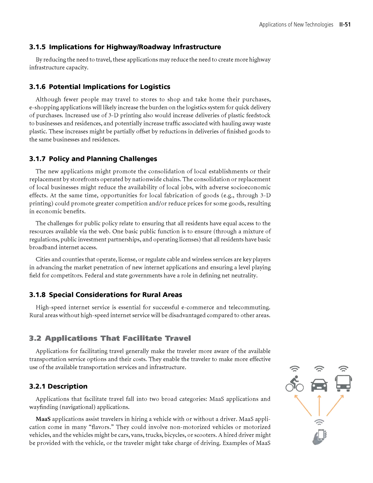
Applications of New Technologies II-51 3.1.5 Implications for Highway/Roadway Infrastructure By reducing the need to travel, these applications may reduce the need to create more highway infrastructure capacity. 3.1.6 Potential Implications for Logistics Although fewer people may travel to stores to shop and take home their purchases, e-shopping applications will likely increase the burden on the logistics system for quick delivery of purchases. Increased use of 3-D printing also would increase deliveries of plastic feedstock to businesses and residences, and potentially increase traffic associated with hauling away waste plastic. These increases might be partially offset by reductions in deliveries of finished goods to the same businesses and residences. 3.1.7 Policy and Planning Challenges The new applications might promote the consolidation of local establishments or their replacement by storefronts operated by nationwide chains. The consolidation or replacement of local businesses might reduce the availability of local jobs, with adverse socioeconomic effects. At the same time, opportunities for local fabrication of goods (e.g., through 3-D printing) could promote greater competition and/or reduce prices for some goods, resulting in economic benefits. The challenges for public policy relate to ensuring that all residents have equal access to the resources available via the web. One basic public function is to ensure (through a mixture of regulations, public investment partnerships, and operating licenses) that all residents have basic broadband internet access. Cities and counties that operate, license, or regulate cable and wireless services are key players in advancing the market penetration of new internet applications and ensuring a level playing field for competitors. Federal and state governments have a role in defining net neutrality. 3.1.8 Special Considerations for Rural Areas High-speed internet service is essential for successful e-commerce and telecommuting. Rural areas without high-speed internet service will be disadvantaged compared to other areas. 3.2 Applications That Facilitate Travel Applications for facilitating travel generally make the traveler more aware of the available transportation service options and their costs. They enable the traveler to make more effective use of the available transportation services and infrastructure. 3.2.1 Description Applications that facilitate travel fall into two broad categories: MaaS applications and wayfinding (navigational) applications. MaaS applications assist travelers in hiring a vehicle with or without a driver. MaaS appli- cation come in many âflavors.â They could involve non-motorized vehicles or motorized vehicles, and the vehicles might be cars, vans, trucks, bicycles, or scooters. A hired driver might be provided with the vehicle, or the traveler might take charge of driving. Examples of MaaS
II-52 Foreseeing the Impact of Transformational Technologies on Land Use and Transportation providers include Uber, Lyft, Gig, Lime Bike, Bird, Chariot, and Spin, among many others. MaaS applications facilitate various kinds of vehicle rentals: ⢠Ride Hailing Applications (Exclusive Use). The application facilitates hailing or sched- uling a ride in a hired vehicle for exclusive use by the passenger for the duration of the trip. The hired vehicle may be an automobile, a van, or a limousine with a driver or even a self-driving AV. ⢠Ride Hailing Applications (Shared Use). The application facilitates hailing or scheduling a ride in a hired vehicle that may carry other non-related passengers for a portion or all of the trip. ⢠Automobile Rental Applications. The application facilitates the travelerâs rental of a vehicle (typically an automobile, van, or truck), usually without a driver and for a specified time. Using the application, the traveler may âbookâ the rental online from any device with internet capability. ⢠Small-Vehicle Rental Applications. The application facilitates the travelerâs rental of a Segway, a bicycle, an e-bike, a scooter, an e-scooter, or similar low-capacity (typically single- person), low-speed (under 35 mph) vehicles. Wayfinding applications do not provide a vehicle. They assist with navigation, making travelers aware of vehicle locations and traffic conditions, and providing routing services and expected arrival times. Wayfinding applications also may locate nearby businesses of inter- est to the traveler or make travelers aware of incidents and hazards. Some wayfinding apps are designed to help pedestrians with visual impairments navigate their environment to reach transit stops and other destinations. Wayfinding applications can deliver these traveler infor- mation services to the traveler over personal communication devices anywhere with internet connection. Many examples of wayfinding applications are available. Two well-known examples are Google Maps⢠and Apple Mapsâ¢. 3.2.2 Deployment Status and Challenges MaaS applications for ride hailing and facilitating vehicle rentals for exclusive or shared use also have become familiar in many large urban areas. At large hotels, train stations, and airports, these applications have become well-established methods for hiring a vehicle with or without a driver. LA Metro has enabled holders of its Metro Payment Cards to use their cards to rent bicycles (Descant 2019). Newer ride hailing applications such as Uber and Lyft offer similar services to taxi- cabs, often at lower costs to the user. The service companies use independent contractor drivers who provide their own vehicle integrated with a cell phone booking and billing application. These newer applications are currently being operated as loss leaders. The lower prices currently are subsidized by the service providersâ investors as the companies attempt to expand market share. Uber, a privately held company, lost $1 billion in 2017. The company showed a profit in the first quarter of 2018 due to sales of its Russian and Southeast Asian businesses. In the second quarter of 2018, it took in $12 billion in gross bookings but spent $891 million more than it took in. Bookings were up 41 percent from a year earlier. About 80 percent of Uberâs gross bookings are paid out to its drivers (Conger 2018). Newer automobile rental applications use internet booking and billing options. The availability of online booking and billing has increased the number and convenience of the rental sites, even making use of public ROW and public garages to park the vehicles between trips. These newer services also are being operated as loss leaders. Small-vehicle rental services (bicycle, scooter, and Segway) currently are offered at stand- alone kiosks or in shops, and often are located in or adjacent to tourist areas in many cities. Newer applications of these small-vehicle ride hailing services combine the newer EV tech- nologies with GPS tracking, sidewalk docking stations (or dockless technology), and internet
Applications of New Technologies II-53 booking and billing applications. These applications also have dramatically increased the number of rental sites (often making use of public sidewalk space) and the number of vehicles available for rental. The newer small-vehicle rental services also are currently being operated on a loss-leader basis. One dockless bike share provider is facing bankruptcy in China (Zhong and Zhang 2018). The companyâs operations were initially funded by investors and the deposits provided by new subscribers. As the market reached saturation, however, investors were unwilling to increase their investments and revenues from new subscribers dropped off. Wayfinding applications already are widespread and well known to users of internet services. 3.2.3 Implications for Personal Travel Demand MaaS applications currently are offering lower cost and more convenient services than were previously available. As such, they increase the share of travelers using their services at the expense of ridership declines in competing traditional services, such as taxi, limousine, and bus services. The new services also result in a net increase in vehicular travel (automobile, bicycle, and scooter) in their service areas. The city of San Francisco, California, has estimated that MaaS automobile services (Uber and Lyft) currently account for 9 percent of the person-trips in the downtown area and accounted for roughly one-half of the observed 10 percent increase in VMT downtown over a 6-year period from 2010 to 2016 (Castiglione, Cooper, Sana, and Ticshler 2018). A consultant for New York City has predicted that full deployment of a 100,000 to 200,000 vehicle shared e-bike system in the city could switch as many as 1 million trips per day from cars, transit, or walking. About half of the trips shifting to e-bikes would come from public transit. About one-third of the e-bike trips would come from vehicle trips. Even with these changes, bike trips would still account for less than 4 percent of daily trips in the city (Plautz 2018). Uber has found that e-bike sharing operations can draw riders from automobile ride hailing services. When the company enabled users of its ride hailing application in San Francisco to rent e-bikes as well, Uber found that overall trips by new e-bike riders using the Uber platform climbed 15 percent while Uber trips in cars and sport utility vehicles declined 10 percent. The greatest shifts occurred during high traffic, congested periods of the day (McFarland 2018b). The City of Portland, Oregon, found that 34 percent of e-scooter trips in its downtown replaced automobile trips (using either personal vehicles or ride hailing) (Portland Bureau of Transportation 2018). In 2018, Washington, D.C., evaluated its 11-month old dockless bicycle-sharing demonstra- tion program (Liza 2018). Six rental-bike service providers initially participated, but because the demonstration program limited each operator to 400 vehicles, some providers elected to leave the program. The dockless bicycles were transitioned from conventional pedal-powered bicycles to e-bikes and e-scooters over the course of the demonstration. Throughout the dem- onstration program, the city continued to operate the docked bikes used in its preexisting Capital Bikeshare program. The docked bicycles were conventional pedal-powered bikes. Observations from the study included the following (Liza 2018): ⢠Docked bicycle-share usage was generally unaffected by the limited dockless demonstration. The docked bicycles seemed to be used by regular commuters and tended to see more even usage throughout the day. ⢠Dockless bicycles did not significantly extend the geographic range of shared-bicycle usage over that of docked (Capital Bikeshare) bicycles.
II-54 Foreseeing the Impact of Transformational Technologies on Land Use and Transportation ⢠Bicycle crashes increased. Dockless bicycle users appeared to be at significantly higher risk of crashing compared to docked bicycle users. ⢠About 10 percent of the dockless bicycles were parked in undesirable locations. Three percent of the dockless bicycles were parked in ways that blocked pedestrian access. By making travelers more aware of the available options and costs, wayfinding applications make traveling easier and facilitate increased travel. It is conceivable that wayfinding applica- tions might also âscare awayâ travelers from making certain trips by making them more aware of the potential delays, but this effect has yet to be observed in a quantifiable way. 3.2.4 Implications for Transportation and Land Use MaaS services need safe and convenient places within the public ROW to pick up and drop off passengers. They also need safe and convenient places within the ROW but outside of the pedestrian and vehicle travel lanes to store the bicycles and scooters in-between trips. Both for new streets and to retrofit existing streets, streetscape designs need to be developed to incorpo- rate these pick up, drop off, and storage places into the ROW. Long-term on-street and off-street parking demands may be reduced by these MaaS services. 3.2.5 Implications for Highway/Roadway Infrastructure MaaS applications will increase the need for pick up and drop off zones, vehicular lanes, bicycle lanes, and sidewalk space in the downtown setting. 3.2.6 Implications for Logistics MaaS applications make it cost-effective for logistics services to connect with local drivers or even AVs that can be hired on a per-trip basis to deliver small, lightweight goods to individual doorsteps of businesses and residences. Wayfinding applications make fleet operators and drivers aware of traffic conditions, thus enabling them to more efficiently and reliably deliver goods. Because MaaS and wayfinding applications make traveling easier, the applications facili- tate both more efficient use of existing roadways and increased use of roadways, and potentially the design and location of goods-collection and distribution facilities. 3.2.7 Policy and Planning Challenges Policy and planning challenges differ for MaaS and wayfinding applications. For MaaS applications, key challenges include: ⢠Developing and Adapting Regulations. The primary policy and planning challenges to MaaS applications relate to adapting the current regulatory and transportation infrastruc- ture to the new usage patterns occasioned by MaaS applications. Greater bicycle, scooter, and ride hailing service use will require adjustments to the allocation of street space to all of the modes of travel. Regulations designed for licensed motorcycle drivers and vehicles need to be adapted to include lighter, lower speed rented vehicles. Policies need to be developed to govern the sharing of sidewalk space, curb space, and travel lanes among automobiles, trucks, conventional bicycles, e-bikes, e-scooters, and pedestrians. NACTO has published guidelines for the regulation and management of shared active transportation (NACTO 2018). The guidelines cover the following topics: â Oversight and authority, â Data standards,
Applications of New Technologies II-55 â Small-vehicle standards for the shared-use context, â Small-vehicle parking, and â Community engagement and equity. NACTO recommends the establishment of uniform national standards for the first three topics and the development of local-level standards by each city or municipality to deal with small-vehicle parking, community engagement, and equity. ⢠Disabled Access. Provision of accessibility for the disabled is a challenge. The city of Detroit, Michigan, is pilot testing hand-powered tricycle rentals. Some service providers have found the accessible bicycles to be difficult to maintain (there are few manufacturers) and a learning challenge for novice users. Another challenge is ensuring that the one-way user will be able to secure a wheelchair at the destination of the trip (Zaveri 2018). ⢠Partnering. Agencies desiring to promote greater use of shared active transportation such as e-bikes and e-scooters through PPPs will need to regulate the activities of the private part- ner, secure steady public funding, and set market-sensitive rates. Identifying meaningful shared objectives and a dependable revenue stream for the private-sector partner are essential ingredients to successful partnerships, and establishing a firewall between the PPP and elected officials often is important. Without appropriate in-house expertise, the experiment can be painful for all concerned (Campbell 2018). ⢠Crashes. Pedestrian/e-bike crashes have been a concern in some cities. New York City has limited the speeds of e-bikes out of concern for pedestrian safety; however, international data suggest that the greatest danger is to the bicyclists. Findings from several studies have addressed details of e-bike crashes (Barnard 2018): â In the Netherlands, researchers found that older male cyclists (over 65 years) were most prone to injury. In this study, the researchers suspected that one factor might be the higher speeds made possible by e-bikes for that age group. â In Switzerland, researchers also found higher vulnerability for older male cyclists but pointed to tram rails as a factor in many crashes. â In Beijing, the research focused on car/e-bike crashes and found that many bicyclist injuries were associated with lack of helmet use. ⢠Data. It has been difficult for cities to obtain usage data from bike sharing and scooter sharing companies; however, the industry has begun to realize the value of cooperating with cities by sharing data and making charitable contributions (Hawkins 2018b). ⢠Equity. Many of the MaaS services function without cash. Many shops are going cash- less. A cashless economy tends to shut out those without access to credit cards and debit cards. About 7 percent of households in the United States do not have a checking or savings account. Another 19 percent rely on products and services outside of the conven- tional banking system. New York City is considering requiring certain businesses to accept cash payments (Bellafonte 2018). Measuring the equity impacts of MaaS applications is a challenge. Equity involves avail- ability and use of the vehicles. A report by Populus Technologies illustrates one approach to measuring equity for shared mobility services (Clewlow, Foti, and Shepard-Ohta 2018). A recent study of bike sharing systems in Chicago found that community groups could be suspicious of bike share services as being a harbinger of gentrification (Plautz 2019a). The primary policy challenge of wayfinding applications is that they currently treat all public roads as equally acceptable for use. This approach conflicts with the desire of agencies to minimize traffic using residential streets and other sensitive land uses, such as schools and hospitals. As agencies adopt various peak-period turn restrictions to eliminate traffic cutting through neighborhoods, the challenge is making all of the wayfinding applications aware of the new time-of-day restrictions or other traffic diversions. The various wayfinding applica- tion vendors have differing lag times between when a new restriction is placed in the field
II-56 Foreseeing the Impact of Transformational Technologies on Land Use and Transportation and when it shows up in the application. Identifying the appropriate contact persons in the vendorâs organization is not always clear. 3.2.8 Special Considerations for Rural Areas Rural areas may not have the critical market size to attract MaaS providers to serve their area. Some blend of regulation and incentives may be required to encourage MaaS operations in a rural area. 3.2.9 Special Considerations for Public Transit MaaS and wayfinding services provide new tools for improving the publicâs transit riding experience, new tools for cost-effectively delivering public transit services, and new challenges for public transit providers. MaaS services provide first-mile and last-mile access to public transit stops. At the same time, the more convenient services and price structure of MaaS services also attract shorter distance trips that would have taken transit. Transit applications enable online booking and payment for transit services. Wayfinding applications are being integrated with public transit applications to provide seamless wayfinding for automobile, transit, and other modes of travel. Three TCRP reports address the public transit impacts and opportunities for working with MaaS providers: ⢠TCRP Synthesis of Practice 132: Public Transit and Bikesharing (Hernandez, Eldridge, and Lukacs 2018); ⢠TCRP Research Report 188: Shared Mobility and the Transformation of Public Transit (Feigon and Murphy 2016); and ⢠TCRP Research Report 195: Broadening Understanding of the Interplay Among Public Transit, Shared Mobility, and Personal Automobiles (Feigon and Murphy 2018). TCRP Research Report 195 concludes that public transit agencies may benefit by proactively engaging with transportation network companies (e.g., MaaS providers) through partnerships whose purposes align with agency goals. Guidance provided in this TCRP report varies by the size of the urban area in which the public transit service operates. Key suggestions can be summarized as follows (Feigon and Murphy 2018): ⢠Transit agencies in large urban areas are encouraged to: â Pursue the role of mobility broker/manager, in which the agency explores opportunities for integration of modes and services while ensuring that the public good is being served; â Focus on partnerships and policies that align transit agenciesâ and transportation network companiesâ (TNC) incentives; â Designate specific curb space near transit stops for for-hire vehicle pick ups and drop offs; â Pursue cost-saving partnerships for âcall-n-ride,â paratransit, and late-night services; and â Track and understand TNC (MaaS) usage. ⢠Transit agencies in mid-sized urban areas are encouraged to: â Pursue first-mile/last-mile partnerships to expand transitâs reach; â Use co-marketing to reach new transit riders; â Support integration of transit into mobile wayfinding apps; and â Partner with large employers and institutions to develop incentives that encourage employees, patrons, and students to make use of transit and TNCs (including MaaS providers) as part of a âcar-free/car-light, transit-centered lifestyle.â ⢠Transit agencies in smaller urban areas are encouraged to: â Pursue partnerships to fill service gaps; and â Use TNCs (e.g., MaaS providers) to support demand-responsive transit services.
Applications of New Technologies II-57 3.3 Applications That Increase Flexibility in Land Use Transformational internet applications that increase efficiency and flexibility in land use seek to connect people who own underutilized space with other people who desire to use the space (sometimes in new ways), often for limited periods. 3.3.1 Description Applications that increase flexibility in land use might involve peer-to-peer or hosted (curated) sharing of underutilized spaces. For example, providers of remote work space may contract with restaurants or other venues to use spaces not typi- cally used by the restaurant/venue during specific hours. The work space provider then rents that space out by the hour (or other designated time period) for use by âmembersâ (typically remote workers who have subscribed to the service) (Bowles 2019). Homeowners and apartment owners may rent out all or a portion of their residences by the night. Owners of private residential parking spaces may seek to rent out their parking space while they are at work. Arranging to lease or sub-lease space is not new; however, new technology and applications have greatly increased the facility and speed with which the related scheduling tasks and transactions can take place, which has encouraged considerable growth and flexibility in the number and variety of participants in such arrangements. Some urban developers are looking into new technology applications for reducing con- struction costs and increasing the attractiveness of buildings to new tenants. As listed by Chen (2018), these include: ⢠Modular housing, which can be built faster and cheaper than traditional construction; ⢠Robotic parking systems, which can decrease the land space devoted to parking; ⢠Signal boosting devices inside new buildings, which can allow cell phone reception within high-rise towers; and ⢠New technologies that enable luxury amenities. Other urban land developers are using technology and applications to include agricultural uses within residential developments (Kendall 2018). 3.3.2 Deployment Status and Challenges Several residence-sharing applications are already in use (e.g., Air BnB). Other built-space sharing applications are currently in pilot testing or are under development. 3.3.3 Implications for Personal Travel Demand By intensifying the usage of existing built spaces, built-space sharing applications will change, and potentially increase, the traffic impacts of those spaces. For example, the location of a res- taurant venue that leases space for use by remote workers during the restaurantâs âoff hoursâ will experience both increased traffic and potentially changing patterns of traffic, depending on the transportation modes chosen by the new/added users to access the space. 3.3.4 Implications for Transportation and Land Use Land use sharing applications will support higher utilization of existing built spaces. They might reduce demand for traditional work spaces and consolidate the use of parking spaces
II-58 Foreseeing the Impact of Transformational Technologies on Land Use and Transportation as more vehicles access the same parking spaces across differing parts of the day or week. In combination with applications such as MaaS, land use sharing applications also may reduce overall demand for traditional parking spaces, and some parking facilities and spaces may need to be adapted to facilitate use and storage of alternative vehicles like e-bikes or e-scooters. 3.3.5 Implications for Highway/Roadway Infrastructure Highway and roadway infrastructure might need to be added or modified to serve the increasingly intense demands for use of shared built spaces. 3.3.6 Implications for Logistics More intensive land uses may require more extensive logistical support services. 3.3.7 Policy and Planning Challenges Monitoring and enforcing land use and zoning regulations is a major challenge as applica- tions encourage new and varied shared uses of existing built spaces. New or modified language in regulations and new enforcement methods may be needed. 3.3.8 Special Considerations for Rural Areas Monitoring and enforcing land use and zoning regulations is particularly challenging in rural areas, where the built structures might be far removed from the public ROW. 3.4 Applications That Improve Government Services Smart city and smart community initiatives develop and integrate data repository and communications applications for better monitoring of real-time needs and better manage- ment of the delivery of government services. 3.4.1 Description Smart city and smart community applications often center on an integrated data exchange to which all divisions of the agency contribute data and from which the divisions draw informa- tion. Often, the public also contributes to the integrated data exchange (through requests for services and notification of events), and members of the public may access and draw from as part of planned public access to government services. Many resources are available for agencies considering employing technology to improve the delivery of government services. Two notable resources are: ⢠NCHRP Research Report 885: Guide to Creating and Sustaining a Culture of Innovation for Departments of Transportation (Lorenz, Rotert, Link, and Crossett 2018); and ⢠The Columbus Playbook (at https://smart.columbus.gov/playbook/), a Website of materials assembled by the city of Columbus, Ohio, to guide other agencies considering improving their use of technology. Several cities, including Portland, Oregon; Fremont, California; and Chula Vista, California, have created smart city action plans. Examples can be found easily by searching the internet for âsmart city action plan.â Guidance on developing a smart city action plan is available at the following Website: http://www.smartcitiesguru.com/smart-city-action-plan/.
Applications of New Technologies II-59 3.5 Applications That Improve the Delivery of Transportation Services Applications for improving highway and transit travel generally employ a combination of vehicle communications devices and smarter field devices (e.g., traffic signals and smart transit stops). These applications could improve highway facility management and improve transit fleet management. The FHWA maintains a Website that lists current research and installations (https://www.its.dot/gov/research_archives/dma/). 3.5.1 Description Active transportation and demand management (ATDM), integrated corridor manage- ment (ICM), and ITS are three highway management strategies that take advantage of the new functionalities made possible by new technologies. ICM employs a variety of management subsystems to optimize the movement of people and vehicles through a transportation corridor. These include transit management, freeway manage- ment, arterial management, incident management, and traveler information services (Christie, Hardesty, Hatcher, and Mercer 2016). Two example applications within an ICM system are: ⢠ICM Incident Management with CVs. Exhibit II-13 illustrates one possible application of CV technology to improve safety within the incident management subsystem of an ICM system. In this example, the downstream CVs report to the TMC that they are stopped. The TMC employs various management algorithms to decide what to do about the situation. It chooses to send messages to the upstream CVs, warning them of the downstream congestion and suggesting a suitable speed for approaching the stopped vehicles. ⢠ICM Arterial Management with CVs. One arterial management application that has been developed for using the greater information provided by CVs is the MMITSS. The MMITSS is a comprehensive traffic signal system that takes advantage of the CV environment to optimize arterial operation for all vehicular and non-vehicular modes of travel (see Exhibit II-14). MMITSS incorporates algorithms from the intelligent traffic signal system, TSP system, mobile accessible pedestrian signal system, emergency vehicle preemption system, and freight signal priority system for optimizing arterial operations (FHWA 2015). Exhibit II-13. Example ICM incident management CV application.
II-60 Foreseeing the Impact of Transformational Technologies on Land Use and Transportation As shown in Exhibit II-14, the vehicles and the pedestrian report their location and status to the MMITSS controller. The bus also may report information on its passenger load and schedule status (early, on time, or late). Similarly, the truck may report whether it is loaded or not. The MMITSS control algorithm assigns priorities to each vehicle and pedestrian and determines the appropriate timing of the signal displays that best meet the objectives the agency has set for operating the arterial. ATM seeks to maximize the reliability, effectiveness, and efficiency of the transportation system through dynamic real-time management of recurrent and non-recurrent conges- tion (FHWA 2019b). ATM employs one or more of the following management strategies, depending on the available system resources and local conditions: ⢠Adaptive ramp metering, ⢠Adaptive traffic signal control, ⢠Dynamic junction control, ⢠Dynamic lane control, ⢠Dynamic shoulder lanes, ⢠Dynamic speed limits, ⢠Queue warning, ⢠Transit signal priority (TSP), ⢠Dynamic toll express lanes, ⢠Traveler information and DMS, ⢠Emergency response, incident management, ⢠Automated enforcement, and ⢠Sensing technologies. Active demand management (ADM) uses information and pricing to adjust travel demand to better fit the capacity available in the transportation system. ADM employs the following management strategies: ⢠Dynamic fares, ⢠Dynamic HOV/managed lane requirements (changing automobile occupancy requirements), ⢠Dynamic pricing, ⢠Dynamic rideshare matching, ⢠Dynamic routing, ⢠Dynamic transit capacity reallocation, ⢠On-demand transit, Source: Adapted from Mahmassani, Rakha, Hubbard, and Lukasik (2012) Exhibit II-14. Example ICM arterial management application of CVs.
Applications of New Technologies II-61 ⢠Predictive traveler information, and ⢠Transfer connection protection. ⢠Public Transit Service Delivery. Transit agencies employ various management strategies to take advantage of the superior information systems provided by new technologies. The agencies may use the technologies to better monitor the status of their vehicle fleet and better inform their passengers of the next bus. The agencies might also reach out to MaaS providers to identify partnership opportunities that improve the rider experience. Transit operator strategies for employing new technologies are covered in the TCRP Synthe- sis of Practice J-07 series, âSynthesis of Information Related to Transit Practices.â Particularly relevant synthesis studies have included J-07/Topic SG-08, which resulted in TCRP Synthesis of Transit Practice 35: Information Technology Update for Transit (Boldt 2000), and J-07/Topic SH-07, which resulted in TCRP Synthesis of Transit Practice 69: Web-Based Survey Techniques (Spitz, Niles, and Adler 2006). Examples of technology applications in public transit include on-demand transit, dynamic transit reallocation, and transfer connection protection: ⢠On-Demand Transit/Dynamic Transit Reallocation. On-demand transit refers to dynamic transit routing that adjusts transit capacity to respond to demand. Most rural systems provide demand-responsive, flexibly routed service to more efficiently allocate scarce transit resources to meet low and unconcentrated demand. Some urban systems also provide this service. Services can range from manual âDial-a-Rideâ services to dynamic transit assignment. ⢠Transfer Connection Protection. Transfer connection protection refers to the practice of guaranteeing rides to ridersâ final destinations in the event that a connection is late or missed. This practice relieves some of the stress associated with transit travel. Guaranteed ride home programs are one example of this protection. These programs aim to provide ride options to transit users who may face extenuating circumstances, such as a missed transit connection. 3.5.2 Deployment Status and Challenges Advanced traffic management systems like ATDM and ICM are in the pilot testing stage and are the subject of special federal demonstration grants. The integration of ATDM and ICM with CVs is still in the research and development stage. The challenges to greater deployment are final- izing the development of the control algorithms that employ CV information and greater deploy- ment of CV capabilities in the vehicle fleet and the roadside infrastructure. The FHWA maintains a Website that provides listings of current research and installations: https://www.its.dot.gov/ research_archives/dma/index.htm. ATM treatments generally are found to improve trip reliability, safety, and throughput of the surface transportation system by deploying operational strategies; however, unique chal- lenges for agencies are associated with each treatment. A recent report published by FHWA addresses some of these challenges and describes a stepwise approach to accomplishing the implementation through the application of the system engineering process; comprehensive planning; and organizational considerations, capabilities, and design considerations (Kuhn, Balke, and Wood 2017). 3.5.3 Implications for Personal Travel Demand The new traffic management strategies for employing CVs will likely reduce congestion and delays, and improve reliability. ICM by itself (without CV) has reduced mean travel times by less than 1 percent (Alexiadis 2016). Combining ICM with CVs should enhance that impact. Reduced congestion and improved reliability should attract more drivers to the corridor from other corridors and other modes.
II-62 Foreseeing the Impact of Transformational Technologies on Land Use and Transportation ADM strategies decrease travel demand or redirect it so that congestion is reduced during peak periods and on busy facilities: ⢠Dynamic pricing of roadways or parking facilities leads to a higher impedance to travel and thus a lower demand during peak periods; ⢠HOT lanes incentivize carpooling and thus promote lower vehicular demand; ⢠Dynamic rideshare matching reduces deadhead times when vehicles run empty to pick up a passenger, and encourages carpooling; ⢠Dynamic routing decreases local circulation and routes vehicles around high-congestion facilities; and ⢠On-demand transit and transfer connections can increase transit use while decreasing single- occupancy vehicle use and thus congestion. ADM strategies also decrease the impedance to transportation by making transportation options more seamless. Decreased congestion, though at a price, makes travel faster and easier. Dynamic routing, rideshare matching, and on-demand transit use technology to make various modes of transportation easier. Transfer connection protection decreases stress asso- ciated with transit use. To the extent that these strategies decrease the impedance to single- occupancy vehicle travel, these strategies have the potential to raise travel demand. Some of the strategies, however, decrease the impedance for carpooling or transit use, which can decrease travel demand. When overall impedance to vehicular travel goes up, travel demand decreases, and the built environment gravitates toward multimodal-oriented land uses. When overall impedance to vehicular travel goes down, travel demand increases, and the built environment gravitates toward automobile-oriented land uses. 3.5.4 Implications for Transportation and Land Use Lower travel times and greater reliability will tend to enhance the spread of urban development. 3.5.5 Implications for Highway/Roadway Infrastructure The new traffic management strategies for employing CVs will likely increase highway capacities. The magnitude of the impacts is unknown as of 2018, although combining ICM with CVs is expected to have a greater impact than the use of ICM alone. Capacity increases from these new management strategies would need to be around 20 percent to avoid having to widen a 5-lane freeway to a 6-lane freeway. However, much lower capacity increases would still allow an agency to postpone a capacity increase for a few additional years. 3.5.6 Implications for Logistics New traffic management strategies utilizing the new CV technologies would reduce shipping delays and increase reliability. 3.5.7 Policy and Planning Challenges The policy and planning challenges of applications that improve the delivery of transpor- tation services relate to funding of the infrastructure improvements and prioritizing them within the region and state. Management strategies that encourage desired behaviors face few public acceptance hurdles, whereas other ADM strategies designed to discourage undesired behaviors may face significant public acceptance hurdles.
Applications of New Technologies II-63 3.5.8 Special Considerations for Rural Areas The new management strategies are generally applicable to congested areas. They may be appropriate for use in rural high-density tourist destinations that experience seasonal congestion. 3.6 Applications That Improve the Delivery of Parking Services Applications that take advantage of improved field sensors can improve curbside parking management and off-street parking management. These applications may dynamically set parking rates to maximize use. They may provide real-time information to travelers via cell phones or DMSs to minimize wasted searching for and available parking space. By identifying and assigning open curb space and directing drivers to the appropriate curbside zone, these applications improve the safe management of pedestrians, bicyclists, transit passengers, and taxi passengers on the sidewalks and along the curbside. 3.6.1 Description Two types of applications are used to improve the delivery of parking services: active parking management and curbside management. Examples of parking applications include SFpark and SpotHero. Although examples do not yet exist of cities pricing the curb directly, a few examples can be found of cities charging TNCs for using public assets. For example, Portland, Oregon, charges 50 cents per TNC ride. These charges are directly passed onto the rider. Additionally, San Francisco has started charging private shuttle-bus companies for the use of city bus stops. The shuttle-bus companies are charged about $1 per stop per day, which is the maximum allowed by California law (Jaffe 2014). ⢠Active Parking Management. This approach involves the dynamic management of park- ing facilities to optimize the performance and use of on-street and off-street parking (FHWA 2019b). Active parking management employs the following management strategies: â Dynamic overflow transit parking, â Dynamic parking reservation, â Dynamic wayfinding, and â Dynamic pricing. Dynamic overflow transit parking provides overflow parking for travelers accessing transit stations or park-and-ride locations at otherwise underutilized parking locations. Transit parking is monitored, and users are rerouted when transit-specific facilities are at or near capacity. The transit agency may have joint-use agreements with lot owners to allow the transit agency to use the lot during times when the lot is generally underutilized. Agree- ments that match transit parking needs with resources among surrounding land uses that have different peak parking periods (e.g., retail or evening dining locations) can make the transit parking system operate more efficiently. This strategy combines the strategy of shared parking or joint-use parking with data management. Although the dynamic overflow transit parking strategy is specific for those accessing a transit station or park-and-ride location, the strategy of monitoring parking demand and sharing parking appropriately does not have to be transit-specific. Dynamic parking reservation enables a user to reserve a parking spot before arriving at the parking location. Private or public parking providers can implement dynamic parking reservation systems. Parking garages or surface lots often are easier to monitor for inventory and to prevent other vehicles from taking reserved spots. One example of a private company
II-64 Foreseeing the Impact of Transformational Technologies on Land Use and Transportation that provides dynamic parking reservations is SpotHero. In this model, partner companies provide and monitor the physical parking spaces and SpotHero provides the internet-based platform used by travelers to reserve a parking spot. A reserved parking spot is not physically blocked off to âhold itâ for the traveler; rather, the application uses inventory trends to esti- mate the number of spots that will be needed (and therefore made available) for reservations. Thus, when a traveler makes a reservation, he or she can expect a spot to be available at the location, but has not reserved a specific spot. The city of Sacramento, California, provides dynamic parking reservations on a limited basis for event parking in several off-street lots (City of Sacramento 2019). Dynamic wayfinding provides drivers with routing to available parking. The availability of parking can be informed by data from sensors, parking reservation information, parking lot or garage ingress and egress information, or human involvement. Based on the type of data, wayfinding can route the traveler to a specific spot or to a general parking area. The Portland International Airport parking information webpage (www.flypdx.com/ parking) lists several options for travelers evaluating their parking choices, including avail- able charging for EVs and a âcell phone waiting areaâ designated for short-term use by family or friends awaiting notification from arriving passengers. In addition, the parking lot at Portland International Airport uses sensors in the parking spots to indicate whether a garage or floor of a garage is full. This information is communicated to customers through dynamic signage. Each parking space is outfitted with a light that shines green if the spot is available, alerting customers to specific available parking spots in any given area of the lot. SFpark, a project of the SFMTA in San Francisco, California, also uses sensors to identify open spaces and direct drivers to available parking locations. The SFpark system provides real-time availability and cost information online and through mobile applica- tions (SFpark 2019). Sensors can be expensive to install and maintain. ParkDC, an initiative of the District Department of Transportation (District DOT) in Washington, D.C., uses an alternate approach that provides users with general estimations of parking availability along a block or corridor by processing paid parking reservations, rather than using installed sensors. Dynamic pricing is the strategy of changing the price of parking in a specific area based on demand. Many agencies that use dynamic wayfinding also use dynamic pricing strate- gies because dynamic wayfinding and dynamic pricing function in similar ways, both in the way the systems collect and use data and the way the applications present information to customers. Dynamic pricing successfully redistributes parking demand by increasing the price of higher demand parking and decreasing the price of lower demand parking. Informing customers of price differences through dynamic wayfinding is an important way to enable customers to choose lower demand and lower priced parking locations. San Francisco and Los Angeles, California; Seattle, Washington; and Washington, D.C., are just a few of the cities that use dynamic pricing. Most cities, like Washington, D.C., use historical parking data to inform and update parking pricing. Parking prices for any given spot can change up to four times a day, but the prices set for each period are held consistent for about 3 to 4 months, at which point they are revisited. SFpark adjusts the prices of 7,000 parking meters to achieve a target occupancy rate for on-street spaces. This program also has experimented with adjusting the prices of 11,500 off-street parking spaces in city-owned garages to improve parking efficiency and reduce traffic. The program has received praise from transportation policy makers and professionals and has increased revenues and occupancies for the city (Pierce, Willson, and Shoup 2018). ⢠Curbside Management. Automobile parking is only one use of the curb. Transit stops, bike corrals, commercial vehicle loading, mobile vendors, sidewalk cafes, parks, and ride hailing pick ups and drop offs are just a few other uses. Increased use of ride hailing and AVs or CAVs
Applications of New Technologies II-65 will decrease the need for parking and increase the need for pick up/drop off curb space. Simi- larly, increases in bike sharing, scooter sharing, microtransit, and personal freight deliveries will increase other needs for access to the curb. In addition to active parking management, general curbside management will become an increasing priority, especially in urban and suburban areas. In the United States, curbside management strategies have been undertaken at several loca- tions. One curbside management strategy is to implement shared use mobility (SUM) zones, wherein designated curb uses are specified and changed by the time of day or day of the week. This approach can allow ride hailing companies to provide passenger pick ups and drop offs during peak times; provide designated areas for freight delivery; and provide parking, pedestrian zones, sidewalk cafes, or other uses during other parts of the day. Washington, D.C. has piloted the use of SUM zones. Starting in October 2017, a 1-year pilot project in Washington, D.C. involved the conversion of a parking area near bars and restaurants in Dupont Circle into pick up and drop off zones for TNCs and taxicabs (Shared- Use Mobility Center 2017). The ITE has published a Curbside Management Practitioners Guide (ITE 2018a) that iden- tifies tools and treatments for managing curbside use by pedestrians, bicyclists, transit, auto- mobiles, and trucks. The guide identifies a process for selecting the appropriate treatments and monitoring their performance. 3.6.2 Deployment Status and Challenges Sophisticated parking system applications have been deployed by public agency operators of off-street parking garages. Some applications have been extended to cover selected on-street parking areas. The major challenge to greater deployment is the installation and maintenance costs of parking space-specific occupancy detectors. Other applications have been developed by private-sector companies to tell users where to find an available parked rental vehicle (car, bicycle, or scooter). The main challenge to further deployment of parking and curbside management strategies relates to finding the necessary funds for the initial investments in sensors and the continuing maintenance and operating costs for those sensors. Installing and maintaining sensor systems for active parking and curbside management tends to be more cost and time intensive than more passive strategies, but this approach offers to provide the highest level of detailed data and optimization options. Other policy challenges include balancing investments by mode of travel (automobile versus other modes) and against other government needs. Earning public support for strategy implementation is a key challenge when residents and businesses take a proprietary perspective on the parking spaces in front of their establishments. As ride hailing and AV usage increases, revenue from parking and traffic violations will decrease. To make up for lost revenues and leverage the infrastructure assets that cities have invested in, cities can move toward pricing their curbs appropriately. Variable pricing also can be used to help achieve a cityâs goals. For example, if promoting active transportation and improving mobility are goals of the city, curbside areas reserved for bicycle parking could be provided at no charge and pooled-rideshare rides or microtransit charged less for curb access than zero-occupancy or single-occupancy vehicles. Establishing a system for curbside pricing and implementing curb usage fees will be a chal- lenge becauseâother than for parkingâthe technology for managing curb access does not yet
II-66 Foreseeing the Impact of Transformational Technologies on Land Use and Transportation exist. An associated challenge will be developing policies that discourage rideshare vehicles from circulating in an area while waiting to match with potential riders, thus increasing VMT and congestion. Charging curb usage fees will likely deter rideshare vehicles and taxis from waiting on the curb. Some solutions to this potential issue are providing specific reduced-price waiting areas for rideshare vehicles or implementing road usage fees that exceed the curb usage fees (so that it is most cost-effective for rideshare vehicles to wait at the curb). 3.6.3 Implications for Personal Travel Demand By giving drivers greater certainty of finding a parking space, applications that facilitate the delivery of parking services make driving a vehicle more convenient and will therefore tend to encourage greater use of personal vehicles like cars and trucks. An Uber-funded study of curbside use in San Francisco, California, found that the peaking of Uber pick up and drop off activity generally mirrored the peaking of automobile traffic on the street (Fehr & Peers 2018). Ride hailing services (including conventional taxis and shuttle van services) accounted for 50 percent to 60 percent of the vehicle activity and 35 percent to 63 percent of the people activity at four of the five curb sites selected for study. At the fifth site, which had no bus service, more than 95 percent of vehicle and people activity was related to the ride hailing services. 3.6.4 Implications for Transportation and Land Use Parking applications enable parking providers to locate spaces, lots, and garages in less visible places, counting on the application to guide users to their facility. Signage will still be needed for people without access to the applications, and remote areas may need more signs. People who do not have access to the parking applications likely will need to search more to find an open space. 3.6.5 Highway/Roadway Infrastructure Parking applications might enable agencies to replace highly visible curbside parking with less visible off-street parking. As curb usage patterns change, vehicles may continue to access curbside parking, but the nature and purpose of vehicles using curbside parking may shift to emphasize shorter-term parking (e.g., rideshare vehicle drop offs and pick ups, parking of MaaS vehicles like e-bikes and e-scooters, and short-term parking for small deliveries, includ- ing deliveries made using AVs or CAVs.) 3.6.6 Implications for Logistics Logistics parking applications could enable urban delivery services to locate open loading zones and docks; however, deployment of these applications would require that occupancy detectors be installed in those zones and docks. 3.6.7 Policy and Planning Challenges Parking applications may enable more businesses to take advantage of shared parking in private lots. The relevant agencies would need to develop the policy and regulatory framework for incentivizing the shared use of private parking lots. Private-sector parking applications for vehicle rentals (including automobiles and trucks, bicycles, and scooters) will increase parking demand for temporary storage of rental vehicles. In
Applications of New Technologies II-67 turn, agencies will need to develop policies and plans for locating the needed parking spaces in or near the public ROW. Cities and mass transit operators would be key players in advancing the implementation of advanced parking and curbside management strategies. Although transit operators and the local transportation department may initiate consideration of parking and curbside manage- ment strategies, the more aggressive strategies will likely require the involvement of the city council and some sort of public participation process. An environmental review process also may be required, depending on state and local regulations and sensitivities. 3.6.8 Special Considerations for Rural Areas Parking applications are unlikely to directly affect rural areas. However, parking applica- tions may be useful to areas that are transitioning from rural uses to more intense suburban or urban uses. Parking applications could facilitate âintelligentâ development solutions that use technology to enable more intense uses to be served by fewer parking spaces. 3.7 Applications That Improve Logistics New technologies and applications are being applied in various capacities that affect logistics. Potential logistics applications of new technology include the following (Chottani, Hasting, Murmane, and Neuhaus 2018): ⢠Automated and Autonomous Trucks. Approximately 65 percent of the nationâs con- sumable goods currently move by truck. Automated and autonomous trucks may reduce shipping costs by 40 percent. ⢠E-Commerce. Shopping at home accounts for about 15 percent of all purchases in the United States. Same-day delivery now accounts for 5 percent of deliveries. In 5 years, same-day delivery might reach 15 percent. ⢠Automation of the Supply Chain. Collaborative robots, advanced sorting systems, and indoor drones might reduce logistics costs by 40 percent. ⢠Asset Sharing. Like logistical dating services, new applications match demand and sup- ply for trucks, warehouses, trains, and ships. Last-mile crowdsourcing models can bring âby the pieceâ independent contractors or even AVs to deliver goods to the doorstep. ⢠Data Analytics. New data and data analytics are enabling carriers to predict demand and optimize routes. Some shippers have been able to significantly reduce inventories and save on warehousing costs. New routing analytics are enabling significant cost savings. The new technologies can reduce truck shipping fuel and labor costs, which are significant considerations for shippers. Fuel accounts for about 20 percent of the shipping cost. Labor (human drivers) accounts for another 45 percent of the shipping cost (Kawamura 2018). An application of new technology being pilot tested by various state DOTs in the Midwest and the South helps truck drivers identify available safe overnight parking spots along the Interstate highway system. Safe overnight parking has become a critical need as the federal government has increased enforcement of limits on driving time and long rest periods for drivers. The new applications and their effects vary according to the type of truck service: long- distance line hauls (usually longer trips between urban areas) and last-mile delivery services to the doorsteps of residences and businesses. Line-haul trucking services are generally interurban trips that may range from 50 miles to 700 miles range. At longer distances, trucks compete with railroad and air cargo services. Within this range, trucks are the predominant
II-68 Foreseeing the Impact of Transformational Technologies on Land Use and Transportation mode for freight transport. With regard to last-mile deliveries, shippers are already employ- ing new technologies and applications to track shipments, dispatch their vehicles, and route vehicles. 3.7.1 Description Applications of new technologies to line-haul trucking include truck platooning to save on fuel costs and use of self-driving trucks to save on labor costs. ⢠Truck Platooning. Currently being researched as an application of AV technology, platooning allows two AV trucks to closely follow a human-driven lead truck. Taking into account that roughly 65 percent of the vehicle-miles driven by trucks are ame- nable to freeway truck platooning, it is estimated that truck platooning could achieve an overall 4 percent reduction in total truck fuel consumption (National Renewable Energy Laboratory 2019). The fuel cost savings would therefore be approximately 1 percent to 2 percent of the per-mile truck operating costs. Some researchers are concerned about the potential for overheating of the engines and tires in the trailing vehicles when platooning is deployed for long distances. The concentrated loading of multiple large vehicles on highway bridges is another concern. ⢠Self-Driving Trucks. This application offers the potential of reducing labor costs to zero for line-haul services. The estimated 45 percent in labor cost savings would be traded off against the increased purchase and maintenance costs for the trucks. A pilot project using self-driving trucks has been operated on the I-10 freeway between El Paso, Texas, and Palm Springs, California (Davies 2017). A human operator rode in the cab to monitor the computer. Uber has been using self-driving trucks to move freight on Arizonaâs Interstate highways (McFarland 2018a). A human driver remains behind the steering wheel. Human and driverless truck cabs are switched out at transfer centers. ⢠UAVs and Smart Lockers. Short-distance aerial delivery services and smart locker sys- tems are among the newer applications enabled by the new transportation technologies. These applications offer the potential to reduce last-mile delivery times and costs. Com- mercially available UAVs can carry small packages (under 15 pounds) for distances of up to 1 mile. Military versions have greater ranges and payloads. Drone package delivery systems are currently being tested in Germany, Iceland, Tanzania, and Rwanda. Deutsche Post/ DHL, Alphabet, and Amazon are testing UAV delivery systems (Regev 2018). Smart lockers enable delivery services to leave a package in a locker at a central, publicly accessible location. The intended recipient can open the locker with the appropriate cell phone application and shipper-provided code. 3.7.2 Deployment Status and Challenges Truck platooning and self-driving trucks are still in the research and development phase. The private sector is actively engaged in pursuing this research. These applications have been tested on the freeways of Arizona with a human monitor/driver present. The best combination of detectors, control software, and human monitor/driver for freeway operations is still under development. It is anticipated that the initial deployments of truck platooning and self-driving trucks will tend to be on rural freeways, where the driving challenges are lower than on congested urban freeways. Various shippers and carriers are now conducting pilot tests involving the use of UAVs to deliver goods and smart lockers to securely hold packages until the recipient can pick them up. The challenges to broader deployment relate primarily to public acceptance of the new technologies.
Applications of New Technologies II-69 3.7.3 Implications for Personal Travel Demand The impacts of line-haul truck shipping applications on personal travel are likely to be minor. Improved package delivery services could reduce the need to travel to the store to pick up a purchase. Aerial deliveries could reduce the burden on highways. 3.7.4 Implications for Transportation and Land Use Lower costs for truck shipping will promote the development of larger capacity warehouses and distribution centers that will be needed to handle the increased volume of goods moving by truck. Reduced rail travel may open up some railyards to redevelopment. UAVs and smart lockers will require modifications to building designs to accommodate the need for aerial access, provide space for the lockers, or both. 3.7.5 Implications for Highway/Roadway Infrastructure Truck platoons might increase the difficulty in changing lanes and entering/exiting freeways. Theoretical studies estimate that with 100 percent truck platooning the capacity of a truck-only freeway lane could be doubled. Simulation studies of lower percentages of trucks platooning suggest that the increase in freeway capacity for the truck lane would be under 10 percent at 50 percent of the truck fleet platooning (Kuhn, Lukuc, Poorsartep, and Wagner 2017). Increased truck movements on freeways might reduce freeway capacities, particularly in mountainous areas with long grades. Load limits on highway bridges will need to be reconsidered in light of truck platoon point loads. Some retrofitting or reconstruction of highway bridges might be required. Aerial deliveries using UAVs will reduce the burden on highways. Locally, streetscapes may need to be modified to provide places for UAVs to drop off deliveries. The use of smart lockers may lead to the development of new or different distribution centers, which may have implications for highway access or local roadway infrastructure. 3.7.6 Implications for Logistics The potential reductions in truck shipping costs offered by line-haul applications are likely to shift some long-distance shipments from rail to trucks. Shippers will need to expand the capacity of their warehousing and distribution centers to handle the increased surges in goods when platoons arrive and depart. The cost savings of UAVs and the improved security of smart lockers will reduce delivery costs. Reduced delivery costs might encourage more e-shopping, thus increasing the number of packages delivered. 3.7.7 Policy and Planning Challenges Providing sufficient space with direct freeway access for enlarged warehousing and distribu- tion centers will be a challenge for urban areas. These expanded centers are likely to continue the trend of locating on the fringe of the urban area, where lower land prices allow larger parcels to be cost-effectively assembled. The shift in rail traffic to truck traffic might work contrary to agenciesâ environmental sustainability goals. Highway patrols and emergency responders will need to develop protocols and procedures for interacting with (pulling over) driverless trucks. State car following regulations may need to be revised to allow truck platooning on rural and urban freeways.
II-70 Foreseeing the Impact of Transformational Technologies on Land Use and Transportation Public access and aerial access to smart lockers and distribution centers will need to be resolved in agency regulations and building codes. Across municipal agencies, priorities also may need to be balanced as increases in small-package deliveries lead to changes in patterns of waste removal and recycling across communities. 3.7.8 Special Considerations for Rural Areas New warehouse and distribution centers will continue to locate on the fringes of major urban areas. With fewer human drivers and more fuel-efficient trucks, there could be a reduced need for rural truck stops. The short flying range of urban UAVs might limit their initial use in rural areas. The use of smart lockers in a centrally located village in-lieu of doorstep package delivery might reduce shippersâ costs of sending goods to rural areas.
