
THE NATIONAL ACADEMIES PRESS
500 Fifth Street, N.W., Washington, DC 20001
NOTICE: The project that is the subject of this report was approved by the Governing Board of the National Research Council, whose members are drawn from the councils of the National Academy of Sciences, the National Academy of Engineering, and the Institute of Medicine. The members of the committee responsible for the report were chosen for their special competences and with regard for appropriate balance.
This study was supported by Environmental Systems Research Institute, Department of Interior/U.S. Geological Survey Grant No. 00HQAG0011, National Aeronautics and Space Administration Grant No. NAG5-9857, National Geographic Society Education Foundation Grant No. 200-0123, and National Science Foundation Grant No. BCS-0076284. Any opinions, findings, conclusions, or recommendations expressed in this publication are those of the author(s) and do not necessarily reflect the views of the organizations or agencies that provided support for the project.
Library of Congress Cataloging-in-Publication Data
Learning to think spatially : GIS as a support system in the K-12 curriculum.
p. cm.
Includes bibliographical references and index.
ISBN 0-309-09208-6 (pbk.)—ISBN 0-309-53191-8 (PDF)
1. Space perception—Study and teaching. 2. Geographic information systems. I. National Academies Press (U.S.)
BF723.S63L43 2006
370.15′2—dc22
2005032115
Additional copies of this report are available from the
National Academies Press,
500 Fifth Street, N.W., Lockbox 285, Washington, DC 20055; (800) 624-6242 or (202) 334-3313 (in the Washington metropolitan area); Internet, http://www.nap.edu.
Cover designed by Van Nguyen. Photo © Blauel/Gnamm—ARTOTHEK. Courtesy of the Städelsches Kunstinstitut, Frankfurt.
Copyright 2006 by the National Academy of Sciences. All rights reserved.
Printed in the United States of America
THE NATIONAL ACADEMIES
Advisers to the Nation on Science, Engineering, and Medicine
The National Academy of Sciences is a private, nonprofit, self-perpetuating society of distinguished scholars engaged in scientific and engineering research, dedicated to the furtherance of science and technology and to their use for the general welfare. Upon the authority of the charter granted to it by the Congress in 1863, the Academy has a mandate that requires it to advise the federal government on scientific and technical matters. Dr. Ralph J. Cicerone is president of the National Academy of Sciences.
The National Academy of Engineering was established in 1964, under the charter of the National Academy of Sciences, as a parallel organization of outstanding engineers. It is autonomous in its administration and in the selection of its members, sharing with the National Academy of Sciences the responsibility for advising the federal government. The National Academy of Engineering also sponsors engineering programs aimed at meeting national needs, encourages education and research, and recognizes the superior achievements of engineers. Dr. Wm. A. Wulf is president of the National Academy of Engineering.
The Institute of Medicine was established in 1970 by the National Academy of Sciences to secure the services of eminent members of appropriate professions in the examination of policy matters pertaining to the health of the public. The Institute acts under the responsibility given to the National Academy of Sciences by its congressional charter to be an adviser to the federal government and, upon its own initiative, to identify issues of medical care, research, and education. Dr. Harvey V. Fineberg is president of the Institute of Medicine.
The National Research Council was organized by the National Academy of Sciences in 1916 to associate the broad community of science and technology with the Academy’s purposes of furthering knowledge and advising the federal government. Functioning in accordance with general policies determined by the Academy, the Council has become the principal operating agency of both the National Academy of Sciences and the National Academy of Engineering in providing services to the government, the public, and the scientific and engineering communities. The Council is administered jointly by both Academies and the Institute of Medicine. Dr. Ralph J. Cicerone and Dr. Wm. A. Wulf are chair and vice chair, respectively, of the National Research Council.
SUPPORT FOR THINKING SPATIALLY: THE INCORPORATION OF GEOGRAPHIC INFORMATION SCIENCE ACROSS THE K–12 CURRICULUM
ROGER M. DOWNS, Chair,
The Pennsylvania State University, University Park
SARAH WITHAM BEDNARZ,
Texas A & M University, College Station
ROBERT A. BJORK,
University of California, Los Angeles
PETER B. DOW,
First Hand Learning, Inc., Buffalo, New York
KENNETH E. FOOTE,
University of Colorado, Boulder
J. FREEMAN GILBERT,
University of California, San Diego, La Jolla
REGINALD G. GOLLEDGE,
University of California, Santa Barbara
KIM A. KASTENS,
Lamont-Doherty Earth Observatory of Columbia University, Palisades, New York
GAEA LEINHARDT (member until February 28, 2002),
University of Pittsburgh, Pennsylvania
LYNN S. LIBEN,
The Pennsylvania State University, University Park
MARCIA C. LINN,
University of California, Berkeley
JOHN J. RIESER,
Vanderbilt University, Nashville, Tennessee
GERALD M. STOKES,
University of Maryland and Pacific Northwest National Laboratory, College Park
BARBARA TVERSKY,
Stanford University, Palo Alto, California
National Research Council Staff
ANTHONY R. DE SOUZA, Director,
Board on Earth Sciences and Resources
KRISTEN L. KRAPF, Program Officer (until November 2004)
YVONNE P. FORSBERGH, Research Assistant (until November 2002)
MONICA R. LIPSCOMB, Research Assistant (until June 2004)
VERNA J. BOWEN, Financial and Administrative Associate
RADHIKA S. CHARI, Senior Project Assistant (from November 2002 to November 2003)
AMANDA M. ROBERTS, Program Assistant (from April 2004)
TERESIA K. WILMORE, Project Assistant (from November 2003 to April 2004)
GEOGRAPHICAL SCIENCES COMMITTEE
ROGER M. DOWNS, Chair,
The Pennsylvania State University, University Park
BRIAN J. L. BERRY,
The University of Texas at Dallas, Richardson
SUSAN L. CUTTER,
University of South Carolina, Columbia
RUTH S. DEFRIES,
University of Maryland, College Park
WILLIAM E. EASTERLING III,
The Pennsylvania State University, University Park
PATRICIA GOBER,
Arizona State University, Tempe
MICHAEL F. GOODCHILD,
University of California, Santa Barbara
SUSAN HANSON,
Clark University, Worcester, Massachusetts
JONATHAN D. MAYER,
University of Washington, Seattle
EMILIO F. MORAN,
Indiana University, Bloomington
DAVID L. SKOLE,
Michigan State University, East Lansing
National Research Council Staff
HEDY J. ROSSMEISSL, Senior Scholar
VERNA J. BOWEN, Financial and Administrative Associate
BOARD ON EARTH SCIENCES AND RESOURCES
GEORGE M. HORNBERGER, Chair,
University of Virginia, Charlottesville
M. LEE ALLISON,
Office of the Governor, Topeka, Kansas
STEVEN R. BOHLEN,
Joint Oceanographic Institutions, Washington, D.C.
ADAM M. DZIEWONSKI,
Harvard University, Cambridge, Massachusetts
KATHERINE H. FREEMAN,
The Pennsylvania State University, University Park
RHEA L. GRAHAM,
Pueblo of Sandia, Bernalillo, New Mexico
ROBYN HANNIGAN,
Arkansas State University, State University
V. RAMA MURTHY,
University of Minnesota, Minneapolis
RAYMOND A. PRICE,
Queen’s University, Ontario, Canada
MARK SCHAEFER,
NatureServe, Arlington, Virginia
STEVEN M. STANLEY,
Johns Hopkins University, Baltimore, Maryland
BILLIE L. TURNER II,
Clark University, Worcester, Massachusetts
STEPHEN G. WELLS,
Desert Research Institute, Reno, Nevada
THOMAS J. WILBANKS,
Oak Ridge National Laboratory, Tennessee
National Research Council Staff
ANTHONY R. DE SOUZA, Director
DAVID A. FEARY, Senior Program Officer
ANNE M. LINN, Senior Program Officer
RONALD F. ABLER, Senior Scholar
ELIZABETH A. EIDE, Senior Program Officer
HEDY J. ROSSMEISSL, Senior Scholar
ANN G. FRAZIER, Program Officer
SAMMANTHA L. MAGSINO, Program Officer
TANJA E. PILZAK, Research Associate
CAETLIN M. OFIESH, Research Assistant
VERNA J. BOWEN, Financial and Administrative Associate
JENNIFER T. ESTEP, Financial Associate
JARED P. ENO, Program Assistant
JAMES B. DAVIS, Program Assistant
AMANDA M. ROBERTS, Program Assistant
Acknowledgments
This report has been reviewed in draft form by individuals chosen for their diverse perspectives and technical expertise, in accordance with procedures approved by the National Research Council’s Report Review Committee. The purpose of this independent review is to provide candid and critical comments that will assist the institution in making its published report as sound as possible and to ensure that the report meets institutional standards for objectivity, evidence, and responsiveness to the study charge. The review comments and draft manuscript remain confidential to protect the integrity of the deliberative process. We wish to thank the following individuals for their review of this report:
Tanya M. Atwater, University of California, Santa Barbara
Victor R. Baker, University of Arizona, Tucson
Angelo Collins, Knowles Science Teaching Foundation, Haddonfield, New Jersey
Mary D. Gunnels, National Highway Traffic Safety Administration, Washington, D.C.
Mary Hegarty, University of California, Santa Barbara
Roberta L. Klatzky, Carnegie Mellon University, Pittsburgh, Pennsylvania
Mark Monmonier, Syracuse University, New York
M. Duane Nellis, Kansas State University, Manhattan
Herbert L. Pick, Jr., University of Minnesota, Minneapolis
Nancy Rankin, Hillview Middle School, Menlo Park, California
Cary I. Sneider, Museum of Science, Boston, Massachusetts
Although the reviewers listed above have provided many constructive comments and suggestions, they were not asked to endorse the conclusions or recommendations nor did they see the final draft of the report before its release. The review of this report was overseen by David J. Cowen, University of South Carolina, Columbia, and Lyle V. Jones, The University of North Carolina, Chapel Hill. Appointed by the National Research Council, they were responsible for making certain that an independent examination of this report was carried out in accordance with institutional procedures and that all review comments were carefully considered. Responsibility for the final content of this report rests entirely with the authoring committee and the institution.
Preface
The title of this report, Learning to Think Spatially, is a description of its contents and, at the same time, a description of the process that led to the report. Although the original charge to the committee appeared clear and definitive when the study proposal was approved by the National Academy of Sciences, the writing process has been a less linear path than we expected. To begin with, the committee comprised a wide range of disciplinary backgrounds: astronomy, education, geography, the geosciences, and psychology (for biographical sketches, see Appendix A). Learning about and from each other took considerable time and effort. It became clear that the original charge had to be reshaped; we could not address that charge until spatial thinking itself had been explored and explained. Only after that was done could we focus on the second part of the title: GIS as a Support System in the K–12 Curriculum.
Spatial thinking—one form of thinking—is based on a constructive amalgam of three elements: concepts of space, tools of representation, and processes of reasoning. It is the concept of space that makes spatial thinking a distinctive form of thinking. By understanding the meaning of space, we can use its properties (e.g., dimensionality, continuity, proximity, and separation) as a vehicle for structuring problems, for finding answers, and for expressing solutions. By expressing relationships within spatial structures (e.g., maps, multidimensional scaling models, computer-assisted design [CAD] renderings), we can perceive, remember, and analyze the static and, via transformations, the dynamic properties of objects and the relationships between objects. (Abbreviations are spelled out in full at their first use in the body of the report and are defined in Appendix I.) We can use representations in a variety of modes and media (graphic [text, image, and video], tactile, auditory, kinesthetic, and olfactory) to describe, explain, and communicate about the structure, operation, and function of objects and their relationships. Spatial thinking is not restricted to any domain of knowledge, although it may be more characteristic of architecture, medicine, physics, and biology, for example, than of philosophy, business administration, linguistics, and comparative literature.
Although spatial thinking is a universal mode of thinking, it has distinctly different manifestations in different disciplines. Part of the nonlinear committee process involved understanding and
taking advantage of those differences. Committee members presented interpretations of the process of spatial thinking from their disciplinary perspective. Spatial thinking uses space to integrate and structure ideas. Many of the committee meetings were, therefore, seminar exercises in the representation and integration of ideas from different disciplines. In this respect, we were fortunate to receive the support of numerous individuals (see Appendix B for a list of people who contributed to the committee’s work). Without their support, the committee could not have constructed an amalgam of ideas about space, representation, and reasoning, especially as they relate to geographic information systems. We have lost count of the times that contributors responded to yet another e-mail containing another (small) request.
That people were so willing to respond is one measure of the importance of the topic. Another is the willingness of committee members to provide draft materials and comments on the drafts of other committee members. Two of us—–Roger Downs and Anthony de Souza—took the responsibility for creating the overall report structure, for weaving together the disparate pieces, and for writing the final report. However, Learning to Think Spatially represents the collective belief of an interdisciplinary group of scholars that spatial thinking merits—if not demands—the focused and systematic attention of scientists and educators alike. We must understand the process of spatial thinking, we must develop systems for supporting the process, and we must ensure that all students have the opportunity to learn about spatial thinking. We need to invest in a systematic educational program to enhance levels of spatial thinking in K–12 students. Our goal must be to foster a generation of students (1) who have the habit of mind of thinking spatially, (2) who can practice spatial thinking in an informed way, and (3) who adopt a critical stance to spatial thinking. These conclusions and recommendations were driven by the breadth and depth of the educational experiences of members of the committee. Three of us had been K–12 school teachers and most of us had worked extensively at the intersection of research and educational policy, helping to develop national standards, curricula, assessments, and specific educational programs for federal, state, and local education agencies.
As with any committee process, Learning to Think Spatially would not have been possible without the generous support, patience, and active encouragement and participation of our five sponsors. The committee gratefully acknowledges the support of the Environmental Systems Research Institute (ESRI), the National Aeronautics and Space Administration (NASA), the National Geographic Society (NGS), the National Science Foundation (NSF), and the U.S. Geological Survey (USGS).
Anthony de Souza and I would also like to thank the numerous staff members at the National Academies who helped during the committee, writing, and publication processes: Kristen L. Krapf, program officer; Yvonne P. Forsbergh, research assistant; Monica R. Lipscomb, research assistant; Verna J. Bowen, financial and administrative associate; Jennifer T. Estep, financial associate; Radhika S. Chari, senior program assistant; Amanda M. Roberts, program assistant; and Teresia K. Wilmore, program assistant.
Through the committee process, we all came to realize the extent to which spatial thinking pervades our lives as scientists, our roles in the workforce, and our everyday lives. To a person, we enjoyed the challenges of learning about thinking spatially. That it took us more than three years to produce this report is a testament to the size, importance, and difficulty of the topic. The road has been long and winding, but if we reach the goal of spatial literacy for American students then our time has been well spent.
Roger M. Downs
Department of Geography
The Pennsylvania State University
LIST OF BOXES
|
1.1 |
Mapping of Cholera in Nineteenth-Century England, |
|||
|
1.2 |
Mapping of Arsenic in Twenty-First-Century Bangladesh, |
|||
|
1.3 |
Role of GIS in Spatial Thinking, |
|||
|
2.1 |
Browsing in Library Space, |
|||
|
2.2 |
A Personal Guidance System, |
|||
|
4.1 |
Reconceptualizations of the Concept of Transfer, |
|||
|
5.1 |
Spatial Thinking and the National Geography Standards, |
|||
|
6.1 |
Ocean Navigation in Micronesia, |
|||
|
6.2 |
Vehicle Navigation Systems in the United States, |
|||
|
6.3 |
Thinking Inside the Box, |
|||
|
7.1 |
High-Tech Systems to Support Spatial Thinking, |
|||
|
8.1 |
Functions of a GIS, |
|||
|
8.2 |
Students Analyzing a Real-World Problem with GIS: Characteristics and Potential Problems of a School’s Tree Population, |
|||
|
8.3 |
ArcVoyager, |
|||
|
8.4 |
Open Versus Closed Software System Architectures, |
|||
|
8.5 |
Illustrative Difficulties That Teachers and Students Confront When Working with GIS, |
|||
|
8.6 |
What Teachers Should Know to Be Successful with GIS in the Classroom, |
|||
|
9.1 |
Technological Evolution in GIS, |
|||
|
C.1 |
Use of the Terms Sex and Gender, |
|||
|
C.2 |
Shadow Projection Task, |
LIST OF FIGURES
|
|
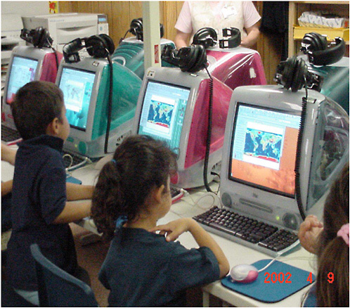
Frontispiece: Young students in a GIS learning laboratory |
|||
|
ES.1 |
Diagram of the DNA structure, |
|||
|
ES.2 |
James Watson and Francis Crick with their DNA model, |
|||
|
1.1 |
Snow’s 1855 map showing the areas of south London served by two water companies, |
|||
|
1.2 |
Spatial distribution of arsenic levels in wells in Arailhazar Upazilla, Bangladesh, |
|||
|
2.1 |
Spatial visualization items, |
|||
|
2.2 |
Underneath a typical urban street corner, |
|||
|
2.3 |
Units of length arrayed in a scalar progression from the micro to the macro, |
|||
|
2.4 |
A concept map depicting how various information sources are used to synthesize a geophysical gravity model, |
|
2.5 |
An information landscape depicting demographic similarities and differences between the 50 states, |
|||
|
2.6 |
Visual browsing query process, |
|||
|
2.7 |
Spatialized query user interface, |
|||
|
2.8 |
Three modules of the Personal Guidance System, |
|||
|
2.9 |
Representations can be brought into direct contact with the real world using wearable computers, |
|||
|
3.1 |
A set of instructions for installing a ceiling fan, |
|||
|
3.2 |
Eratosthenes’ technique for determining the size of Earth, |
|||
|
3.3 |
Ptolemaic system, |
|||
|
3.4 |
Epicycles in the Ptolemaic system, |
|||
|
3.5 |
Retrograde motion, |
|||
|
3.6 |
Astronomical parallax, |
|||
|
3.7 |
The Hertzsprung-Russell (H-R) diagram, |
|||
|
3.8 |
Map of the solar neighborhood, |
|||
|
3.9 |
The period-luminosity diagram for the Cepheids, |
|||
|
3.10 |
The characteristic light curve of a Cepheid variable, |
|||
|
3.11 |
Cepheids in the Andromeda galaxy, |
|||
|
3.12 |
The redshift distance relationship, |
|||
|
3.13 |
Describing the shapes of natural objects, rigorously and unambiguously: stereograms of crystals, |
|||
|
3.14 |
Describing the shapes of natural objects, rigorously and unambiguously: classification of folds, |
|||
|
3.15 |
Diagrammatic representation of equal-area projection of various fabric elements, |
|||
|
3.16 |
Flow chart for identifying minerals, |
|||
|
3.17 |
Ascribing meaning to the shape of a natural object: jigsaw-like fit of the coastlines of Africa and South America, |
|||
|
3.18 |
Ascribing meaning to the shape of a natural object: Siccar Point, |
|||
|
3.19 |
Ascribing meaning to the shape of a natural object: distribution of modern species of planktonic foraminifera, |
|||
|
3.20 |
Ascribing meaning to the shape of a natural object: carbonate-shelled microfossils, |
|||
|
3.21 |
Ascribing meaning to the shape of a natural object: the shape and orientation of the mineral grain in this photomicrograph are interpreted as evidence that the rock has undergone shearing, |
|||
|
3.22 |
Ascribing meaning to the shape of a natural object: reasoning from first principles, |
|||
|
3.23 |
Recognizing a shape or pattern amid a cluttered, noisy background, |
|||
|
3.24 |
Visualizing a three-dimensional object, structure, or process by examining observations collected in one or two dimensions, |
|||
|
3.25 |
Describing the position and orientation of objects in the real world relative to a coordinate system anchored to Earth, |
|||
|
3.26 |
William Smith’s geological map of England and Wales, |
|||
|
3.27 |
Mentally manipulating a volume by folding, faulting, and eroding: geometry of the lower duplex at Hénaux, |
|||
|
3.28 |
Marie Tharp in 1960, |
|||
|
3.29 |
Tharp’s original hand contouring of a portion of the mid-Atlantic ridge, |
|||
|
3.30 |
World ocean floor panorama, |
|||
|
3.31 |
Diagram of central places in southern Germany, |
|
3.32 |
Diagram of a classic central place system, |
|||
|
4.1 |
A sample mental rotation task, |
|||
|
5.1 |
Specify locations and describe spatial relationships using coordinate geometry and other representational systems, |
|||
|
5.2 |
Use visualization, spatial reasoning, and geometric modeling to solve problems, |
|||
|
5.3 |
Specify locations and describe spatial relationships using coordinate geometry and other representational systems, |
|||
|
5.4 |
Specify locations and describe spatial relationships using coordinate geometry and other representational systems, |
|||
|
5.5 |
Use visualization, spatial reasoning, and geometric modeling to solve problems: developing spatial thinking, |
|||
|
5.6 |
Use visualization, spatial reasoning, and geometric modeling to solve problems: building additional spatial thinking skills, |
|||
|
5.7 |
Guide to the content standard for physical science for grades K–4, |
|||
|
5.8 |
Guide to the content standard for physical science in grades 9–12, |
|||
|
5.9 |
Guide to the content standard for Earth science in grades 9–12, |
|||
|
5.10 |
Specify locations and describe spatial relationships using coordinate geometry and other representational systems, |
|||
|
5.11 |
Use visualization, spatial reasoning, and geometric modeling to solve problems, |
|||
|
5.12 |
Specify locations and describe spatial relationships using coordinate geometry and other representational systems, |
|||
|
5.13 |
Geometry Standard: Specify locations and describe spatial relationships using coordinate geometry and other representational systems, |
|||
|
5.14 |
Use visualization, spatial reasoning, and geometric modeling to solve problems, |
|||
|
6.1 |
Using a calculator to solve a mathematical problem, |
|||
|
6.2 |
A Puluwatan canoe, |
|||
|
6.3 |
A mattang stick chart, |
|||
|
6.4 |
Representation of the Etak method, a system for tracking position at sea, |
|||
|
6.5 |
The dangers of an inappropriate map projection, |
|||
|
7.1 |
Components of a GIS, |
|||
|
7.2 |
A raster-based map of Santa Barbara County, |
|||
|
7.3 |
Map of the United States recorded on a vector GIS of polygons, lines, and points, |
|||
|
7.4 |
A geographic information system, |
|||
|
7.5 |
Geographical data can be divided into geometric data and attribute data, |
|||
|
7.6 |
Attribute data consist of qualitative or quantitative data, |
|||
|
7.7 |
Phases in the scientific method, |
|||
|
8.1 |
Six graphic variables that can be used to symbolize geographic phenomena, |
|||
|
8.2 |
Two screenshots from Earthviewer, |
|||
|
8.3 |
The WIMP (windows, icons, menus, pointers) environment for computing, |
|||
|
8.4 |
Multistage analysis in a pictorially based GIS, |
|||
|
8.5 |
Trees conflicting with utility lines, |
|||
|
8.6 |
Hazardous trees: trees in poor or dying condition, |
|||
|
8.7 |
A screen display from a user-built map generated from Level 4 of ArcVoyager, |
|||
|
8.8 |
ArcView digitizing, |
|
8.9 |
“On-screen” representation of a haptic choropleth map of southern California, |
|||
|
8.10 |
ArcView Quick Reference Graphical User Interface, |
|||
|
8.11 |
On or off themes: adding a theme in ArcView 3, |
|||
|
8.12 |
Active and inactive themes: one active theme, |
|||
|
8.13 |
Active and inactive themes: two active themes, |
|||
|
8.14 |
Logical queries: query window in ArcView 3, |
|||
|
8.15 |
Logical queries: query windows in ArcView 8, |
|||
|
8.16 |
Logical queries: select by theme, |
|||
|
8.17 |
Zooming in: ArcView 3 zooming tool, |
|||
|
8.18 |
Zooming in: standard procedure for defining a box to create a rescaled map, |
|||
|
8.19 |
Zooming in: what happens when a user clicks in a site and accidentally wiggles before releasing the mouse?, |
|||
|
8.20 |
Teachers’ feelings of preparedness to incorporate digital content into their classrooms, |
|||
|
8.21 |
Browsing the DLESE library for educational resources by subject, |
|||
|
8.22 |
A page from ESRI’s Geography Network web site from which users can access a huge collection of geospatial datasets, |
|||
|
9.1 |
The U.S. map, showing average annual precipitation superimposed on county and state boundaries, is based on a built-in project in ESRI’s ArcExplorer Java Edition for Education, |
|||
|
9.2 |
This map of elevation and earthquakes, superimposed on state borders, is part of a project generated by ESRI’s ArcView 9, |
|||
|
9.3 |
An oblique perspective view of North America showing earthquakes (greater than 3.0 on the Richter scale), |
|||
|
9.4 |
A frame, showing Mount Everest, from a QuickTime video file exported from ArcGlobe, |
|||
|
10.1 |
Timetable for implementing Recommendations 2–6, |
|||
|
11.1 |
Map of infant mortality rates, |
|||
|
11.2 |
Maps of variables affecting infant mortality, |
|||
|
C.1 |
Shadow projection drawing tasks, |
|||
|
H.1 |
Map of South Asia with countries, rivers, and major cities named with graphs contrasting total and annual rainfall for Bombay and Mangalore, |
|||
|
H.2 |
Map of South Asia with countries, rivers, and annual precipitation, |
|||
|
H.3 |
Map of South Asia with countries, rivers, and types of agriculture, |
|||
|
H.4 |
Map of South Asia with countries, rivers, and population density, |
LIST OF TABLES
|
8.1 |
Major GIS Software Products Used in K–12 Education, |
|||
|
8.2 |
Potential GIS Database Volumes for Some Typical Applications, |
|||
|
8.3 |
Assessment of the Capacity of GIS to Spatialize, Visualize, and Perform Functions, |
|||
|
8.4 |
Assessment of the Design of GIS to Meet Educational Goals, |
|||
|
8.5 |
Assessment of GIS in Terms of Its Appropriateness to Meet Student Needs, |
|||
|
8.6 |
Computational Requirements for Idrisi and ArcView Software, |
|||
|
8.7 |
Assessment of GIS to Match the Educational Context, |
|||
|
8.8 |
Assessment of Programs for the Implementation of GIS as a Support System, |


